Location: North 68.79230, East 017.03675 (GPS at the summit)
Difficulty: (YDS) class 2.
Climbed August 31. 2012.
Information:
How to get there:
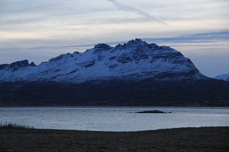
Drangen is the highest mountain on the island Rolla. From Bardufoss, drive south on Hwy. E-6, passing
Setermoen, then Hwy. 851 west to Sjøvegan. Continue along Hwy.84 following signs for Rolla, then turn left
on Hwy. 848. Cross to Andørja on a bridge, then by way of tunnel to Rolla. Drive exactly 9 kilometer after
you exit from this subsea tunnel. The trailhead is up along a road going right, parking is about 100 meter further
along the main road on its left side. This (parking) location is N68.74361, E017.00585, elevation about 22 meter.
Route description:
Pass the gate on the right, then follow the road uphill. When the road is getting
more level, you cross the (dry) creek on a bridge. 50 meter further along, a small
forest road goes sharply right.
There are signs for Drangen and Solvatnet (map: Sulvatnet, 494 m) here.
Almost immediately, a trail marked with red paint forks off to the left. Follow this
trail. The trail will take you gently uphill initially through birch forest, to the lake Solvatnet.
Above the forest, the trail is marked with red paint on rocks as well as with
small red wooden markers. Pay attention, since there are several trails made by sheep.
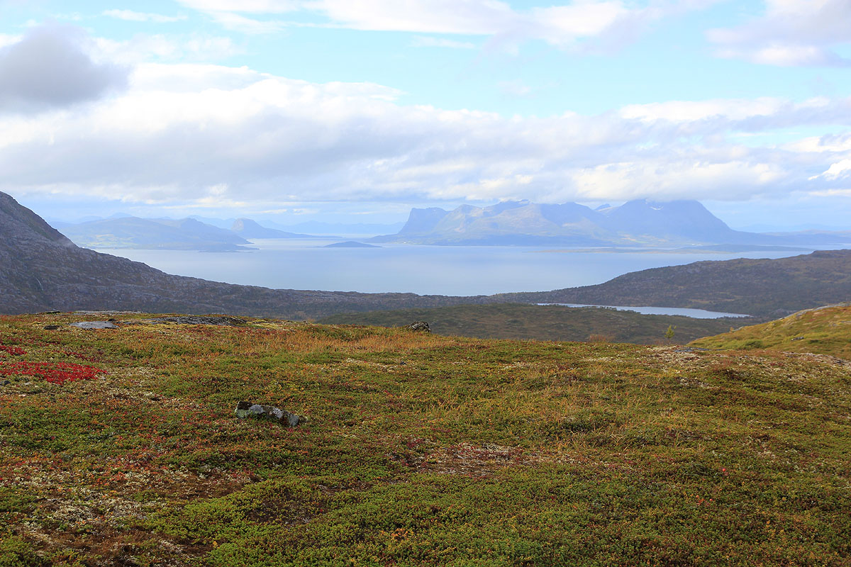
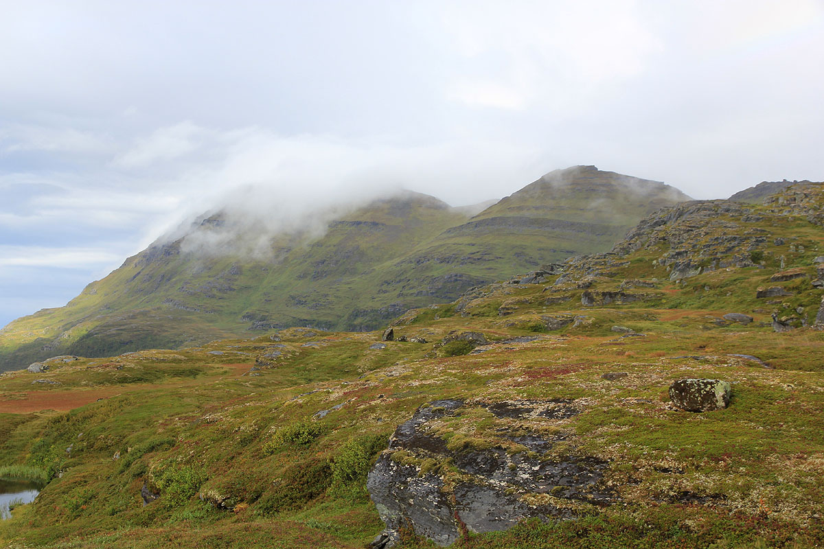
Continue on the left side of lake Solvatnet, then more right as you climb the first, somewhat
steeper hill. The route climbs between the sharp summits above the lake and Rundtind, a grass
covered hump (map: 872 m) further along. Soon, you will see a very distinct and broad ledge that contours
Rundtind on its left (west) side. Your trail will gain this natural passage and follow it some
way before climbing higher in order to reach the saddle on the main ridge just north of Rundtind.
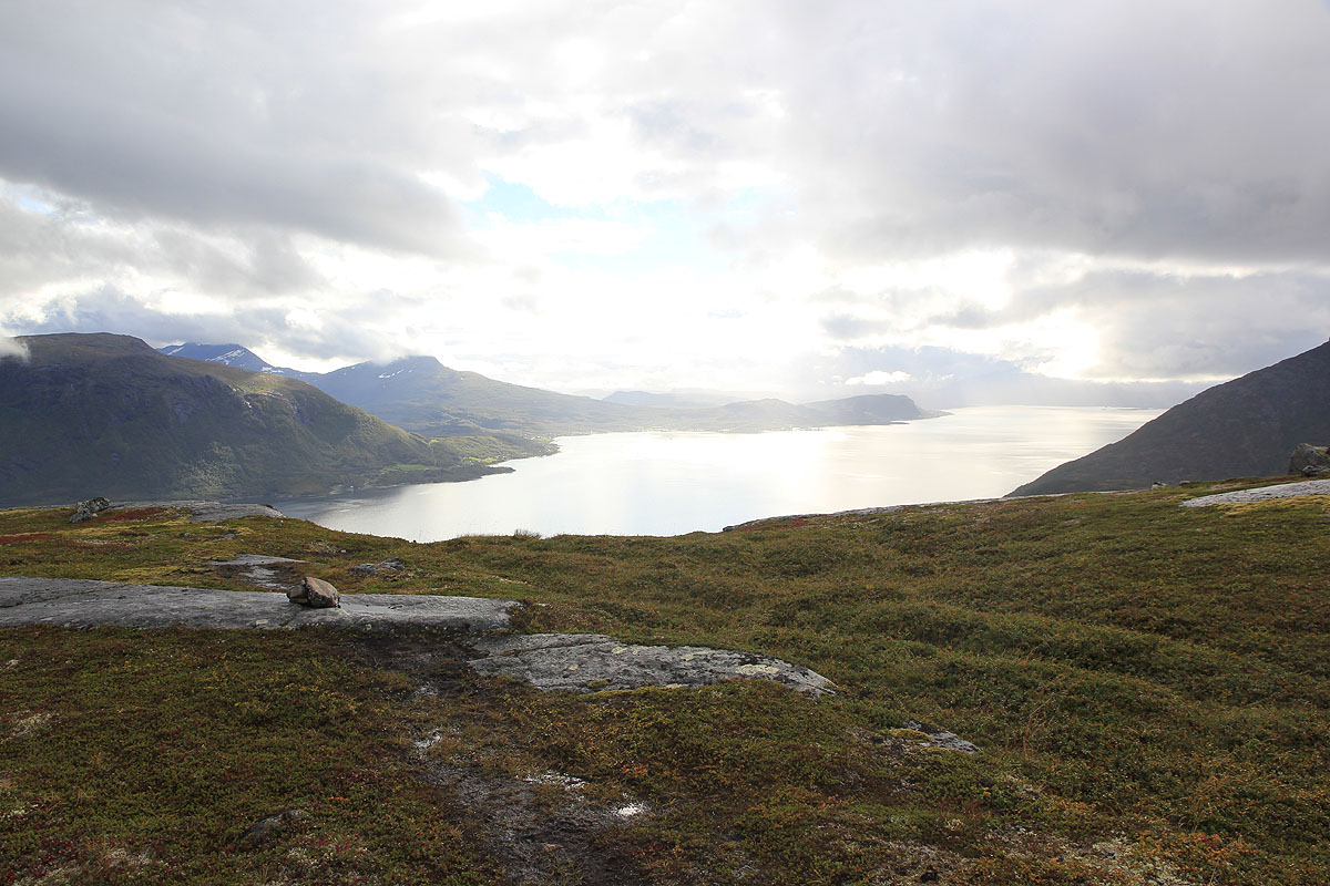
Once in this saddle, follow the generally well marked trail north. This trail will mainly stay
on the left (west) side of the crest as it bypasses Mellatinden (map: 975 m)
as well as several local (smaller)
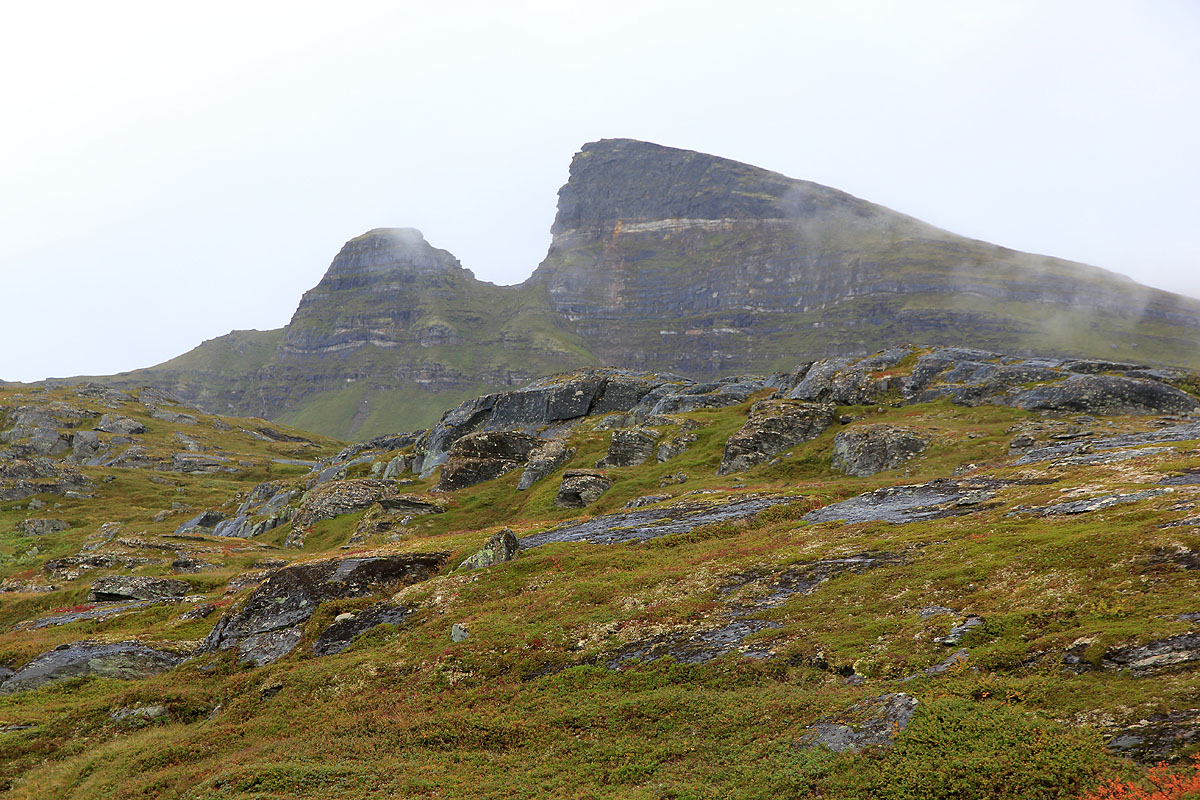
peaks before arriving at the proper, final summit slope. You will get to a point where red paint
on the rocks inform you that the there are two alternatives for the final pitch. They are
called Alt.1 and Alt.2, respectively. Alternative 2 goes right and may involve some easy
scrambling. Alternative 1 continues left and is a trail all the way to the summit. Follow this
trail, it first ascends a bit, then contours left and pretty much circles the summit before
finding a nice and easy way up on the top plateau. Do not climb right, but be patient and follow
the red marks.
Comments:
I made a last minute decision to spend this weekend in Troms. The forecast was at least better
than Bergen. Arriving in Tromsø around 1000, I was soon on my way south. Drangen seemed like
a possible goal for a late afternoon hike.
I left the car at 1430 and had a very pleasant walk up to Solvatnet.
The clouds broke and the sun
came back out adding light to an already
nice mix of gentle meadows (with ripe cloudberries!) and
sharper peaks behind. Higher up, the clouds
were still in command. I followed the trail without much difficulties and
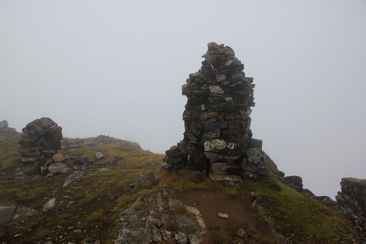
arrived at the summit by 1700.
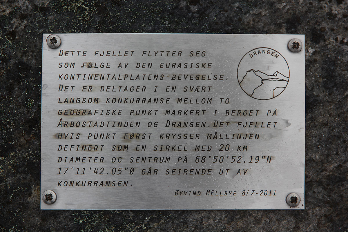
The summit has an interesting sign describing the movement of this
island due to the shifting of continental plates. Otherwise, the visibility was limited and I started
my descent after 10 minutes. On my way down, the wind increased rapidly and got to storm level. It was
so bad that one could loose control, I deliberately walked about one meter below the local saddles that
the trail crosses, as the east side looked rather uninviting.
I was back at my car by 1910, two hours. My plan was now to stay in Sjøvegan, the same nice place
as in May 2005. However, this place did not exist any longer and the camping at Elvelund came to
my rescue. The next day, I planned to investigate Reitetinden.