How to get there:
From Bergen, drive E-39 north to Romarheim. There is a signed road
going right. This road serves Modalen, but is also a cross road
towards E-16 and Dale.
Continue up the Modalen valley (Do NOT enter the long tunnel that connects to Eksingedalen).
After somewhat more than 10 kilometer, locate the signed road that forks right. The sign
reads Nygaard 6km. Drive this road and take the second right after arriving in the
Nygaard general area. The road that cotinues serves Kvanndalen and Steinavatnet. Drive east to
the end of the road near a hydro electic poer plant installation. There is a large area
for parking (also in winter). This is the tailhead, location N60.89328, E006.05584, elevation
about 520 meter.
Route:
This route is marked on several maps as a summer trail. It may also be
followed on skis in winter. Head uphill from the parking,
then cross a small bridge
across the creek. Continue right, then left to reach the flat
aareaa near Krosstølen. (The trail ascends on the left side of
the creek on my map, however, this was an easier ski ascent.) Turn more
south and head into the distinct little valley with power masts.
You will see a clear (big) ramp/ledge traversing the steeper rock face to
your south, check visually that there is no avalanche issues here. You need
to descend slightly in order to
cross the small valley Viermyrdalen, in order to find the best route of
ascent up the small ridge then onto the ramp. The route now continues
in a straightforward fashion, south-west to the summit of Blånipa.
Stay high (left) to avoid the big gully that descends north just before
the summit.
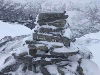
Note that the highest point is not at the cairn, but about 50 meter
south-east. This loccation is about 1 meter higher, that is, 1072m.
Comments:
I did this trip as a Bergen Mountaineering (DNT) skiing trip with participants
that started signing up already in December. We were 15 people on the trip.
Leaving Bergen at 0800, we were
ready to ski shortly after 1000.
The ascent took
a bit more than 2 hours.
We skied back down the west side of the big gully, a very
nice ski descent.
From the bottom, an easy ascent east would reconnect with
our uphill route. We were back at the parking around 1400.