Location: North 67.14180, East 14.68280 (from Map)
Romsdal, Norway
Difficulty: (YDS) class 3
Climbed August 8. 2020.
Information:
How to get there:
From Bodø, drive towards Fauske, shortly after you cross a big bridge
look for Hwy. 17, forking right. This is the coastal highway going south.
The sign says Saltstraumen as well as towns further south. Take Highway 17.
You cross Saltstraumen on a big bridge, continue on Hwy. 17, you will cross
two more bridges. After the second bridge, drive about 2 kilometer and look for a
turnout with a small parking area on your left. This is in a right curve on the
road. This location is N67.18027, E014.59991, elevation about 80 meter.
Route description:
A well marked trail starts out from the parking area. This trail first climbs gently
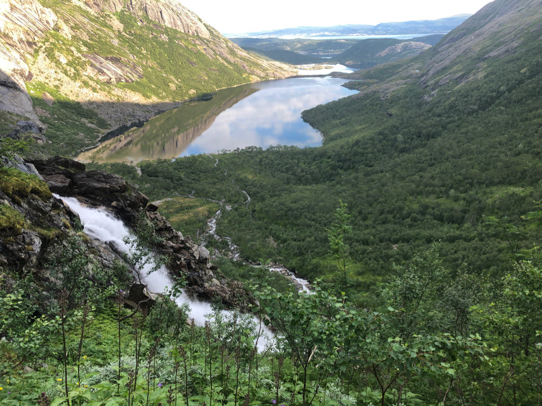
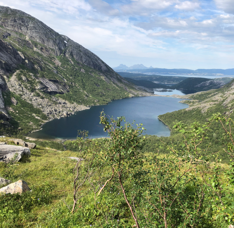
to the upper Åselivatn lake at elevation 161 meter. The river is crossed on
a bridge and the trail continues on the east side of the lake.
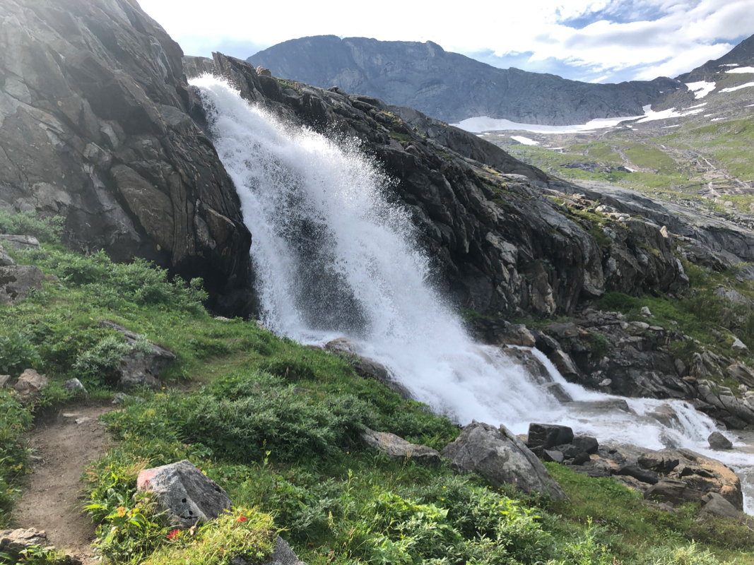
There is a step in
the valley at the end of the lake. Nice waterfalls.
The trail climbs this step. The trail
is easy all the way, but still equipped with a chain on the steeper sections.
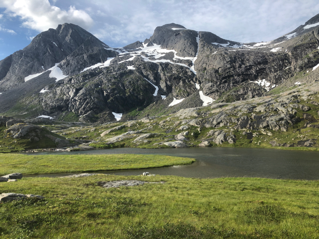
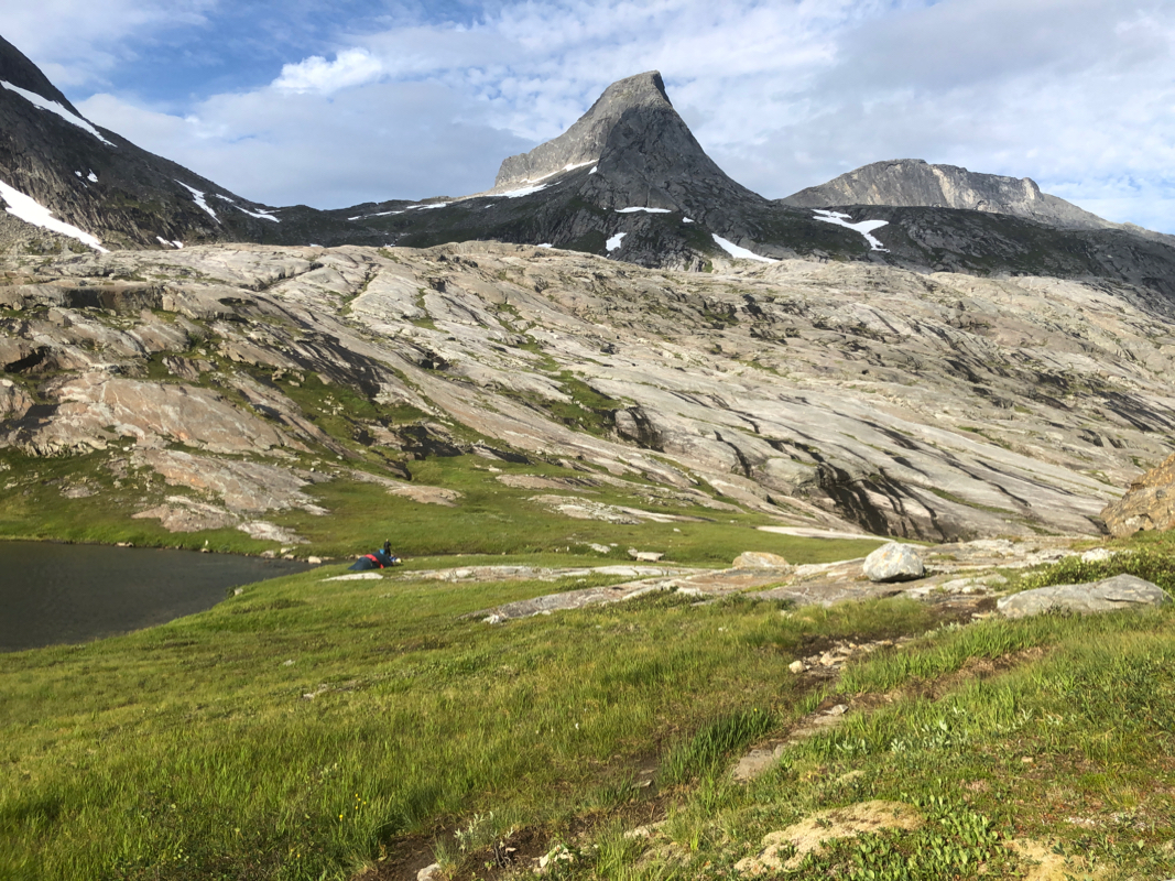
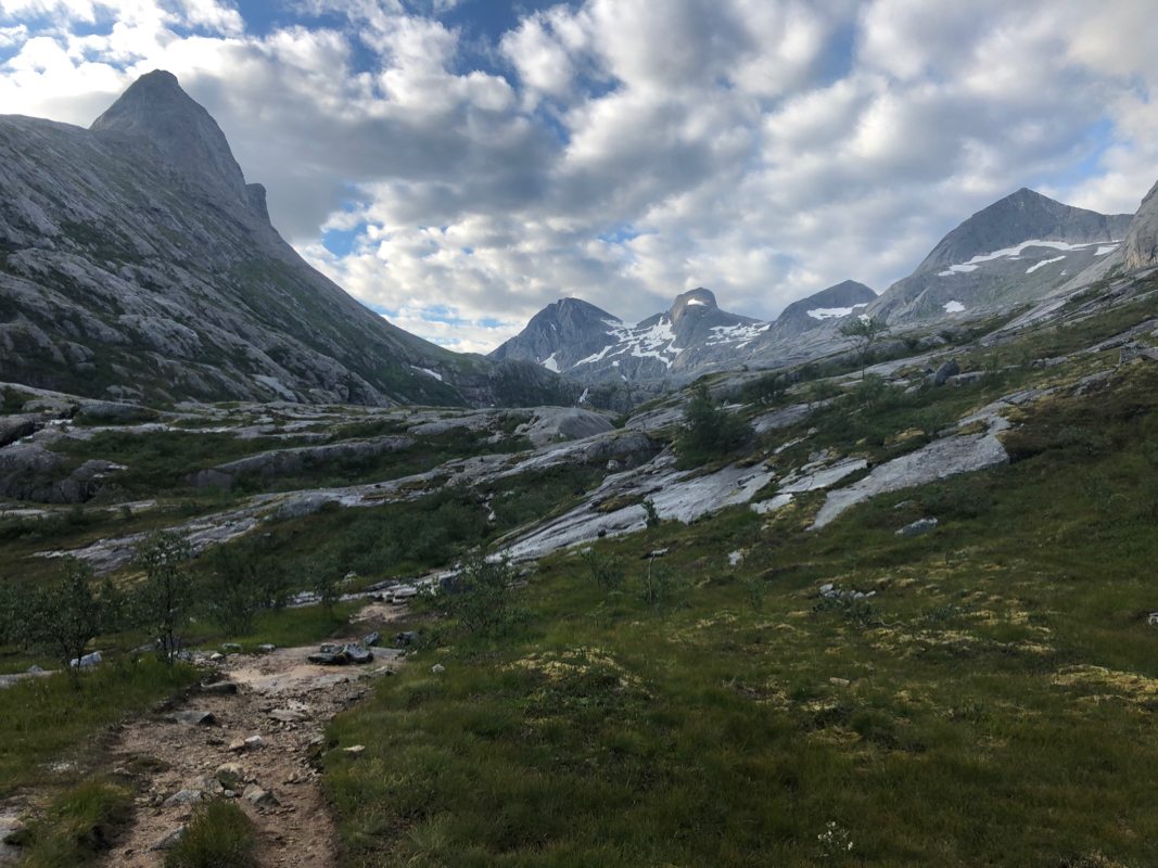
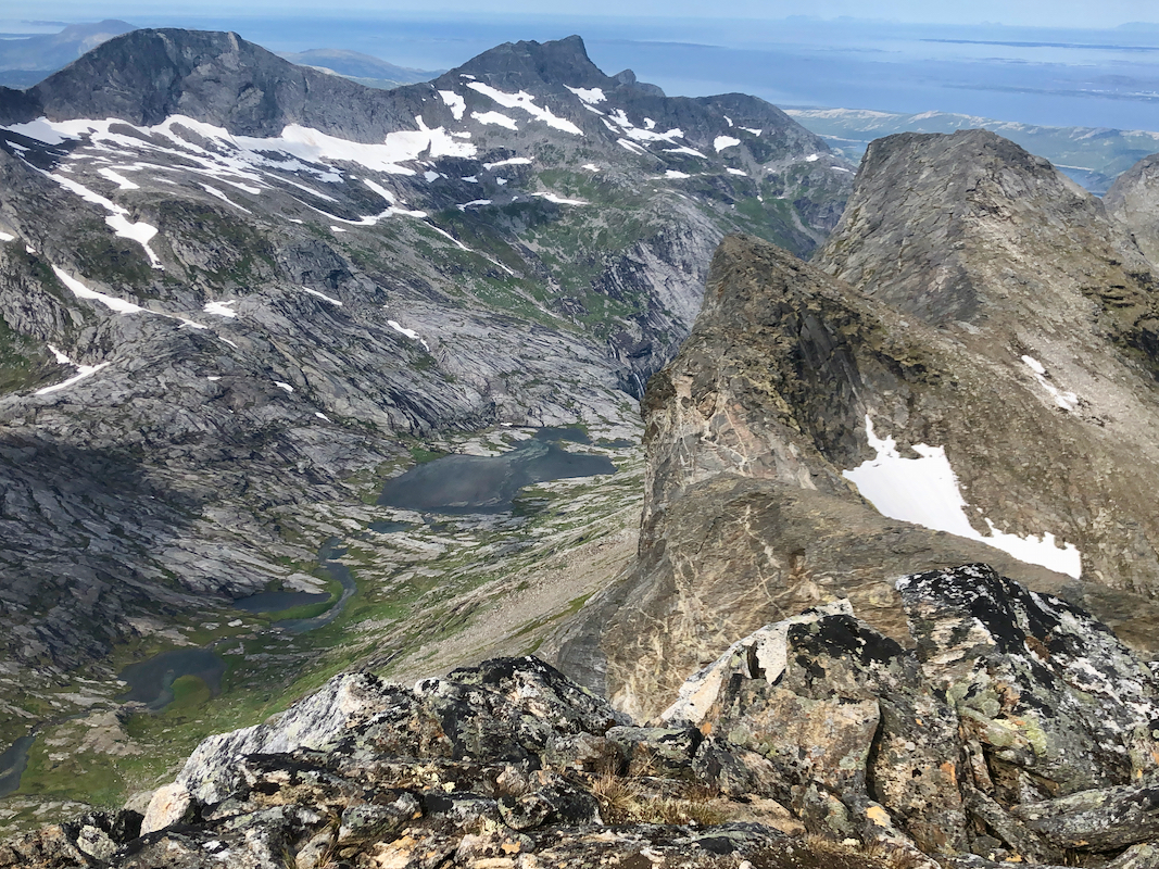
Next, the trail continues into the upper Åselidalen valley, a very scenic landscape
with several small lakes.
There are impressive peaks
on both sides of this valley.
Continue past lake 381 m, then pass 3 smaller lake as the trail continues into
the upper part of Åselidalen.
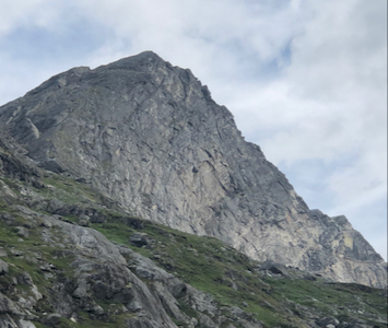
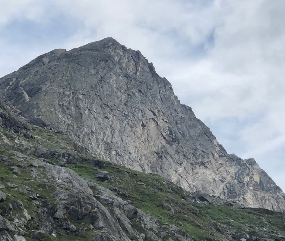
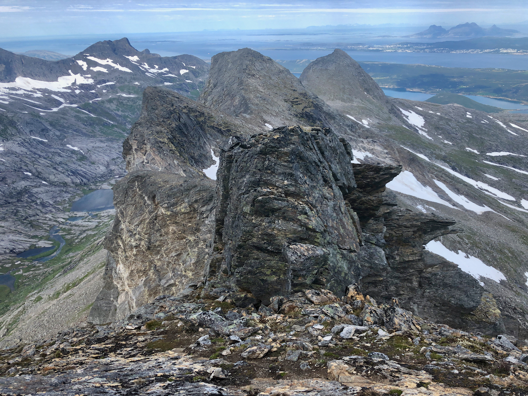
The peak comes into view as the last big peak on your left haand side. One should
leave the trail approximately at location 67.14032, 14.65644. From this area you
should see the peak and
the distinct col on its left side. Moreover, there is
a very distinct pinnacle standing in the middle of this col.
Head uphill, more or less
directly towards this col with the pinnacle.
In order to
avoid as many sections with rocks, the best route is likely to stay a bit right
of a direct line from the valley floor to the col. Otherwise, this ascent is
reasonably straightforward.
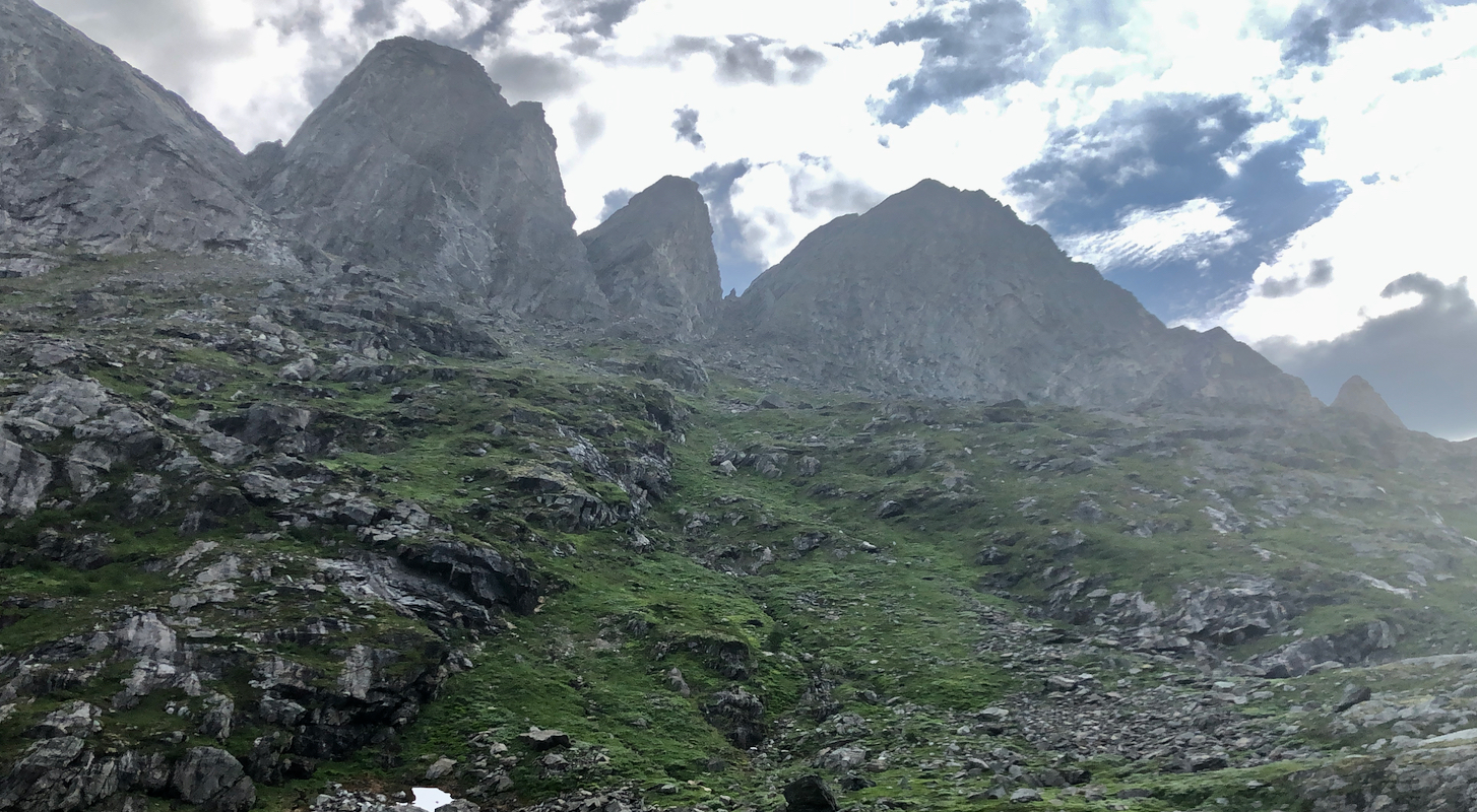
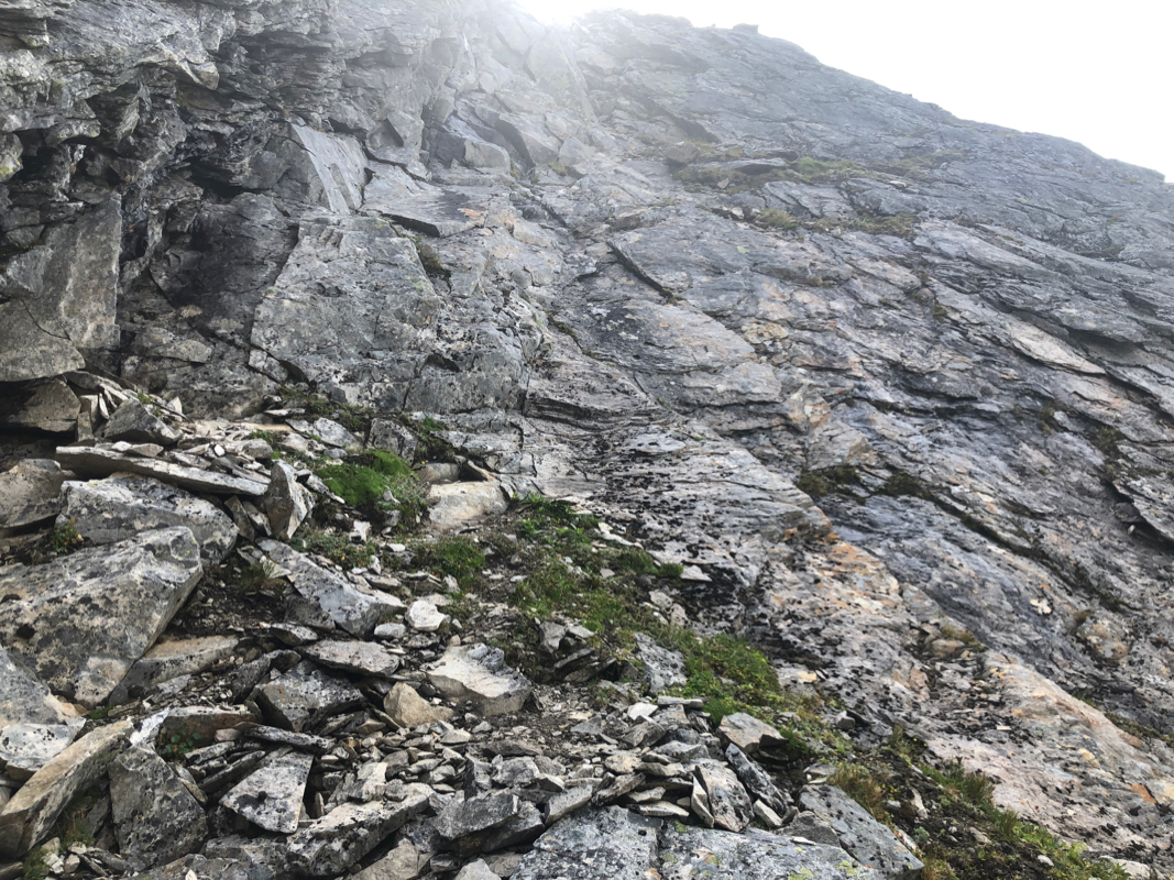
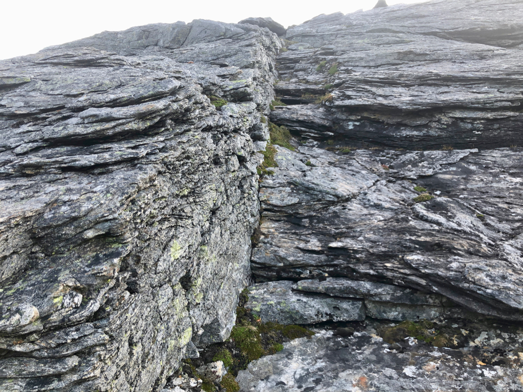
The terrain around this col is wild and rugged.
The ascent from the col starts out slightly below the col itself. The first
steepish section is short and likely easier when dry than wet.
As soon as this first section
(YDS class 3) is behind you, so is the
crux of the ascent.
You quickly
gain easier ground. Proceed uphill and move as far left as the terrain
allows. Follow the path of least resistance. You will advance up a ridge
that narrows, in fact, it may look as if you will "cliff out". Fortunately,
a short and easy downclimb is possible.
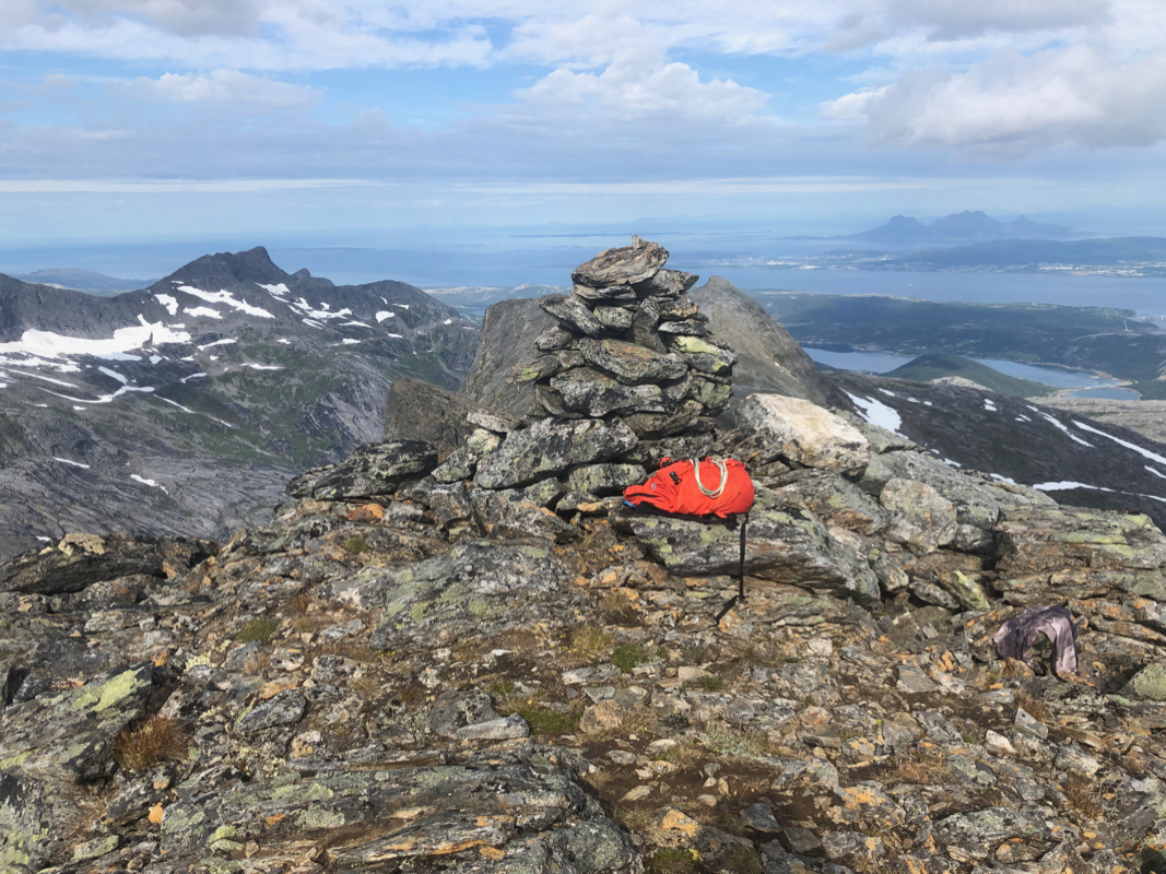
The rest is quite easy and you
arrive at a very nice summit. Comments:
I stayed at the nice DNT hut Gjælentunet. From here, a very short
drive to the trailhead.
I started walking already at 0645.
The morning hike was delightful. I walked by several tents, it seemed like
people were still asleep. This valley can be highly recommended.
Reaching the small lakes in the upper valley, I soon noticed the
pinnacle as well as the peak itself. One should not head uphill
too early, much better to use the nice trail and continue until
a pretty direct ascent to the col is possible. Once in the col,
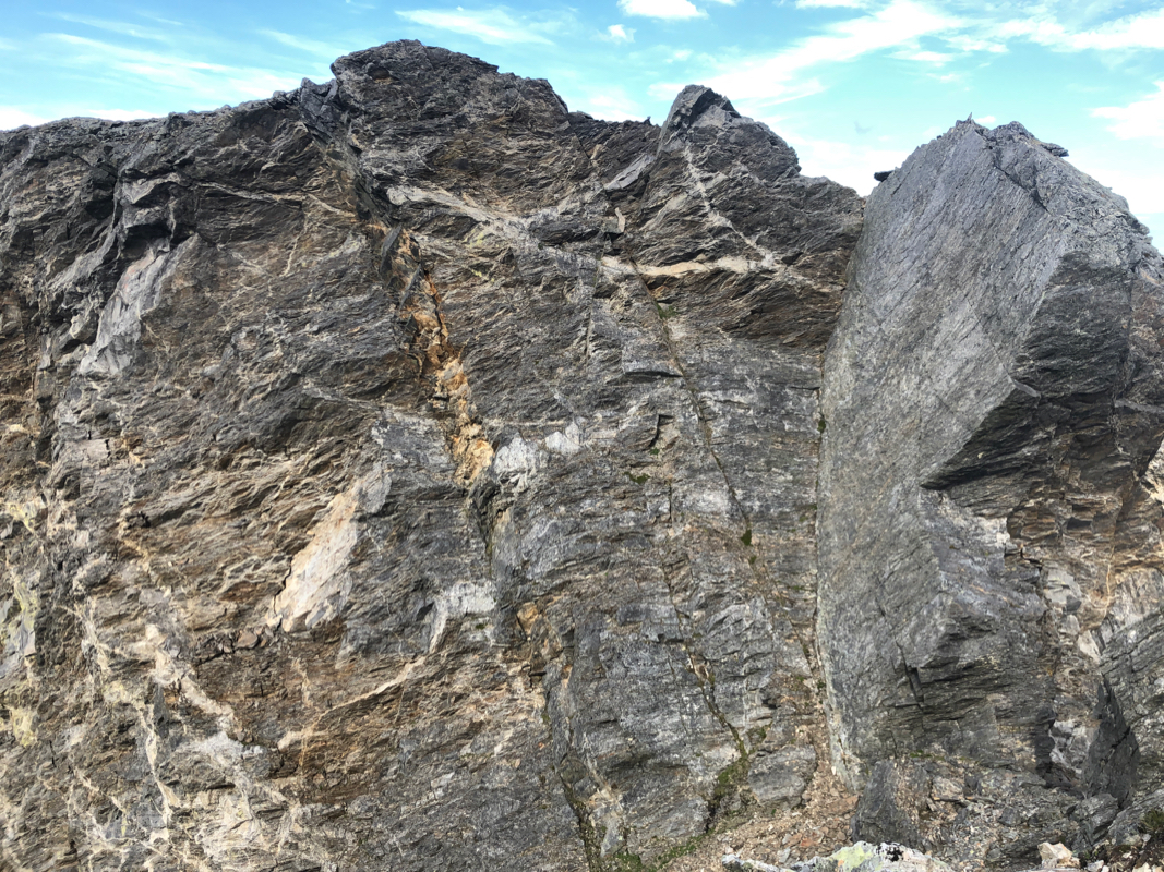
I looked at the beginning of the climb. Not really difficult,
but one should be careful when moving in this terrain all by
yourself. I had seen a picture of what I thought was the
crux of the climb, some fairly long slanted chimney. Thus, when
I spotted what looked a bit like this,
I proceeded to
climb it. Not very difficult, but fairly long and (YDS) class 4.
I was happy when exiting left and I did not really look forward
to the downclimb, but I knew I could do it safely. The rest was
pretty straightforward. The fact that you move up on ridge that
suddenly has a drop was a nice detail.
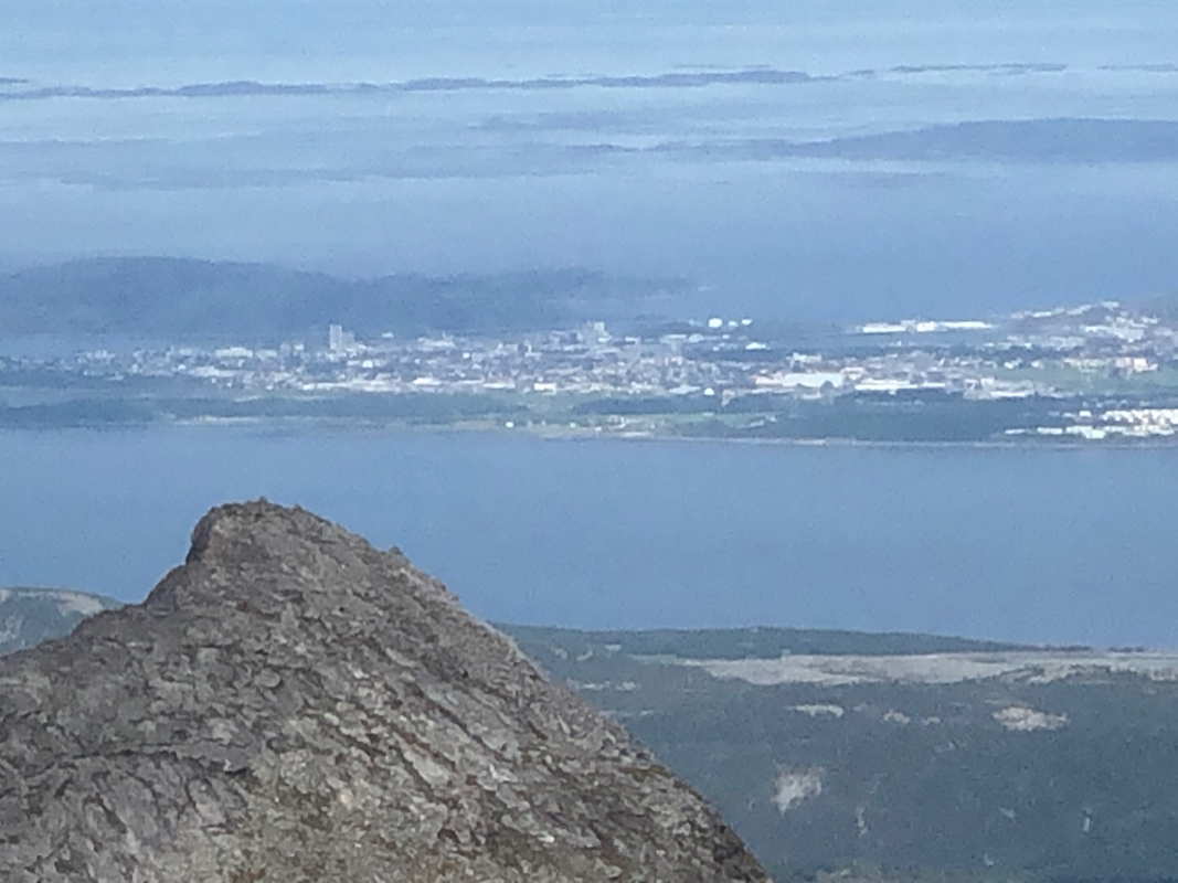
I arrived at the summit at 1045, so 4 hours with no rush and
several brief stops along the way.
A very nice spot, I had a long rest with some lunch and time for
enjoying the view.
After 45 minutes, it was finally time to head
back down. I descended along what seemed to be the easiest way and
to my big surprise, arrived below the chimney I had climbed on my
way up. Thus, the only remaining section was the very last few
meter immediately above the col.
Next, the pretty long, but easy descent to the valley floor followed
by a nice hike along the trail
back to the car at the trailhead.