Chimborazo
- Chimborazo
- 6268 m
- Primary factor 4123 m
- Location: South 01:28.125 West 078:49.055 (GPS on the summit)
- Highest in Ecuador.
- Saddle: 2145 meter
- Saddle location: Near Olmos in Peru.
- Difficulty: Grade F+, YDS class 2, snow/ice climb.
- Climbed December 17, 2008.
|
|
Information:
How to get there:
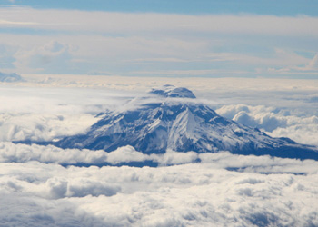
Chimborazo, the highest mountain in Ecuador and the point that has the maximum
distance from the center of the planet, is located south of Quito. The drive may easily
take about 4 hours. From Ambato, take the Ambato to Guaranda road that runs
on the NW side of Chimborazo.
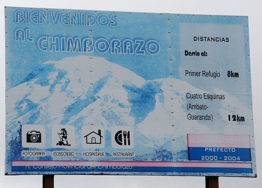
At location S01:29.908 W078:52.511, elevation about 4350 meter, a smaller road
forks left. There is a prominent sign.
Drive this road until it ends at the lower refugio. This
is at S01:28.514 W078:50.753, elevation
about 4840 meter. Park here, this is the trailhead.
Route description:
From the trailhead/parking follow a well worn trail straight uphill to the Whymper Refugio.
This hut is located at S01:28.367, W078:50.335 at an elevation of approximately 5040 meter.
As such, it must be among the higher mountain huts anywhere in the world.
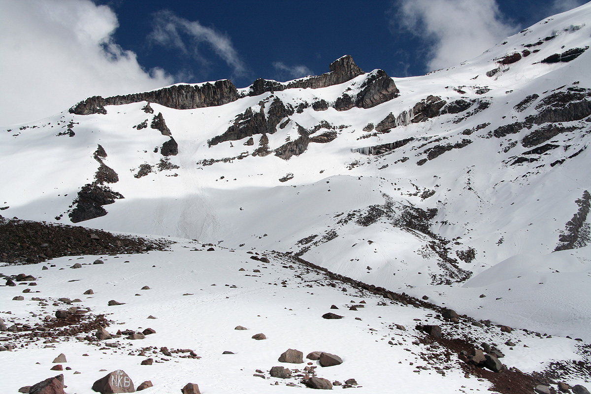
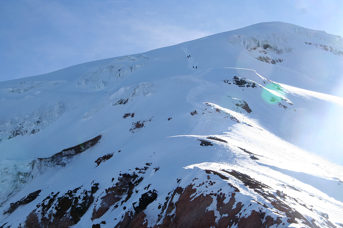
The normal route starts out from the NW corner behind the refugio. The path first contours
around a smaller hill, then climbs the slope behind in order to start an ascending traverse
(to the right when facing uphill). This traverse follows a natural, broad ledge that subsequently
connects with a slope that (now going more left) connects to the saddle above, a fairly distinct
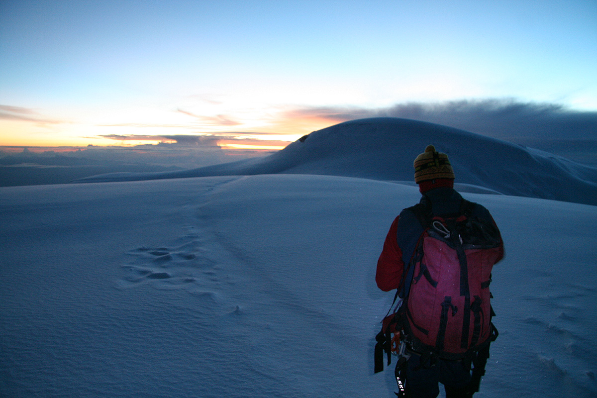
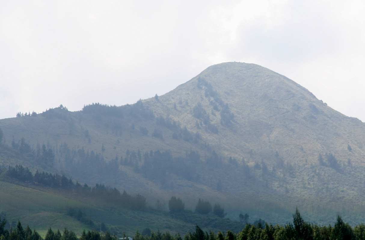
snow ridge. This picture shows
this area in somewhat detail. It should be fairly obvious
to see how to make an ascent that takes advantage of the natural features.
As soon as one reaches the ridge, turn right and start climbing
the ridge ahead. (The ridge is (much) steeper than it appears) This is the
west ridge. The slope varies between 30 and 40 degrees and the ridge has a vertical rise of
about 1000 meter. When you finally top out, you are on a false summit, but the true summit
is in clear view. Turn slightly left and head directly towards the true summit, you will
most likely have a crevasse on your right hand side. The summit can be climbed directly.
Return to the Ecuador summary page.
Trip Report (continued):
The beginning of this trip report is here.
Day 9:We travel to the Whymper hut.
We woke up to our second morning at this small, charming hotel outside the
Cotopaxi National Park. Diego should pick us up around 0900, until then we were busy
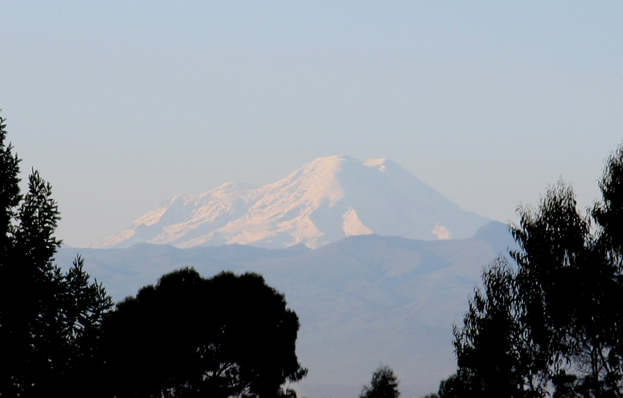
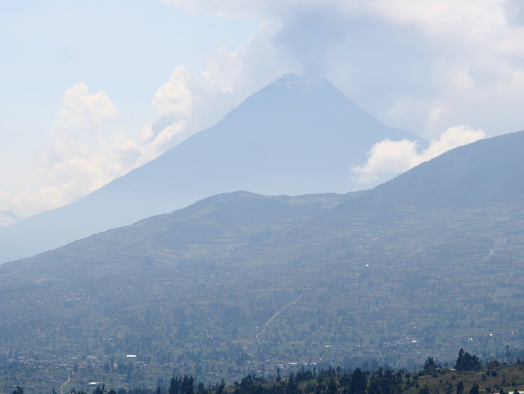
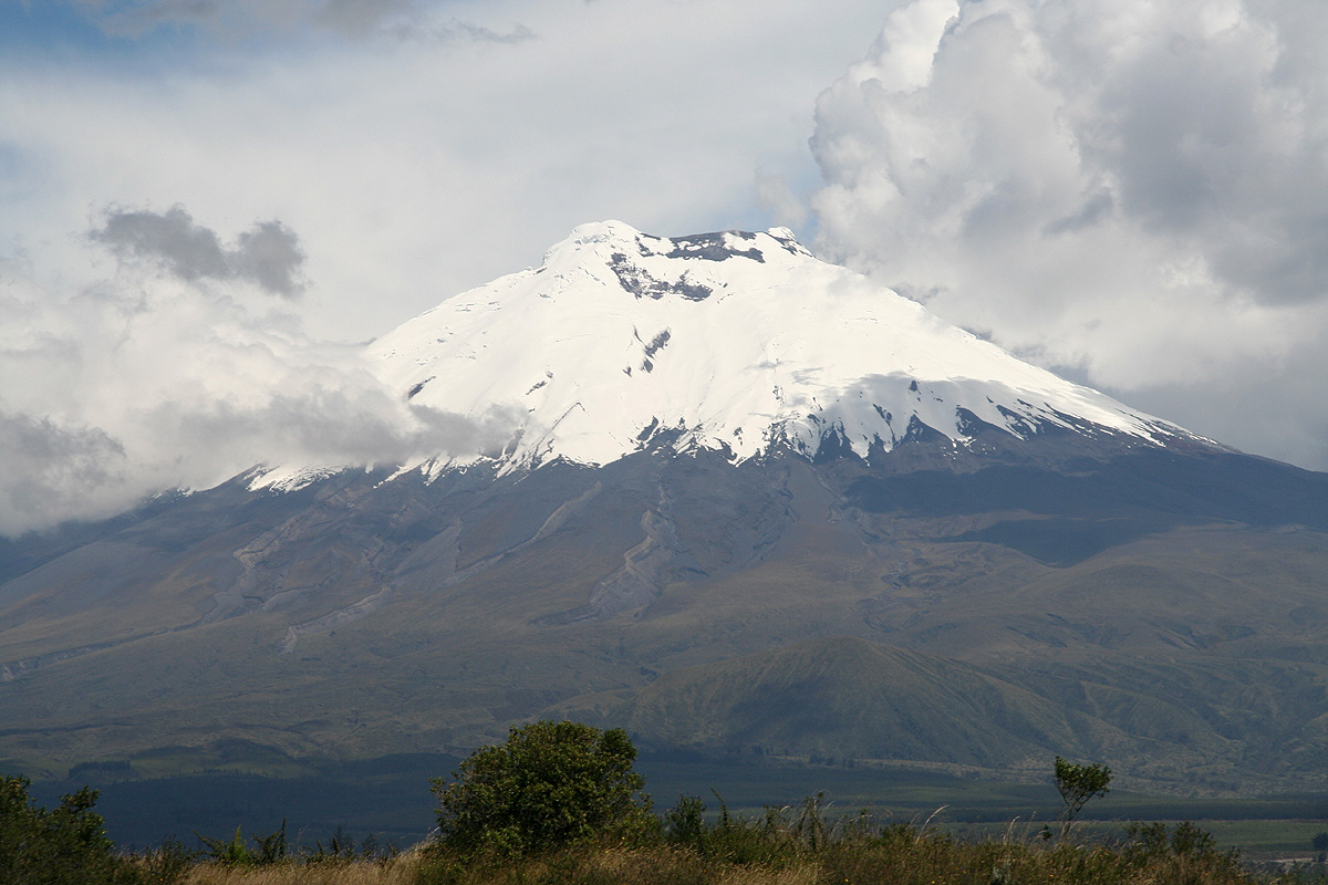
with breakfast, reorganizing gear and taking photos of Chimborazo in the south. She had
been totally invisible yesterday, but today the weather was clear to the south and suddenly
she was there. Enormously large, that was easy to see from this distance.
It was indeed a fine
morning. Illiniza was barely visible above the local hilltop to
the west and Cotopaxi was
still clear of clouds in the opposite direction.
We left the hotel around 0915 and had a safe drive to the parking at the
lower refugio serving Chimborazo.
Along the way, we passed the city of La Tacunga, and got a good view of
the recently more active volcano Tungurahua (5023m).
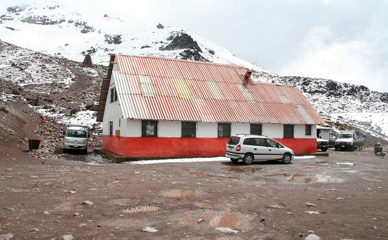
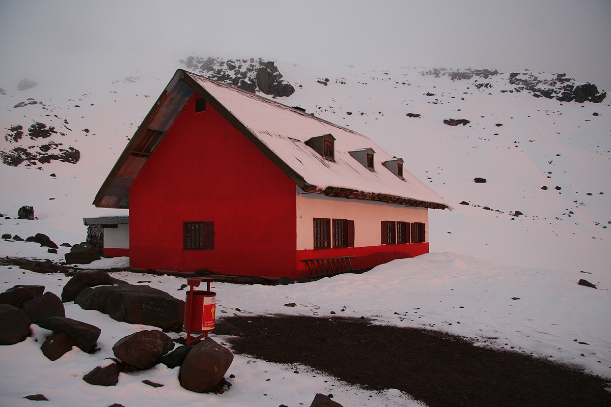
From the lower refugio, the short hike to the upper refugio
took about 25 minutes. We arrived in rather foggy weather around 1300.
This hut, the Whymper Refugio, was quite well organized with
several smaller bedrooms. This is preferable as the level of noise and general
disturbances are greatly reduced. Located at an elevation of 5040 meter, it is also by far
the highest location of any hut that I have visited.
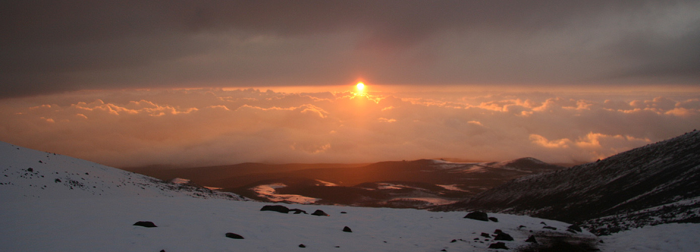
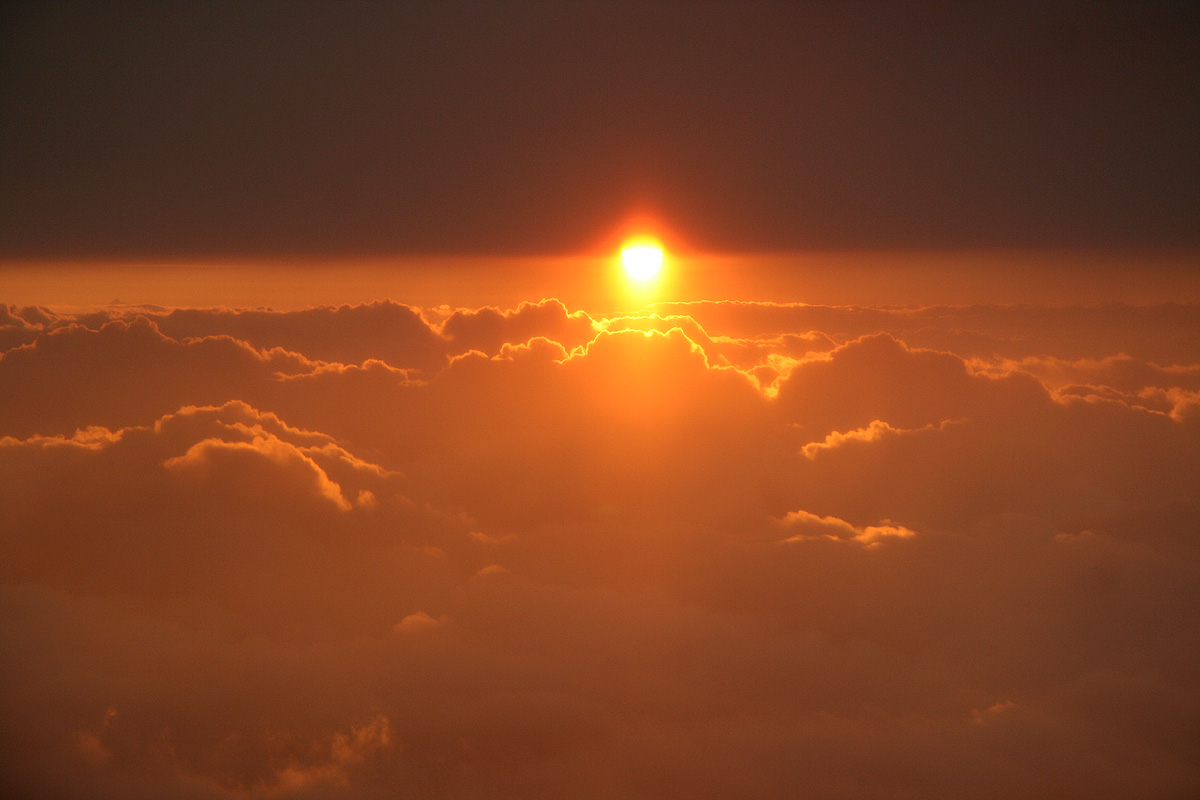
The evening came with a
rather spectacular sunset. We
had clouds sort of above and below, with
the sun setting between the layers.
We all hoped that this would evolve into another cloudless
night providing good conditions for our upcoming climb.
Day 10:We climb Chimborazo.
The plan called for the same two teams that we had formed on Cotopaxi, but with Adam and Diego
starting already at 2300, while Rob and I would head out at midnight. It was felt that giving
Diego and Adam a head start and allow them to move a bit more slowly would maximize Adam's
chances of getting to the summit.
However, at 10 PM when it was time for Adam to get up and prepare for departure, he did not
feel well and decided against climbing. This, obviously, was a significant setback, but there
was little that could be done at this time.
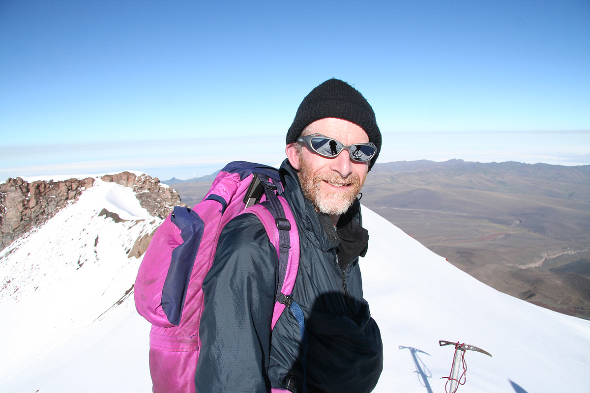
Rob and I got up at 2300, we had breakfast and we were ready to depart by midnight. It turned out that
everybody else had left by then. Thus, again we were dead last. However, we set a good pace and by the
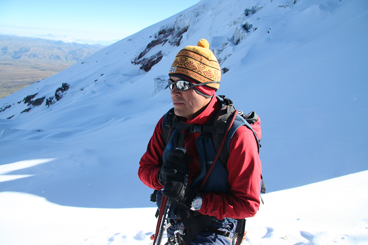
time we hit the ridge (after 45 minutes) we were almost in front. A short way up the ridge and we overtook
the team in front. It turned out that the snow condition along this ridge was pretty difficult. Loose snow
and no support for an ice axe, it went straight down to the blade if I tried to lean on it. Combine this
with a steep uphill, every time I tried to step in the place left by Diego's boot my boot would slip
backwards at least half way back. Thus, the crampons were of little help and walking uphill seemed at
least 50 percent more work than what one normally would expect. Diego carried the lion's share of the
work, but it was still hard to break trail walking as number two. I could also see and hear that
Rob following behind me had continuously hard work.
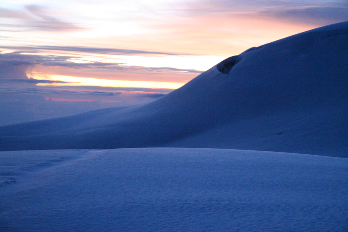
The hill seemed to go on indefinitely. We could see some sort of horizon, but it moved ahead about as
fast as we moved uphill. No other team seemed willing or capable of helping out with the trail breaking.
In fact, most teams slipped farther and farther behind and below us. We made a number of brief rests
as we steadily gained elevation. I was quite surprised about how tired I felt, very different from
Cotopaxi. This ridge, 1800 meter long, took us 5 hours to ascend. We finally topped out around
0540 at an elevation of 6240 meter. To
see that the remainder of the climb was mainly flat terrain with
a small uphill at the end gave us a considerable moral boost. As we headed across, we could see that
we and the morning would arrive at the summit together.
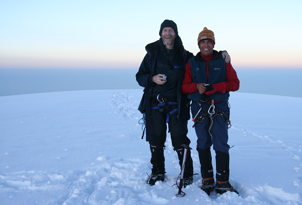
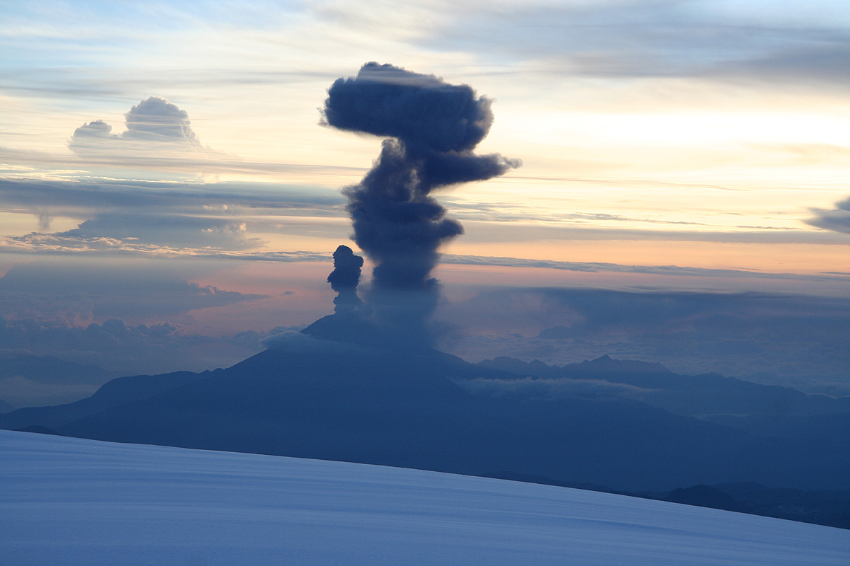
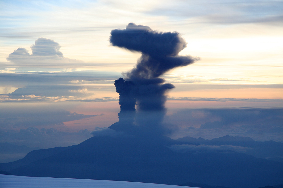
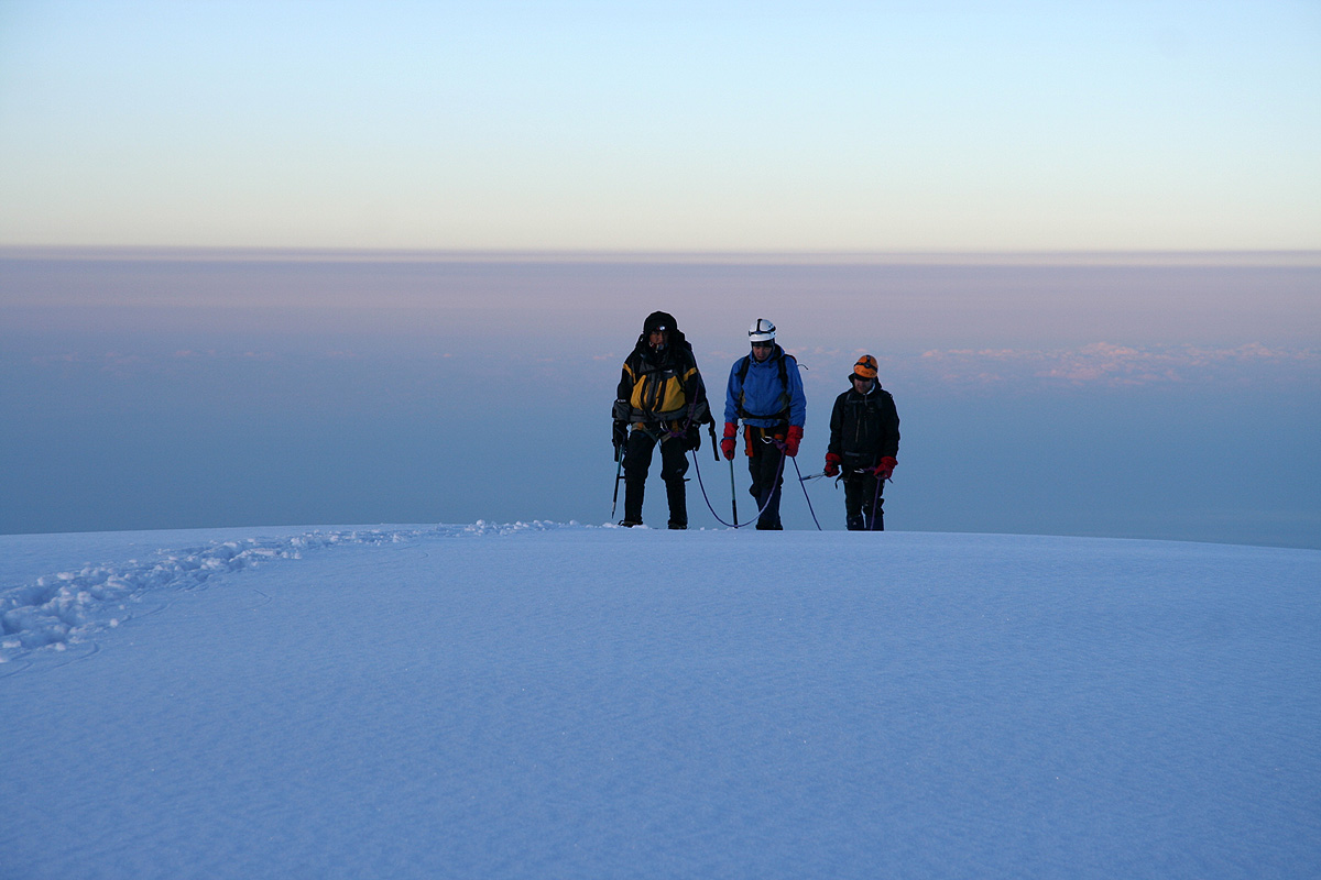
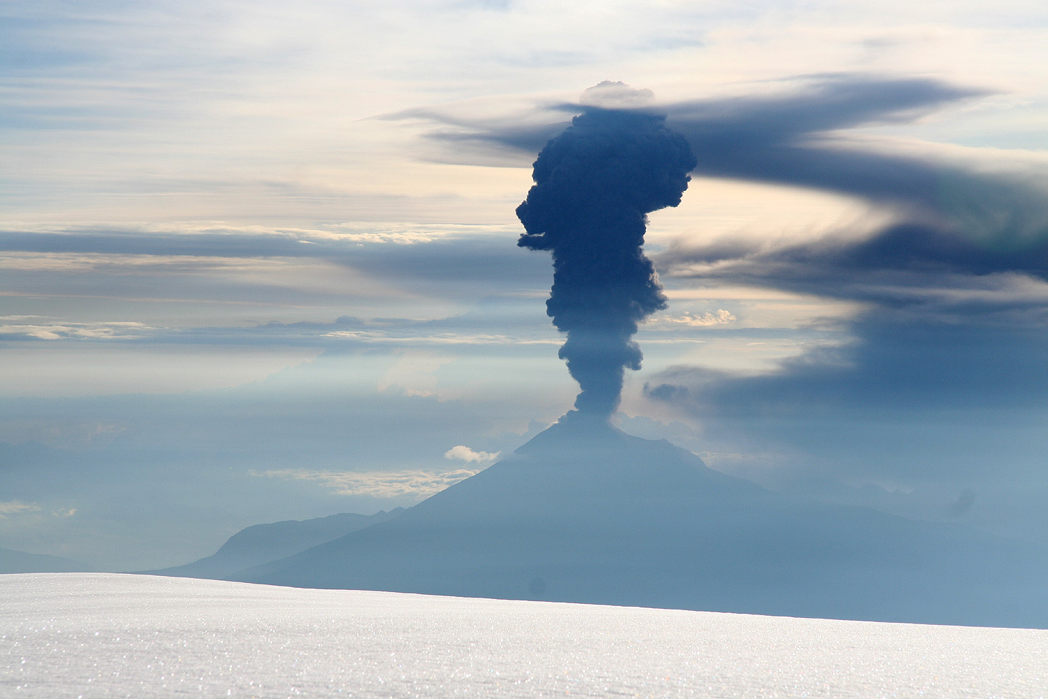
We were at the summit at
0610, and just looking, the volcan Tungurahua decided to
start an eruption right then
in order to celebrate our ascent. It put on quite a show,
an impressive sight
from a very special spectator's position.
After about 20 minutes a second team made the summit.
A local guide and two Norwegians from
Rogaland! What an unlikely event. The two looked very tired and they both declared that without
us breaking trail, they would never have made it. It turned out that no other team made the
summit today, thus 3 Norwegians and one Englishman plus two local guides made the true summit this
day. Considering that at least 50 people had started out, this was indeed a very low percentage.
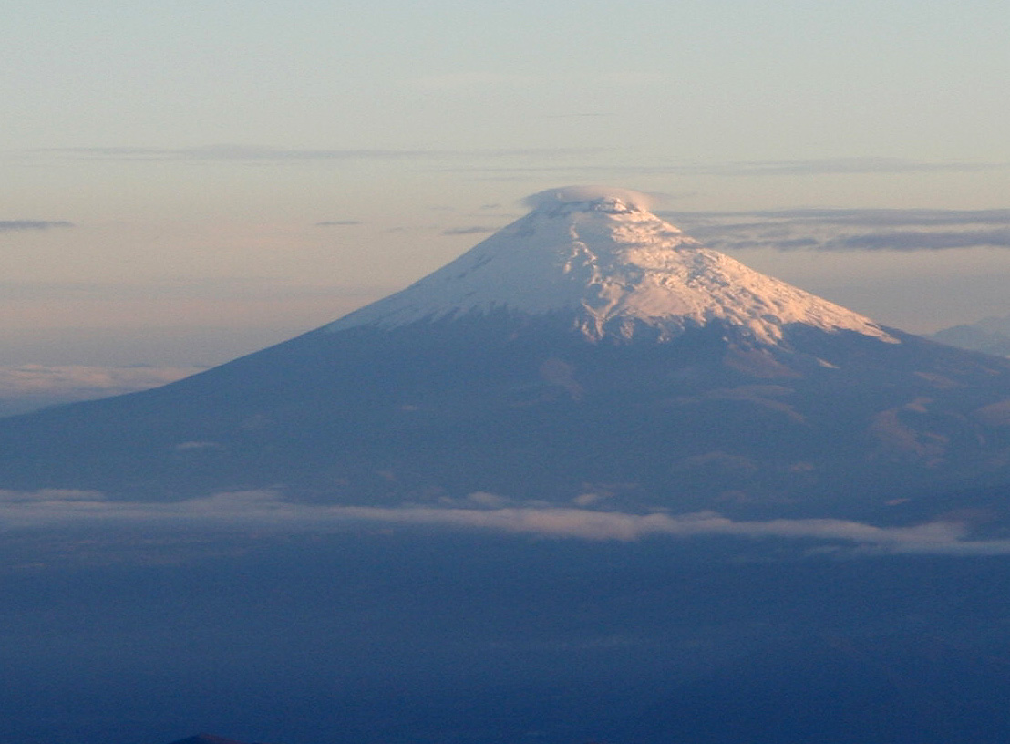
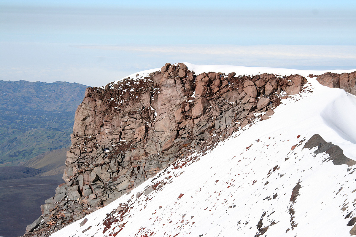
We enjoyed a spectacular view from the "top of the world", nothing higher going north in America.
Cotopaxi looked really nice, we were there 3 days ago.
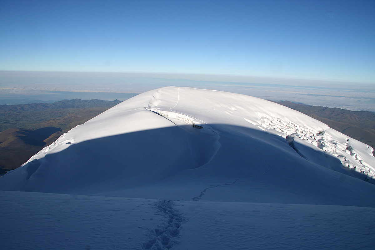
Looking back to the false summit also
revealed a beauty in this summit landscape.
The first volcanic eruption across from Tungurahua subsided, but shortly thereafter a
second eruption
created a new, symmetric plume of ash rising vertically above its top.
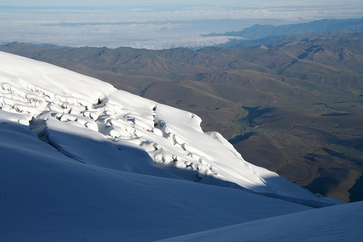
Our route was free of crevasses, but one need not look much to the side
to see that there are quite a few crevasses almost
everywhere. Also, just to the
left of our route ascending the west ridge,
the terrain looked a lot less inviting.
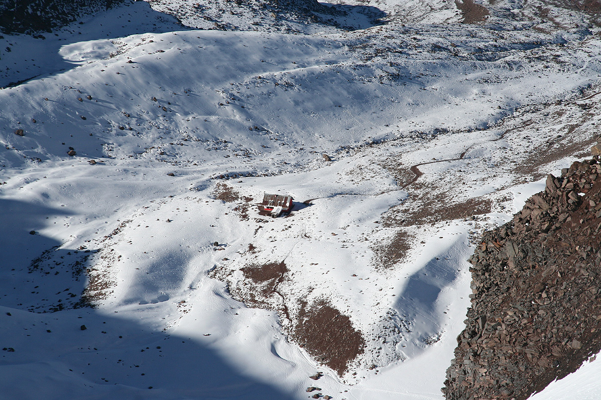
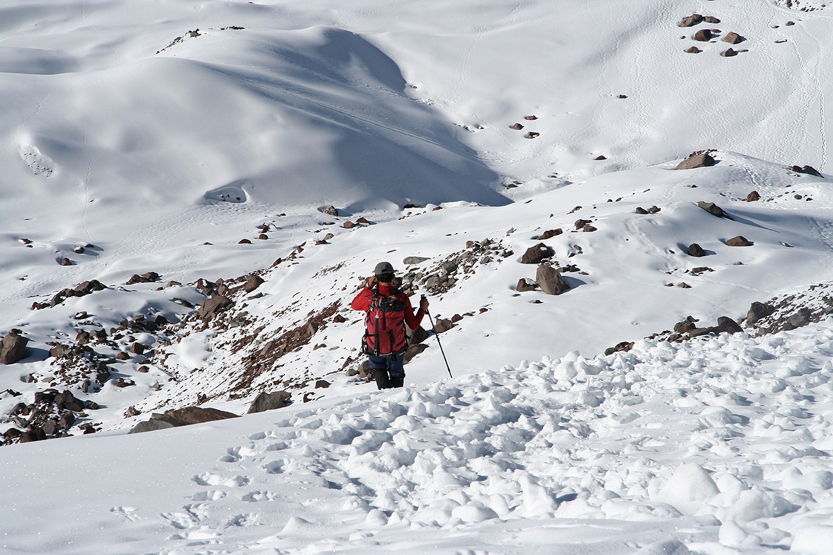
We started the descent at 0650. As always, walking downhill on soft snow is a lot easier
than walking up. In fact, in seemingly no time compared to our
ascent, we were back down at the snowridge in the col. From here, we had a very
good view directly down to the refugio.
The route below here has gained a bad reputation due to rockfall danger from
the cliffs. This year, because of abundant snowfall, this danger was very low
indeed. We were in no hurry to descend, it was still very early in the morning. We had been very tired, but
this was now all gone. Rob was
truly enjoying the ridge views before making the final descent. Similarly,
Diego surely was quite happy.
His team had made the summit and he had contributed in a significant way.
There was little left, but to descend the last steepish hill.
We were back down by 0900 after yet another long rest where we took off crampons and fleece.
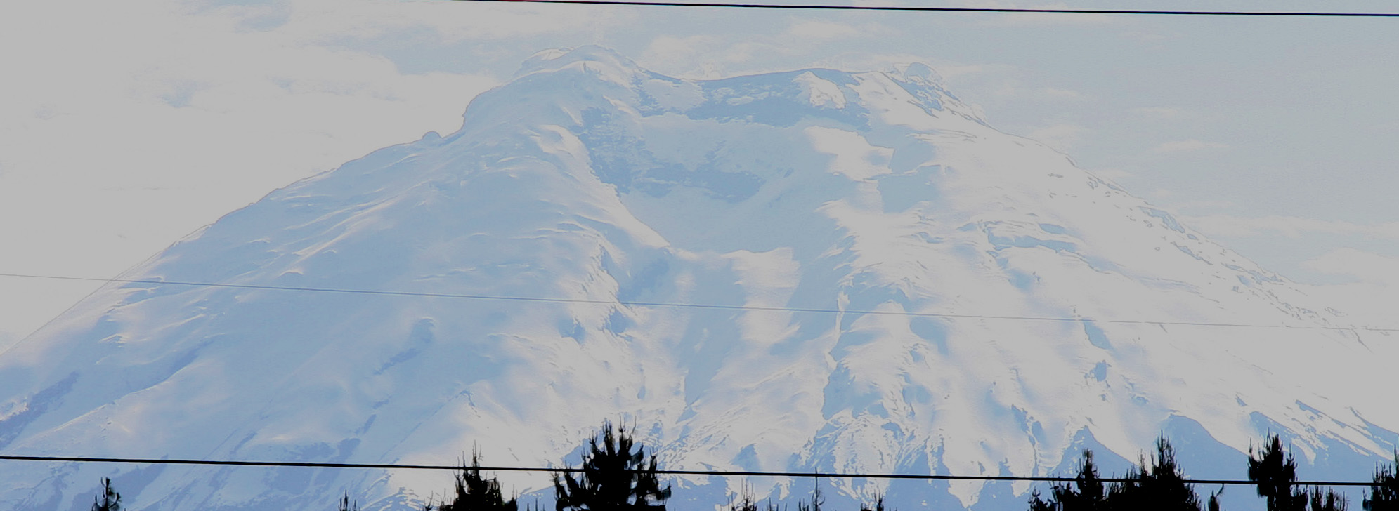
The sun was baking hot above 5100 meter. We departed from the refugio by 1000 and the car was ready
for our long drive back to Quito before 1100. Interesting, Chimborazo was already gone in a thick
cover of clouds. On our way back, we had good views
of Cotopaxi as well as our little
bonus top, Loma Santa Cruz Chica.
We all felt motivated for our last planned peak
Cayambe. The agreement was that Diego would pick us up
around 1500. This would allow just enough time to drive
to the Cayambe hut, have dinner, then sleep before our third
and last night climb. If this worked out, we would be back in
Quito by Friday afternoon, leaving Saturday for some Christmas
shopping before our early Sunday morning flights.
Thus, this trip report continues with the ascent of
Cayambe.
Resources: