Location: South 03.24345, East 036.74982 (GPS at the summit)
Difficulty: YDS class 2+
Climbed January 23. 2019.
Information:
How to get there:
This mountain is located near the city of Arusha. From Arusha, take the
main Hwy. (T2) east towards Moshi.
Turn left approximately 20 kilometer from Arusha, there are signs for
Arusha National Park. After a bit more than 7 kilometer, you will reach
the Park Headquarter. Here, registration and the purchase of permits must
be done. This is at location S03.31267, E036.88009, elevation about 1400 meter.
Continue on a park dirt road about 11 kilometer to the trailhead. This is located
at S03.23299, E036.85004, elevation close to 1600 meter.
Route description:
This climb is normally organized as a 3 night, 4 days climb. This is a very
leisurely schedule, with short days and plenty of rest. All kinds of people will
attempt this climb and the difference in physical condition may be very large.
Thus, for some parties this is still considered a tough climb. A stronger party
may want to consider a 2 night, 2.5 days climb if cost and time is an issue.
The first leg is from the trailhead to the huts called Miriakamba. There are
several trails and a road, the shortest trail is about 6 kilometer with
an elevation gain of 900 meter. Park regulations require the party to be
escorted by an armed park ranger. The main danger is the buffalo, this animal
can be quite aggressive and very dangerous to people. The ranger typically
leaves after noon and takes everybody as one group. The result is a very slow
walk adjusted to the slowest participant (there is always one such person).
Expect the walk to take about 4 hours.
Miriakamba is a nice place with rooms that each feature 2 bunk beds, ie. a maximum
of 4 people per room. There is a separate dining room as well as kitchen facilties.
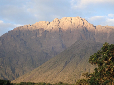
The next section of this climb continues up a broad ridge then onto a wider slope
where the trail runs very gently with many zig-zags. There are some benches
and tables near the half point way at location S03.22461, E036.78550, elevation about
3100 meter. The sign at this location reads 3050 meter, so 50 meter off.
This climb is about 1060 vertical meter. It can easily be done in 3 hours, but
with a larger group and a "pole, pole ranger", one should expect another 4 hours.
You now arrive at the second and highest huts called Saddle hut. It is again quite
a nice complex, pretty similar to Mirakamba. The huts are located just below the
broad saddle connecting Little Meru with Meru at location
S03.21825, E036.77338, elevation about 3565 meter.
The summit is climbed from Saddle Hut. People typically start around 0100 or even earlier,
again there is this incomprehensible argument that one should see the sunrise from the
summit. This often fails anyway, due to clouds. If the day is nice, one will have an
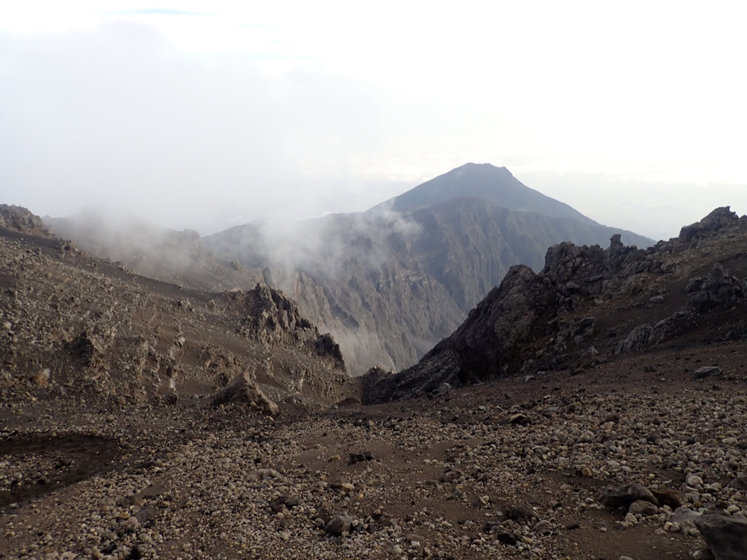
equally good view from the route along the ridge.
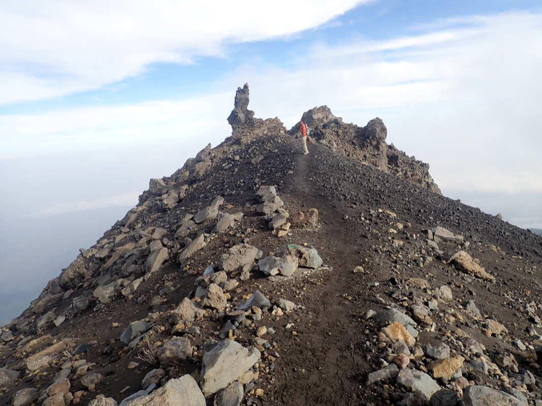
The rest of the route follows a well marked path
sometimes along the very top of
the ridge, but also staying below the ridge crest, mostly on the right hand
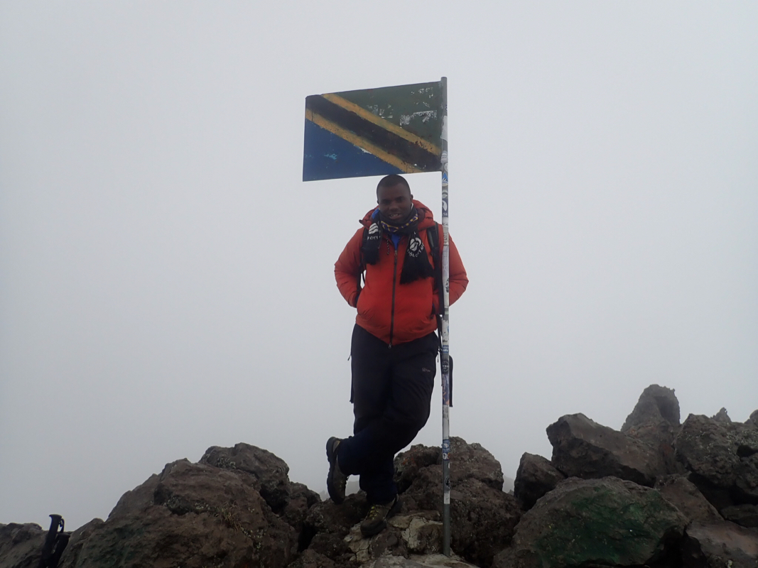
side when ascending. Near the top, you will see a Tanzania flag up high, signaling
that you are soon on top.
Comments:
I resisted strongly the requests to start in the middle of night.
An elephant had been using (and destroying!) the lower part of
the trail to Rhino Point and the ranger wanted to escort people
past that point. It was agreed that the Swiss group, the Israeli
group and the two from Canada would all leave at 0100, while
I would leave (with Geoff) at 0500, a full 4 hours behind.
I slept well, did not notice the early departures and woke up at 0400.
After the normal big breakfast masterly prepared by Geoff, we were
ready to leave at 0445, no need to hang around and wait for 0500.
We walked with the ranger (He carried a rifle dated 1909!), until
we were past the elephant tracks, he turned back and we started moving
slightly faster.
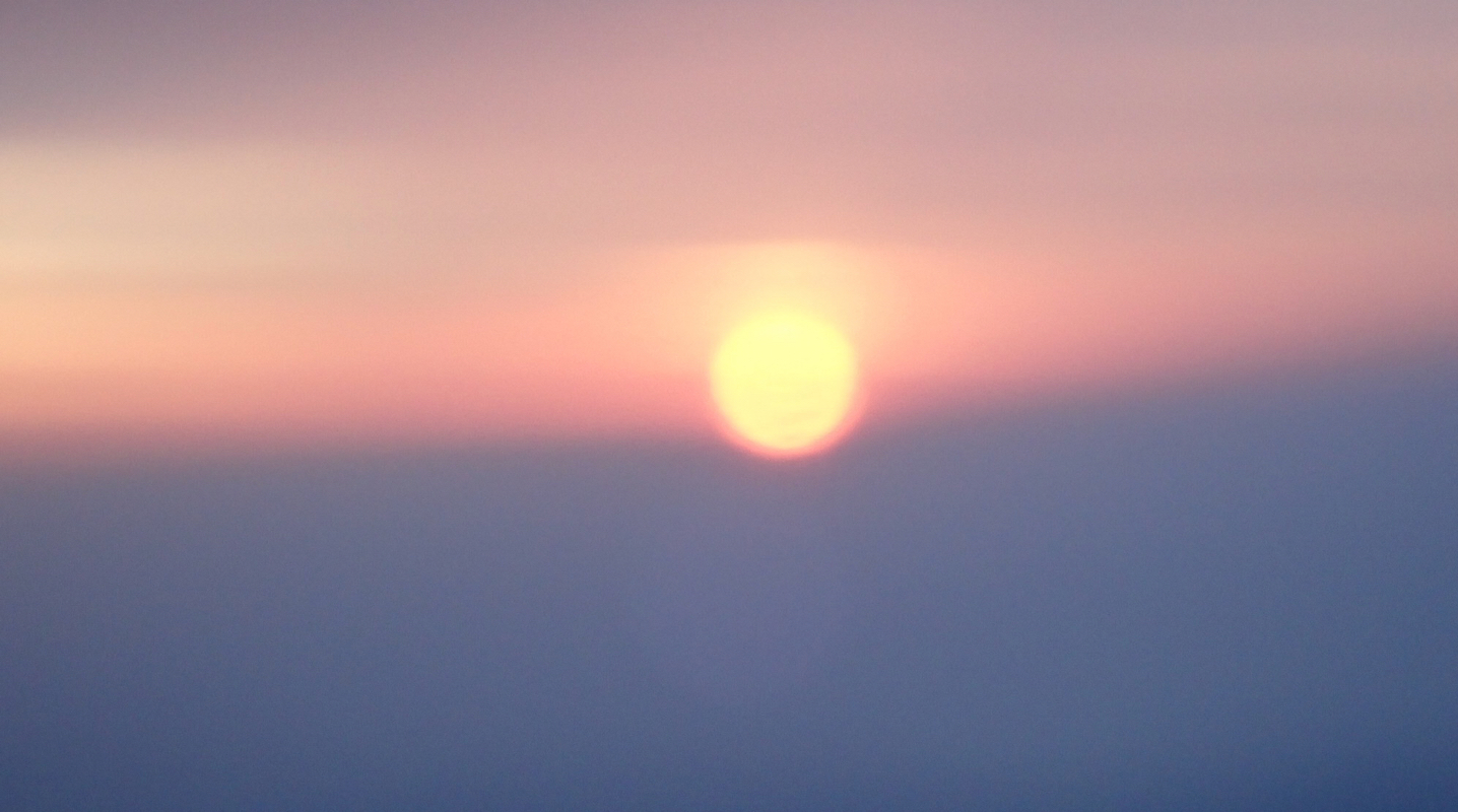
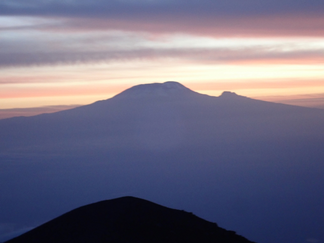
We had a pretty good sunrise while
on the main ridge, here we met
one of the Swiss that had turned back due to problems with breathing.
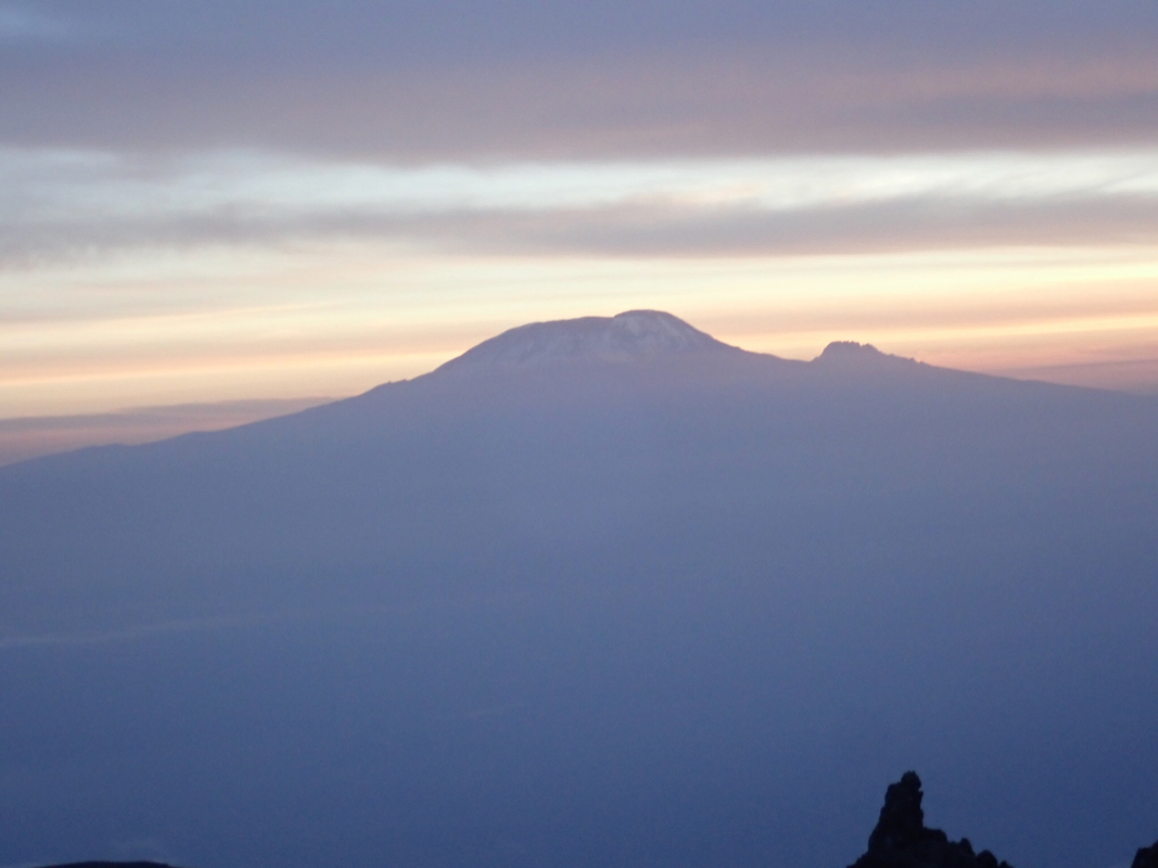
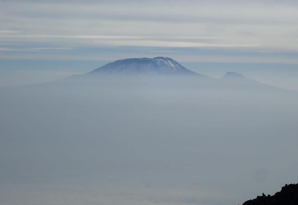
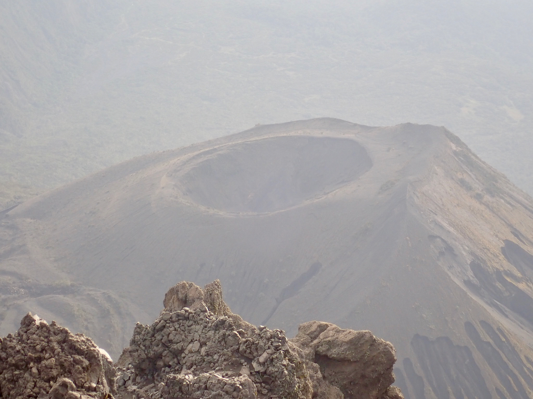
Kilimanjaro looked good
in early morning light, I was there 24 years ago.
Next, somewhat more than 30 minutes before we reached the summit, the
rest of the Swiss were coming down after a successful ascent.
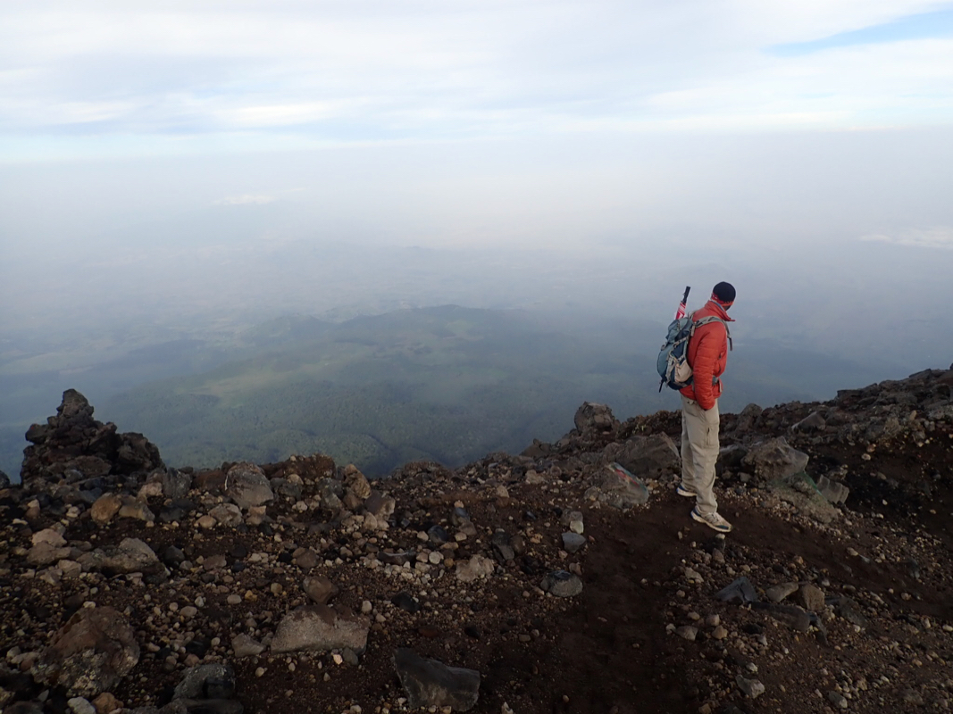
Soon, the summit was in sight, arriving there
at 0740, 2:55 from
Saddle, quicker than I had planned for. The Canadians had just arrived
and the Israeli group was also celebrating
the summit. I let my GPS
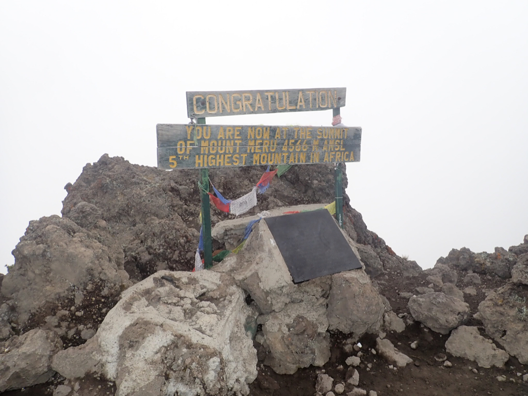
average for about 15 minutes, the elevation came out at 4580m, so
about 14 meter higher than the official value.
Rob measured 4582 when he was here, so pretty consistent. Given that the
official signs are both higher and lower than what our GPS measures, it
is likely that Meru is in fact
higher than what the summit sign says.
We spend 25 minutes on the summit, a nice place to be with the sun
warming. Kilimanjaro was visible above her clouds.
The Israeli group leaves before us, but we pass them fairly
soon lower on the ridge. We are back at Saddle hut in 1:45 at 0950.
Meru was my last peak on this trip to Tanzania in 2018,
the previous peak was Shungwi.