How to get there:
To get to Papua, you need to fly to Port Moresby. The national airline,
Air Niugini is the only airline serving the country and tickets are generally
quite expensive.
From Port Moresby, continue with a domestic flight to the town of Mount Hagen, the third
largest city in Papua. This flight is one hour. The most convenient way to have a supported
climb is to organize this via Raphael Anis Kewa. he can be reached
by email to: troutfarm22@gmail.com or anisrafael606@gmail.com, and by
whatsapp: +675-7268-0743.
From Mount Hagen, travel west on Highlands Hwy. to Togoba, then go more north on Enga Hwy.
Fork left onto the Hwy. serving Tambul near location S5.8187, E144.0125. Drive this road beyond
Tambul to location S05.965159, E143.840801, elevation near 2790 meter.
You should see a portal
on your left, this marks the beginning of the trail.
Route:
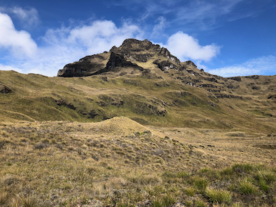
A very nice trail, largely made with pieces of wood placed across, runs very gradually up
through forest following a broad ridge. When the trail breaks into the open, the ridge is
more pronounced. The trail descends off the left side of this ridge and
soon enters a is all grass.
Continue to follow a pretty clear track following
this valley uphill. The track will always stay right, that is you will have the main
river on your left hand side while gently walking uphill. Unfortunately, this grass is quite
wet, possibly less so near the end of the dry season. Higher up, the valley turns slightly
right and you will arrive at the campsite located at S06.029063, E143.897157, elevation about
3630 meter. There are several nice spots for tents here.
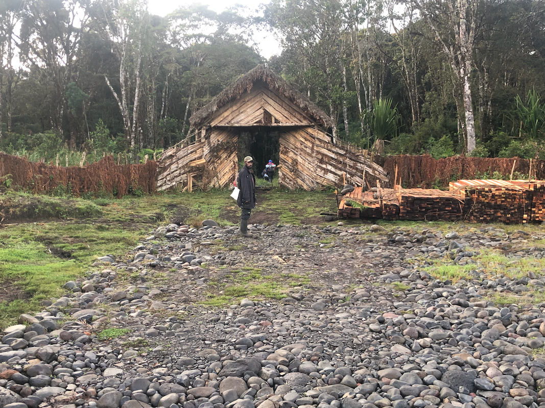
A small hut slightly uphill is used
by supporting porters and guides.
The summit climb continues, still on a very clear trail, uphill to reach the saddle that
marks the end of the valley.
From here, the route just follows the ridge, then zig-zags up
steeper grass.
There are a couple of spots with some fixed protection.
This protection has seen better days
and is more
of a hindrance than
help in some spots.
When it rains, this
route is steep and slippery, one should take care and check for stable footing. The upper part
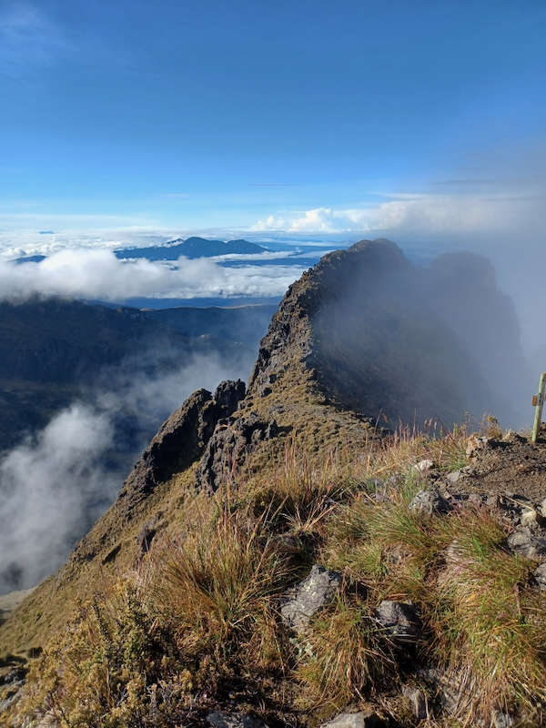
of the route follows a somewhat more gentle gully to reach the ridge very close to
the summit. This ridge continues
from the summit point,the next hump being only
slightly lower.
Comments:
After climbing Mount Wilhelm we returned to
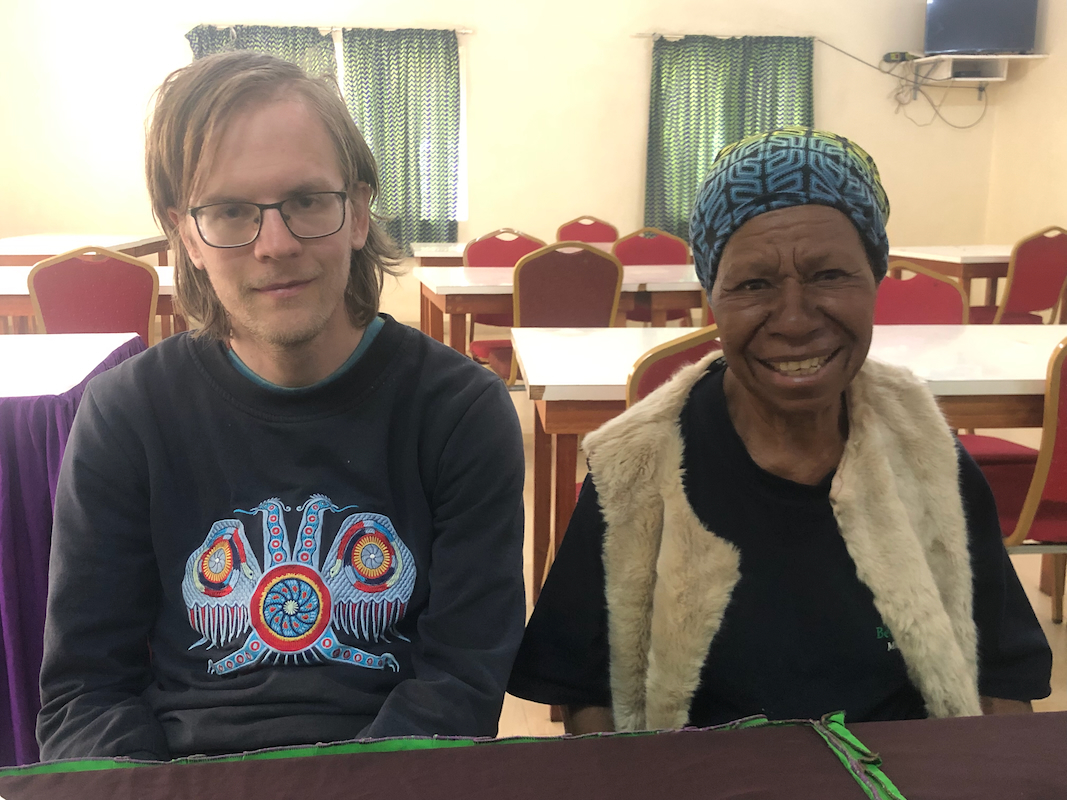
Mount Hagen where we met Raphael.
Lunch was served. It was
nice that Betty could join us
before she needed
to return with preparations for her next visitors. We drove
to a lodge called Magic Mountain, location S5.79914, E144.07912, elevation
near 2480m and stayed there for the night.
The next morning, we drove to the trailhead, arriving there after daybreak at 0700.
It took us about 1:20 hours to reach the grass valley, then another 2 hours to arrive
in camp. We put up my Bibler mountain tent and where all settled before the afternoon
rain started.
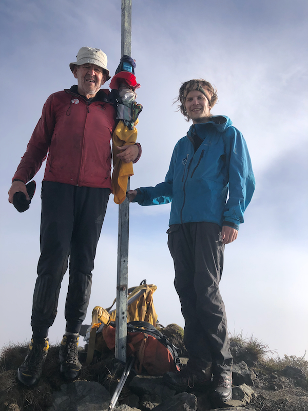
The next morning, we started out for the summit, leaving camp at daybreak, 0605 and reaching
the summit after 1:50 hours, shortly before 0800. We spent about 20 minutes
there enjoying a clear sky to the east, while local clouds accumulated on our west side.
A very bright, circular rainbow appeared in the clouds and we could see the shadow of the sharp
summit with us on the very top, in the middle of the circle. Very fascinating and slightly
difficult to capture with our mobile camera.
We descended back to camp in 1:15. A long break with a small lunch, then breaking camp, starting
the return trek at 1030. We reached the forest after 1:30 and called our driver from
the clearing on top of the ridge. Unfortunately, he was not anywhere nearby and we walked slowly
towards the trailhead, making a final stop about 300 meter before the road.
Our contact Raphael as well as the local guide that had been with us on the summit, Stanley,
pointed out that it might be dangerous to wait at the road. Thus, we did not walk the final few
meter before the driver had confirmed by phone that he was indeed only 1-2 minutes away.
We drove back
to Mount Hagen
and checked in
to Highland hotel. The place was reasonably nice, but quite over-priced. The restaurant
could not provide our first pick from the menu, and our second choice, was also not
available. I ordered a beer with my meal and interestingly, a main question asked was
if I wanted the beer in a can or in a bottle? The same beer. I ended up having a bottle
first, then a can.
The next morning, we checked out and the hotel did provide complementary transport to
the airport. We were now on our way to Bali, unfortunately, this involved 4 flights
via Manila and Taipei.