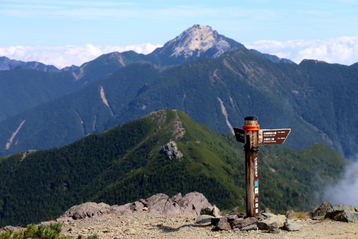
Location: North 36.28928, East 137.64781 (GPS on the summit)
Difficulty: YDS class 2
Climbed August 14. 2016.
Information:
How to get there:
This mountain, the highest in Japan aside from Mount Fuji, is best accessed from the
town of Kofu (N35.64725, E138.53897). Locate the small valley going west, with a Hwy.
numbered 20 (there is another Hwy. 20 as well, so pay attention.) The correct valley
has a place called Ashiyasu Hot Spring marked near its upper end. Since there is almost no
parking available at the trailhead and since the road from Ashiyasu is rather narrow, there
is bus service between these two points. The parking lot in Ashiyasu is located at
N35.63315, E138.36252, elevation 950 meter. This parking is free of charge. One may also
take this bus service directly from the town of Kofu.
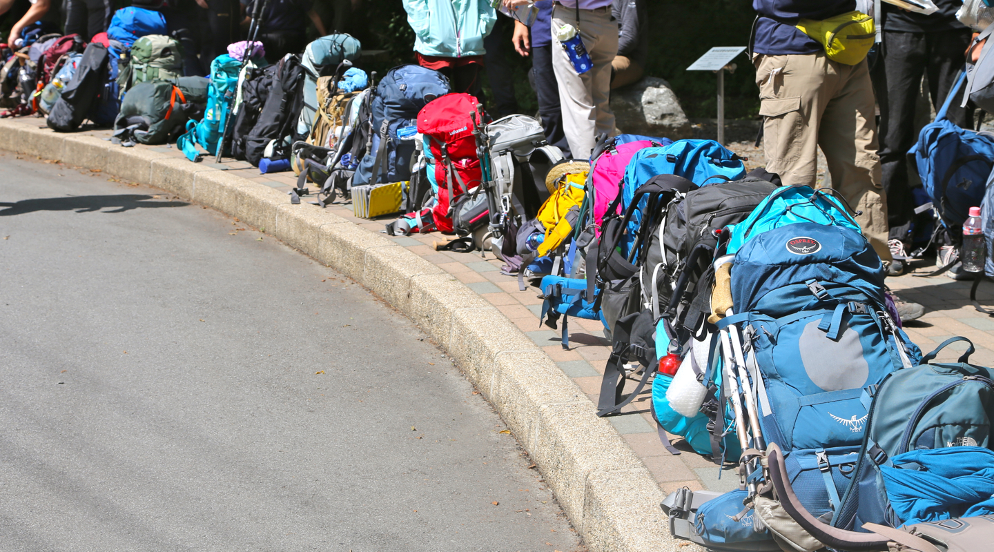
The bus trip from Ashiyasu parking takes about 1 hour and the fare is a bit more than
1000 yen. Buses operate frequently in the main season for hiking (late July and August).
Often, more than one bus will depart in order to get everybody going.
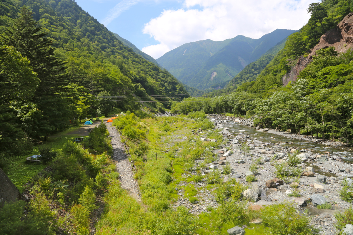
The bus will deliver you to the trailhead at the bottom of a pretty wild and narrow
valley, this location is N35.69705, E138.27080, elevation about 1530 meter.
Route description:
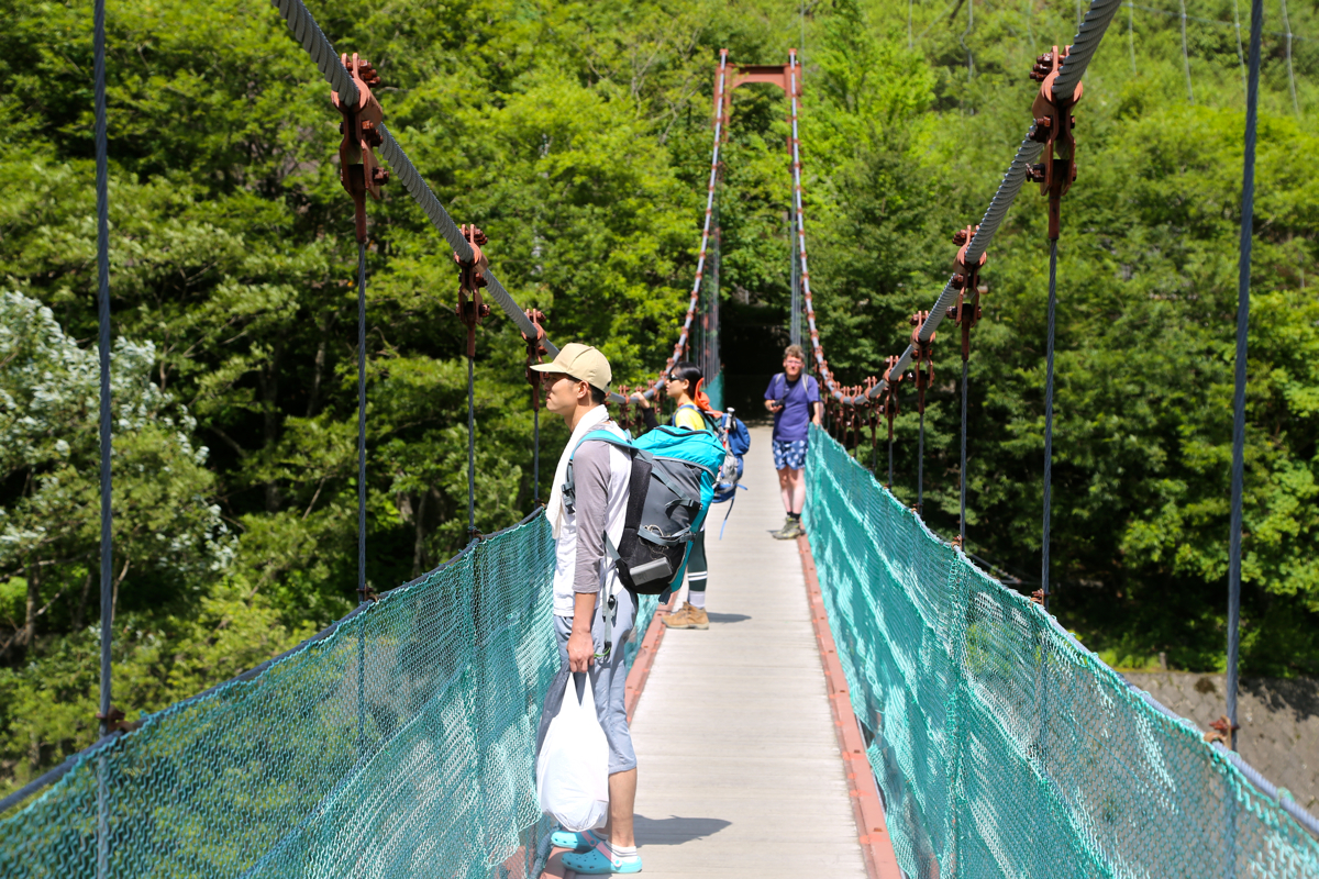
Walk up the paved road to find the nice
suspension foot-bridge across
the river. On the far side, the
trail serves a camp ground slightly upstream,
the main trail starts from here. Immediately after crossing the bridge, a smaller
trail forks left and provides a small short-cut to the main trail.
Head up the trail, initially along a river in a small side-valley. Soon, there
is a trail fork. Both trails may be used, however, this description will only
cover the trail forking right.
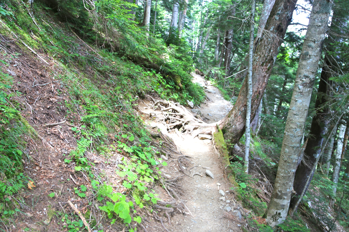
Go right, the trail almost immediately starts a steep and relentless climb up
a spur. Sharp zig-zags,afew smaller sections with man-made steps, you ascend
about 700 vertical meter before the trail reaches a small plateau, then traverses
off to the left. This traverse is mostly horizontal,
with a few smaller up and
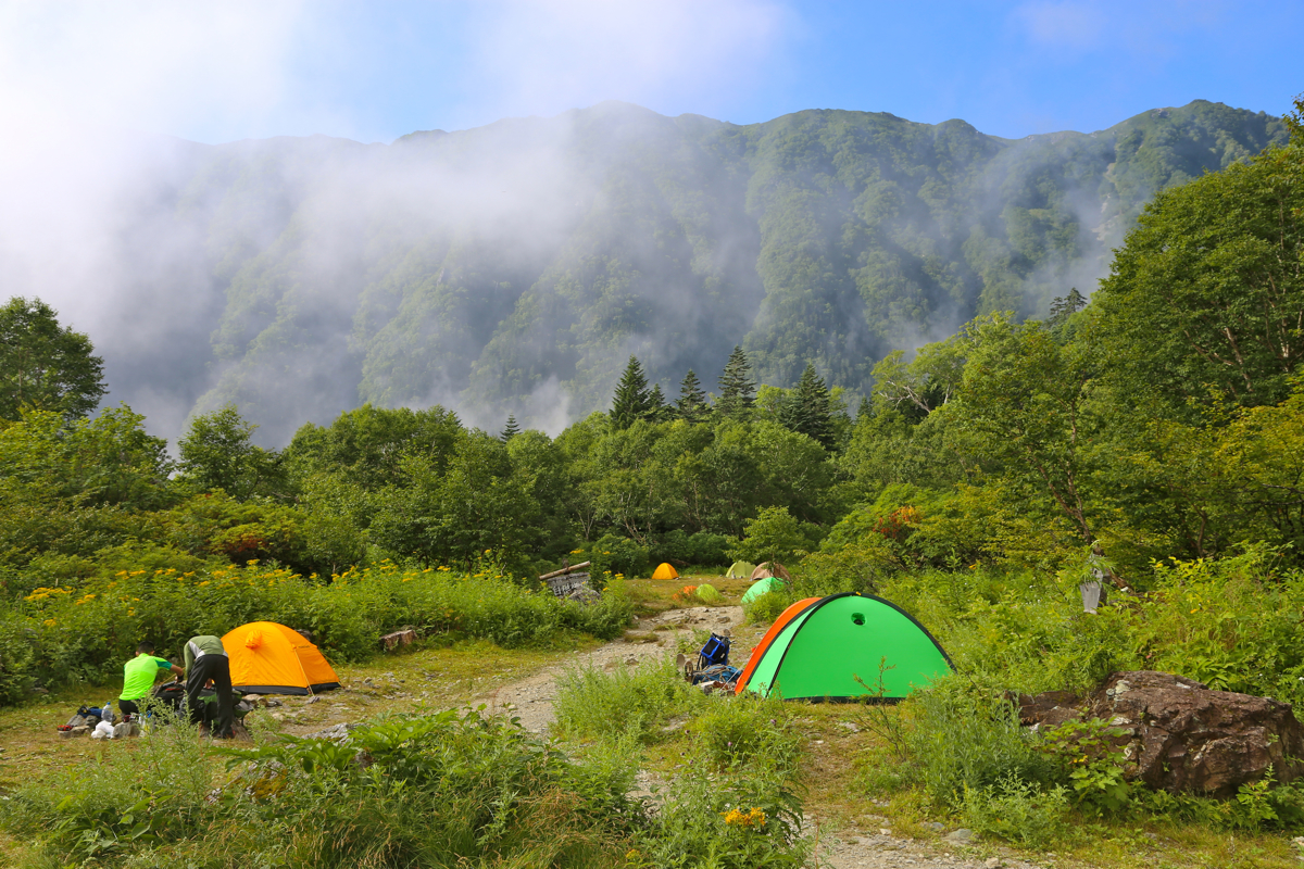
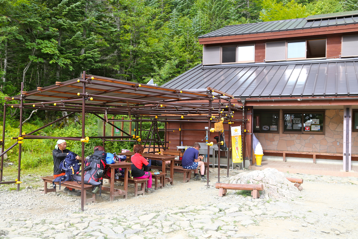
down sections in order to reach a major hut located at
N35.68593, E138.25237, elevation about 2235 meter. There is also a nice area nearby where
hikers can pitch their tents.
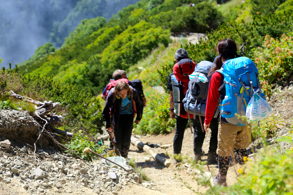
From the hut, the route starts out up a green gully (low vegetation only), partly also
climbing a bit on the right hand side of this among bigger trees.
The trail finally tops out on
the main crest (the north ridge of Kita) at elevation
2845 meter.
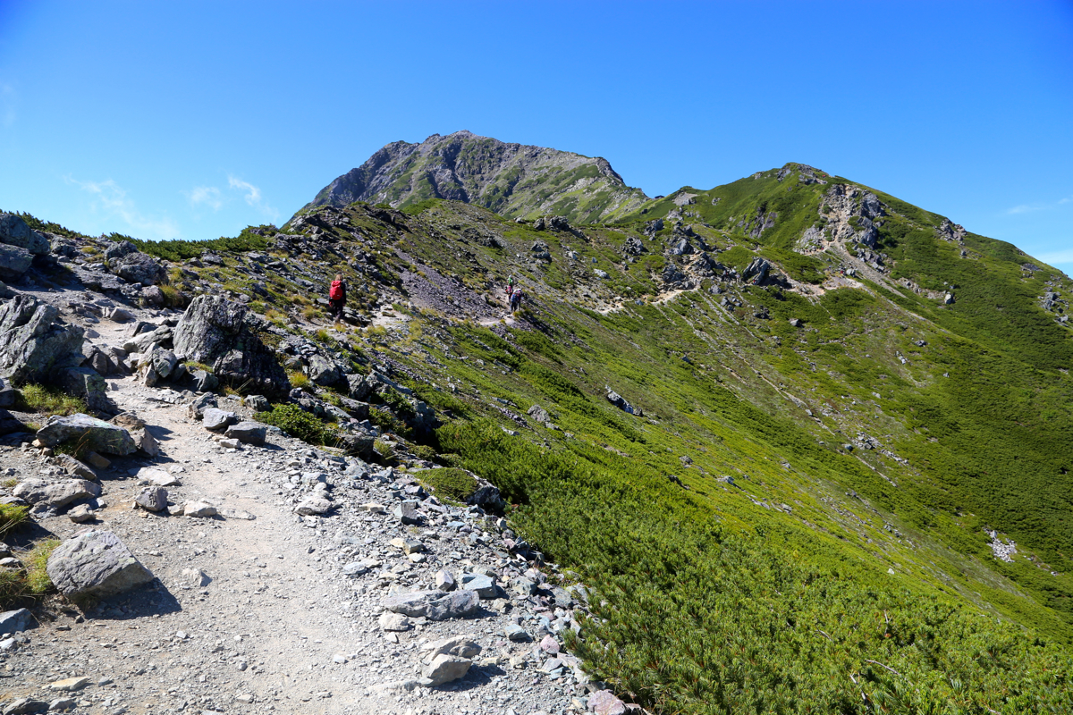
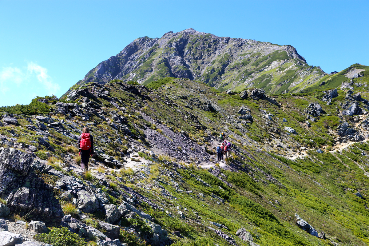
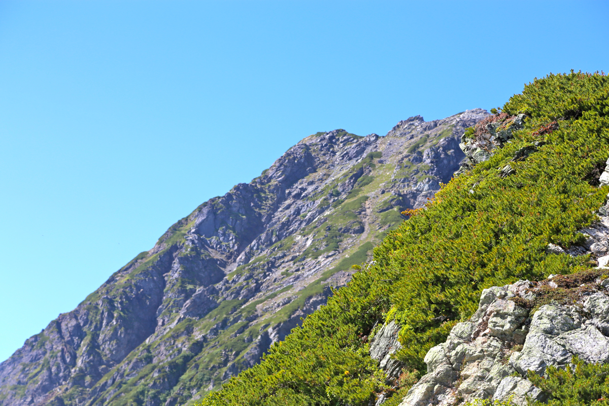
From here, one just follows the obvious trail on
or near the ridge.
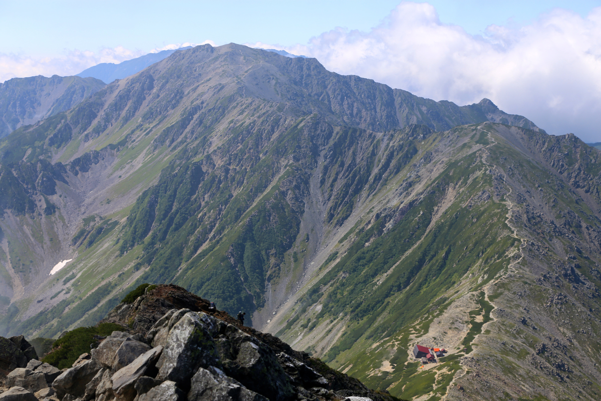
You will pass
a Japanese mountain hut at slightly more than 3000 meter of elevation. The trail continues
up a slightly steeper section, then more gently in rocky terrain. You finally pass
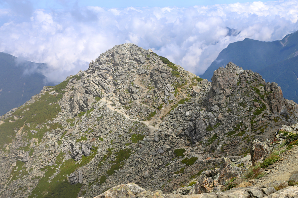
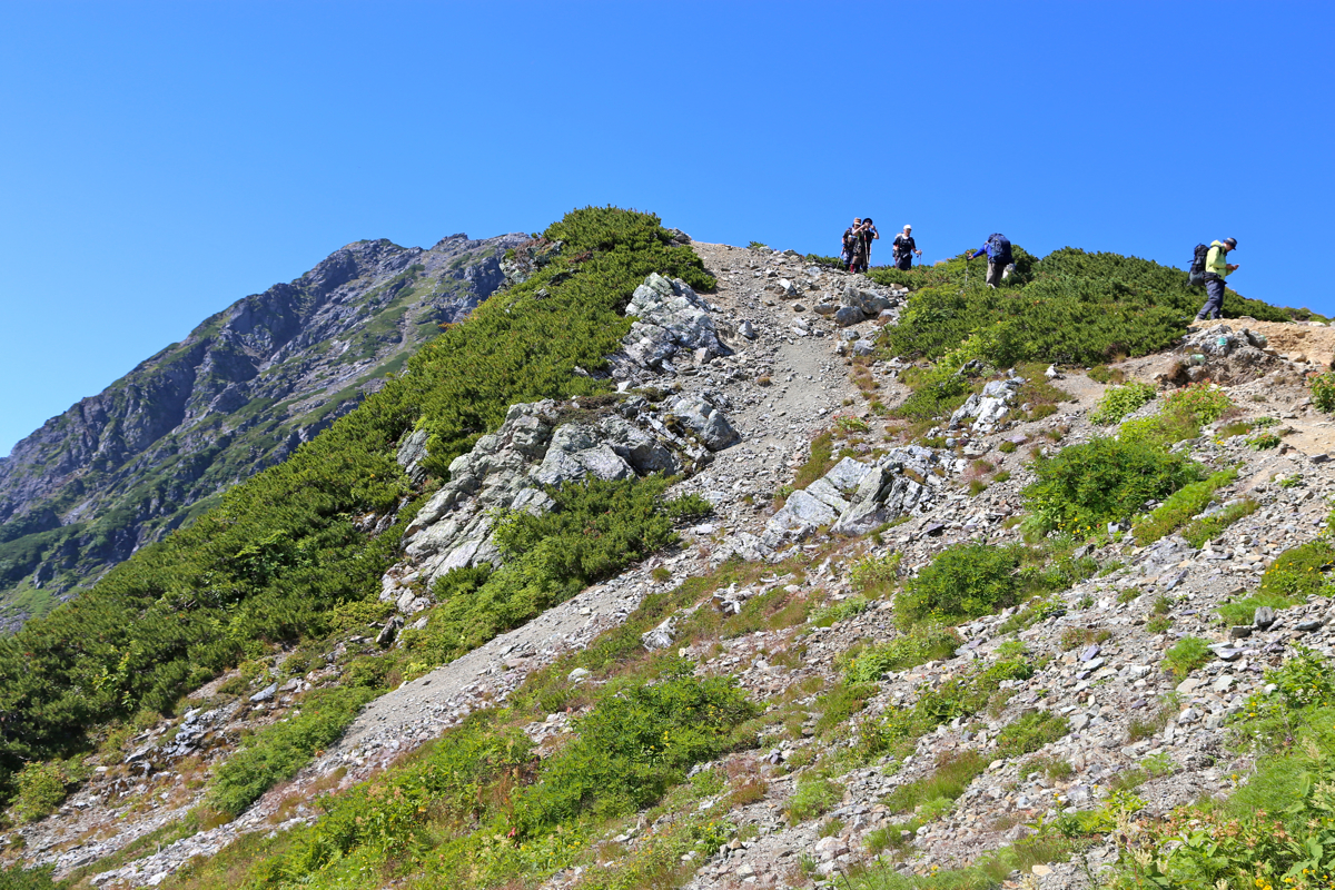
a false summit (pic. is looking back)
on the right before entering the short, final summit ridge. Comments:
We caught the first bus, at 0515 from Ashiyasu parking, arriving at the trailhead
around 0615. After some short preparations, we were on our way by 0625.
Quite a substantial uphill, up the spur,
then more horizontally, arriving at the hut
in 1:20. We took a good 15 minute break here before
taking on the next big uphill,
from the hut to the main crest.
This is where the scenic part
of this climb really begins. We truly enjoyed the
hike up to and past the mountain hut, then onwards to the summit.
The false summit tricked me, so we first ascended it only to discover that the
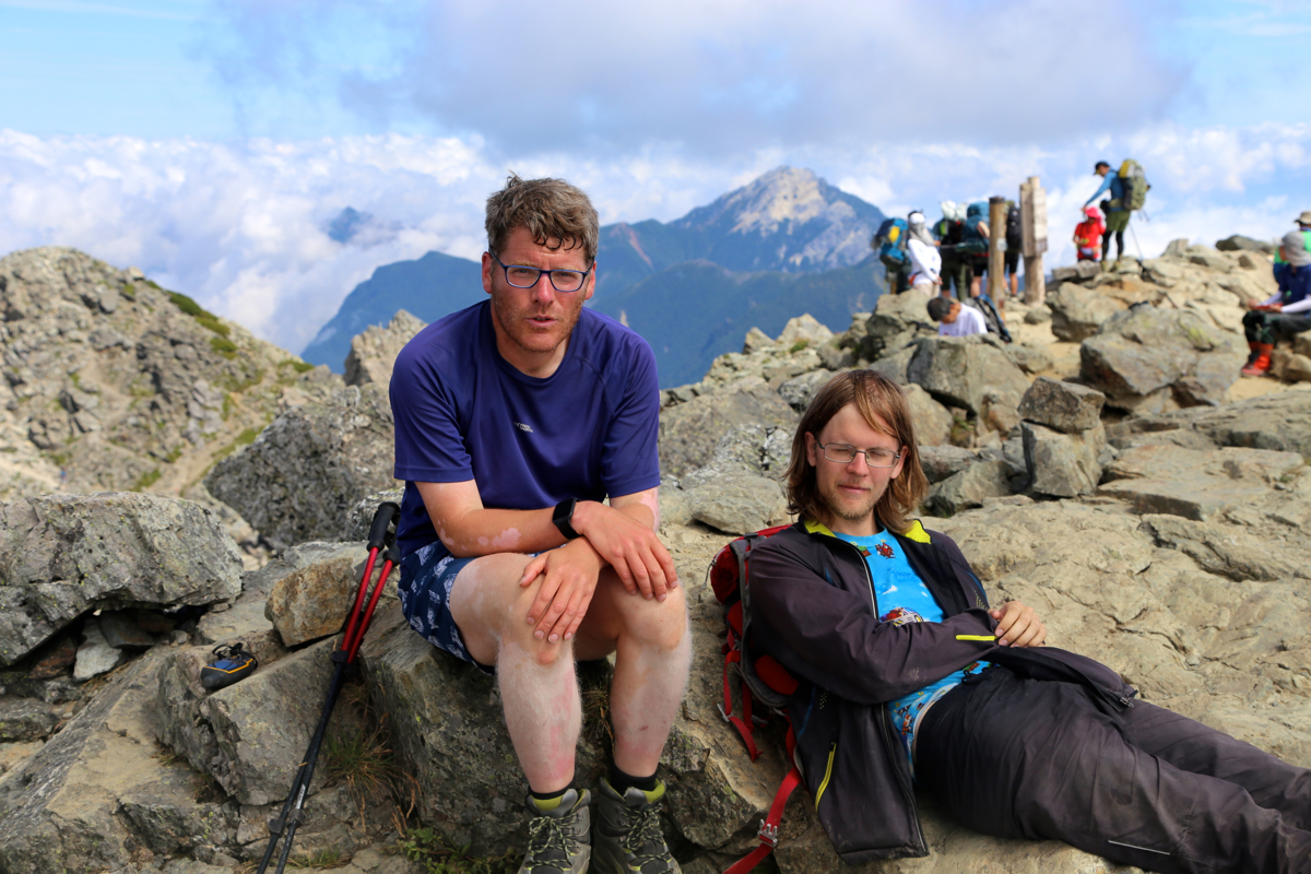
crowd was standing across at the true summit, a bit further away.
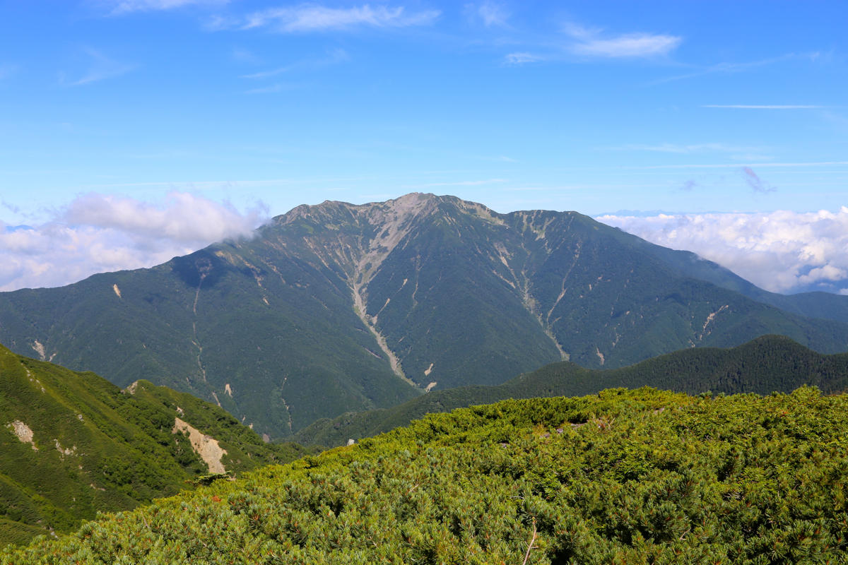
We were there at 0940, so 3 hours of walking. Nice weather, quite a few clouds below us, but also
nice views across to nearby mountains, some almost as high, most likely exceeding
3000 meter. The ridge that
continues south looked very nice, however, we need to
catch a bus in order to get back to our parked car.
We spend 50 minutes on the top.
This is the last ultra prominent mountain of
our trip, but also the highest mountain in Japan that does not look like
a vulcano. Hotaka, our second mountain, is almost as high, perhaps the best two
peaks among the set of 21.
We subsequently descend back down to the lower hut and decide to order
lunch (rice and curry) there.
About 40 minutes later we descend to the trailhead in 1:10, well ahead of the scheduled
bus departure. The time is now
1340, there is a long line
for the bus. The bus leaves at 1430, in fact 3 buses leave at the
scheduled departure time in order to carry the people that have been waiting.
Here is a quick summary of peaks climbed in our trip to Japan.
