Location: North 01.05925, East 035.41053 (GPS on the summit)
Difficulty: YDS class 1
Climbed February 6. 2020.
Information:
How to get there:
This summit is located quite close to a paved road in the
Cherangani Hills. If approaching the ultra mountain Nakugen from the south,
then this hill may be easily visited on the way.
Locate the point N01.05456, E035.42061 along the road. The elevation is
about 3060 meter. If you have a 4WD, then drive up the steep track that
meets the road at this point.
Route description:
From the main road, drive up a steepish track (4WD only), stay right
of some escavated area and continue steeply uphill to a road fork on the main crest.
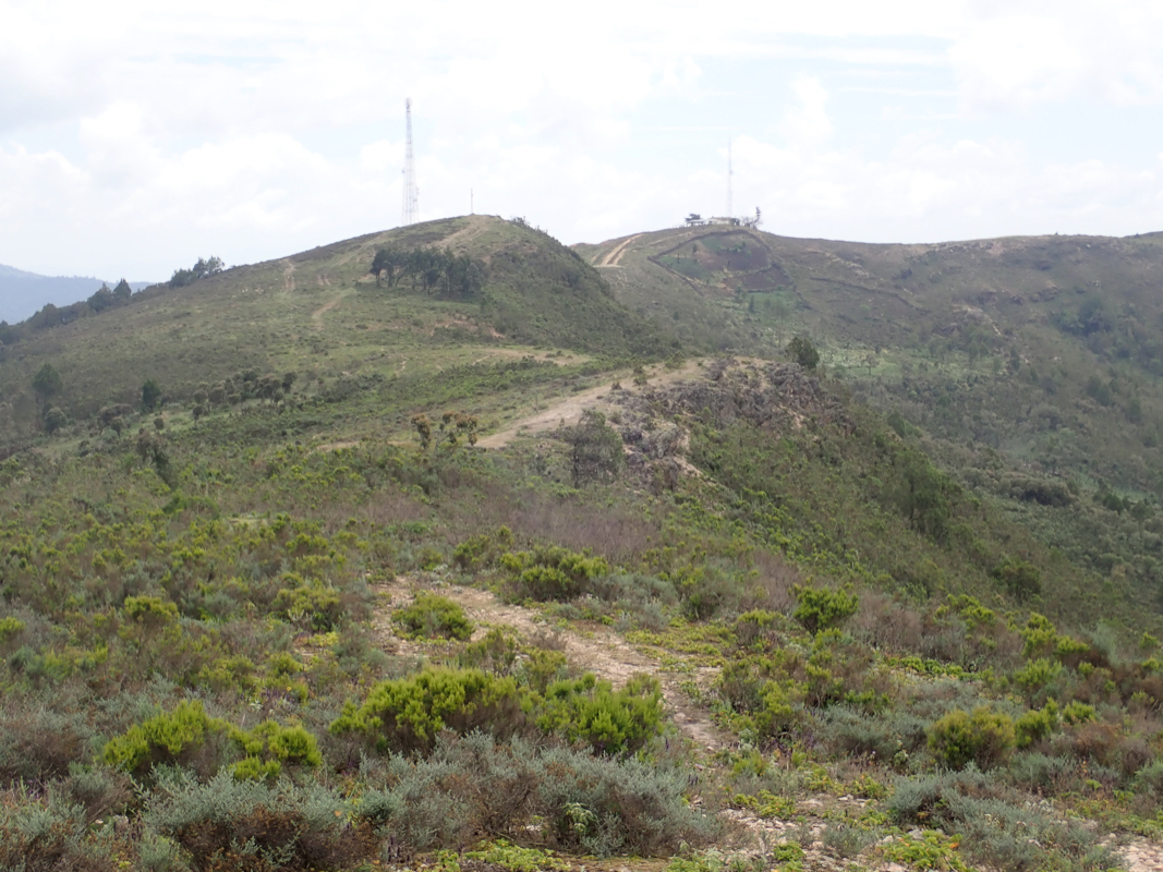
Turn right and park next to some fenced in antennas. The south summit (the left turn)
is clearly lower. From the car park, there is a very short stroll up to the
middle summit having a cross.
From here, walk north along the main crest, a small descent followed by a similar
ascent will get you to the north summit
which is the highest on this summit ridge.
Comments:
The previous part of this report describes the ascent of Ngiro.
On February 5th., we got an early start from our hotel in Baragoi. This day would be
a driving day. Our goal was to move west and hopefully reach the lodge at the foot
of the mountain Mtelo.
The question was how far south we needed to drive before finding a road going east to west.
Google and the map indicated that we needed to go south passing Kisima, then going west
on Hwy. D-370. We did as told, however, after about 5 kilometer, with 80 more
to go, the road deteriorated so badly that we hardly made any progress. The only
option was to turn around and go back to Hwy. 77.
We continued south on Hwy. 77, our next option was to cross west on Hwy. C-51, in order to reach
Hwy. B-4 at a place called Marigat south of lake Salabani. The first part of C-51 was ok, but
then the road turned into a very long nightmare. Big rocks and steep grades. The road descended
into a valley and it seemed like no car had driven here for quite a long time. Possibly a motor bike,
but no vehicle. We carried on and when we finally were close to Marigat, the road was flooded and
another detour south was the only option. It was clear that we would not reach Mtelo and we stopped
for an overnight in the small town of Chemolingot. The night was too warm and we also needed precautions
with respect to malaria mosquitos.
We got an alarming text message from the lodge at Mtelo informing us that a key bridge on Hwy. B-4 had
been destroyed and that the only way to reach him would be to return south, then cross the Cherangani Hills
to the west side before going north. One of the few highways with green color on the map and then
no bridge? By now we had so many surprises related to roads in Kenya, but this? In any case,
we observed that the access road to the town of Tamkal forked left before this river. Tamkal was
a key town in our plan to climb Nakugen from the north. We therefore decided to attempt Nakugen
as planned, but now before travelling to Mtelo. We started shortly before sunrise and travelled
north from Chemolingot on B-4. A nice, 2-lane highway until,
without warning, it abruptly changed
to a 4WD track in the middle of some hills! We tried to continue,
but quickly agreed that we should
give up our plan to reach Tamkal. It seemed quite incredible that a major highway could change
like this, what happened? Did they just run out of money in the middle of construction?
Thus, our new plan would be to drive south, then try to cross the Cherangani Hills, possibly finding
a route to Nakugen from the south. Given the state of roads in Kenya, we had no clues of how long
this might take, Adam thought perhaps 3 days? We were just giving up on B-4 ("BeFour" as we named it.)
This was a "green" painted major highway, while all the roads up in Cherangani were tiny "white" roads.
Driving south went well and to our pleasant surprise, the side road C-51 running west from Marigat into the
Cherangani was also paved. In fact, almost all roads up in these hills were paved, We decided that the small
town of Tangul would be our new starting point for Nakugen. Before getting there, we drove right
next to a prominent hill named Kaisungur. It looked like an easy bonus and after 2 days of driving
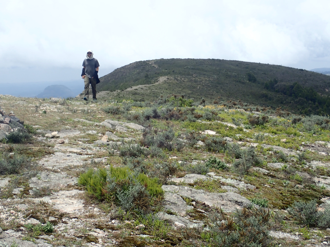
we needed to stretch our legs. I coached the landcruiser all the way up to some antennas
on the main summit ridge. From here, we spent about 30 minutes exploring the middle and the (highest)
north summit.
This trip report continues with Nakugen.
Resources:
Images
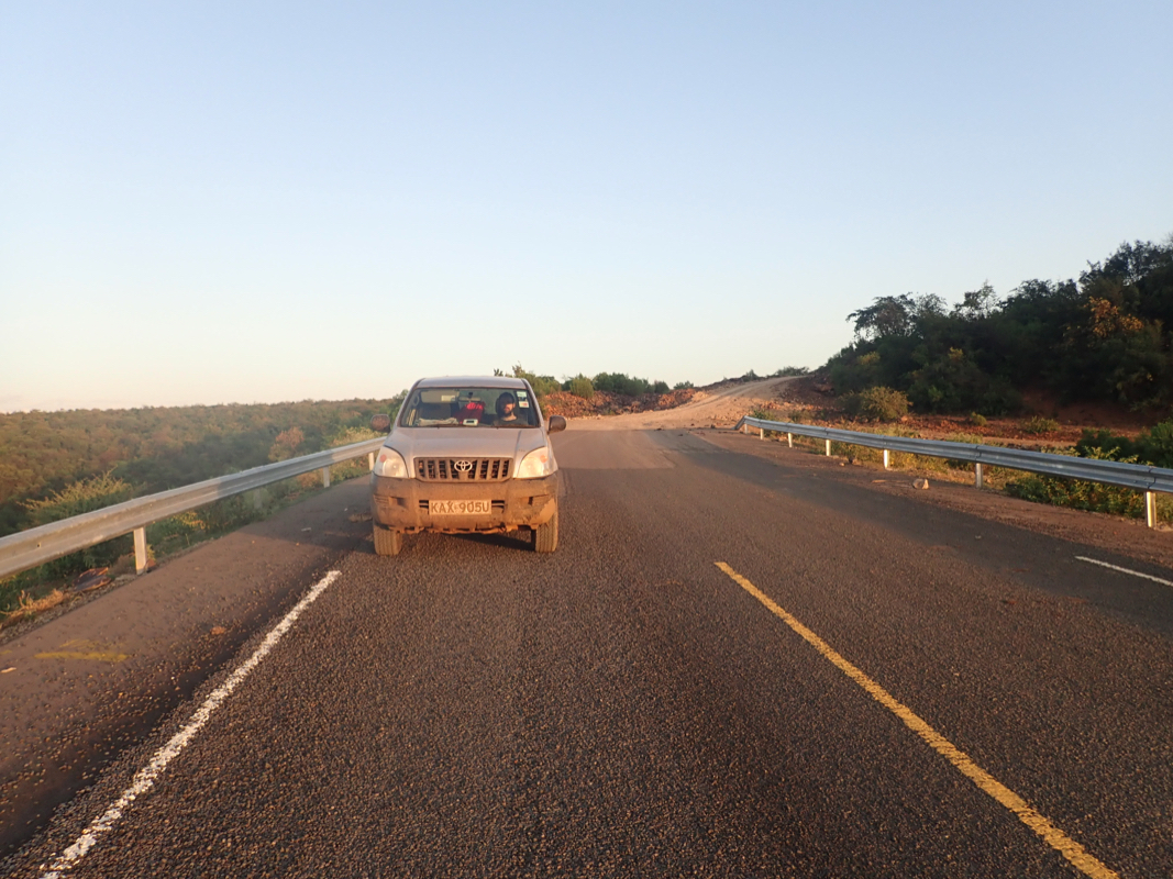
Sunrise on B-4, this was "BeFour" things got better "After".
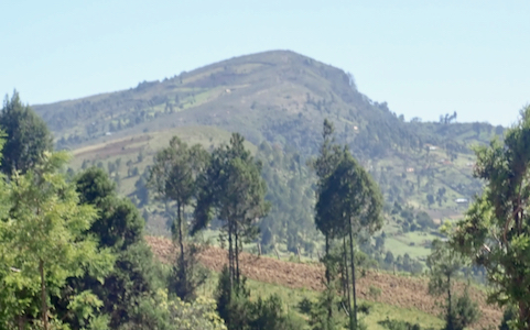
The summit ridge, as seen from the north summit. The middle and the south summit.