How to get there:
This summit is about 21 kilometer north-east of Montreux.
The west access is from the village Grandvillard, then a nice (narrow) paved road
ascending to Les Baudes, there is a parking lot just before the farm house at location
N46.535739, E007.115339, elevation about 1280 meter.
There is also trail access from the east side, closer to Gstaad, however this was not
explored.
Route description:
Head up along the road to the upper building. The trail starts here, initially left,
then right, ascending through the forest.
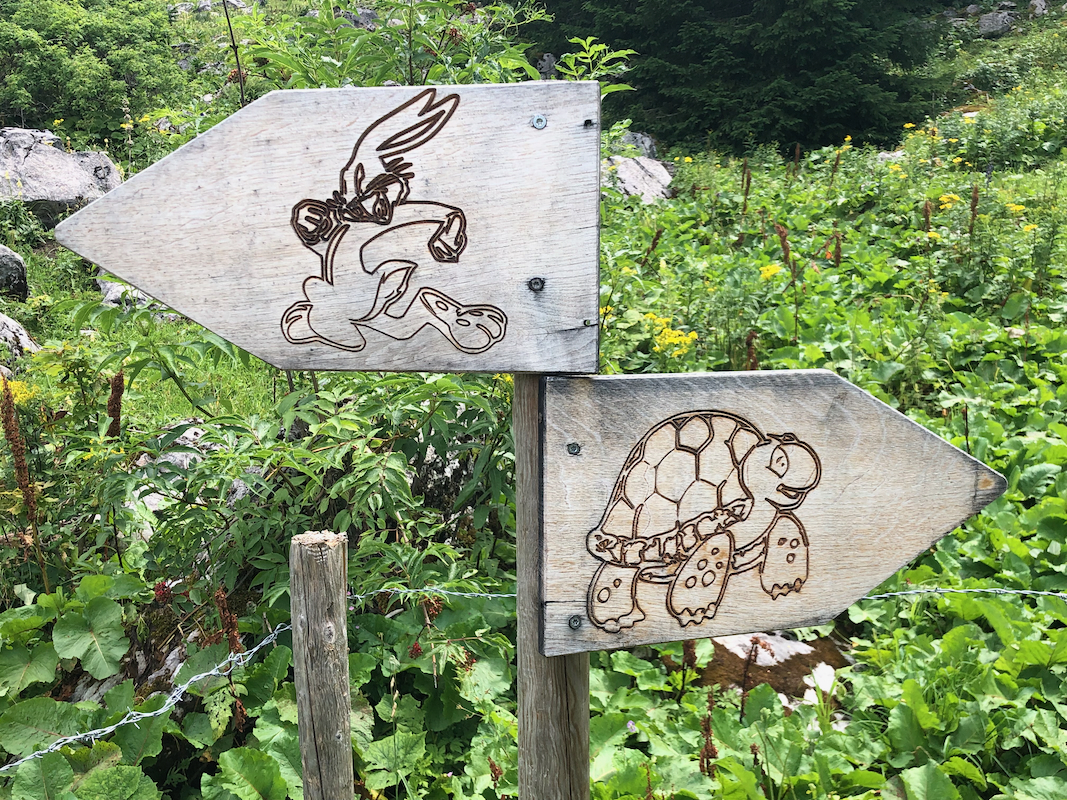
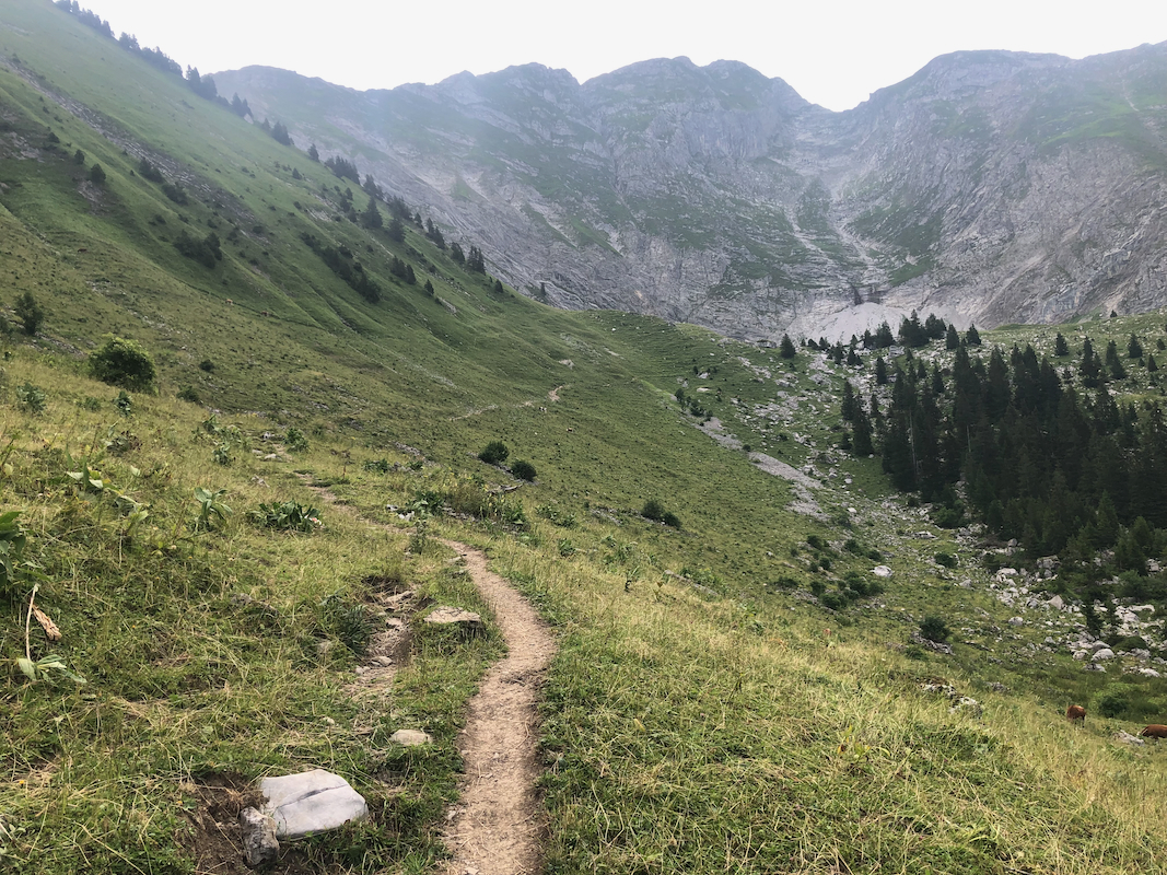
You emerge in the upper valley, a nice sign
informs you that there are two trails up to the refuge, named
Bounavaux.
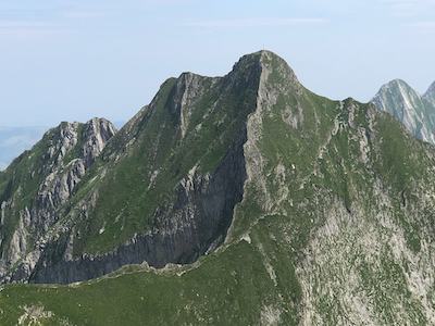
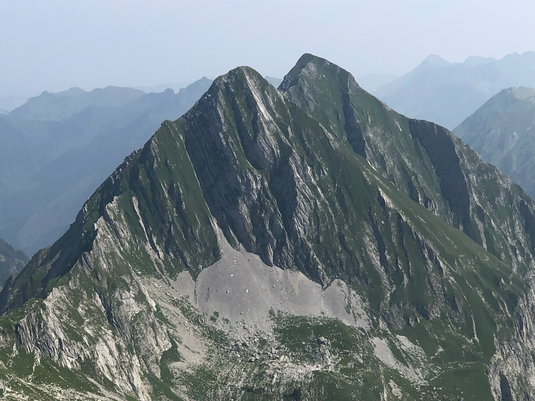
The route continues in a gentle ascending traverse
directly towards the steep mountain towering above.
Just before an upper farm building, there is a trail fork. Going left climbs a nice col
named Col de Bounavaletta, just below 2000 meter elevation. Turn right here and follow
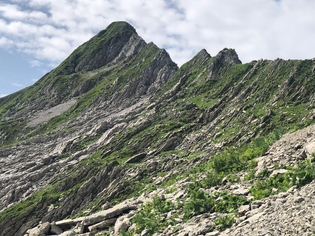
the marked trail as it scrambles upward, then does a pretty long ascending traverse to reach
the north ridge.
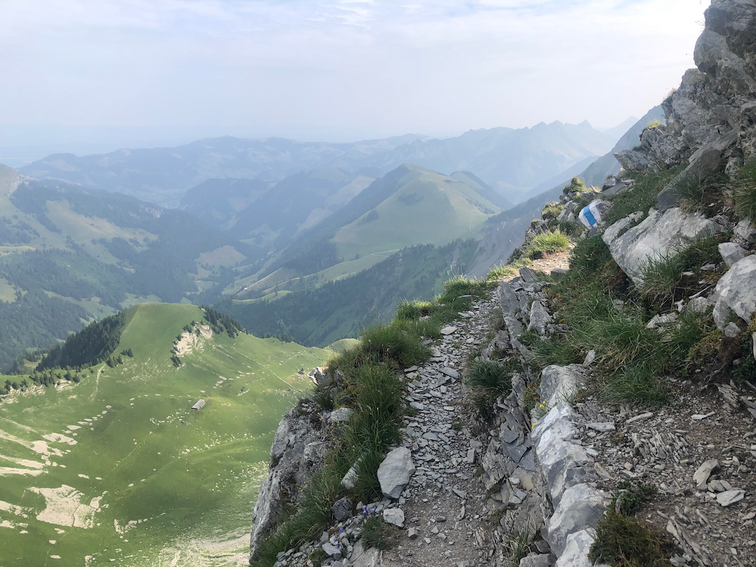
From here, the normal route turns right and traverses well
below the ridge, then
climbs a small slope (there is a wire here), to reach an upper plateau.
Note: There is a more airy variation, just climb the ridge and follow it
towards the summit of Vanil Noir.
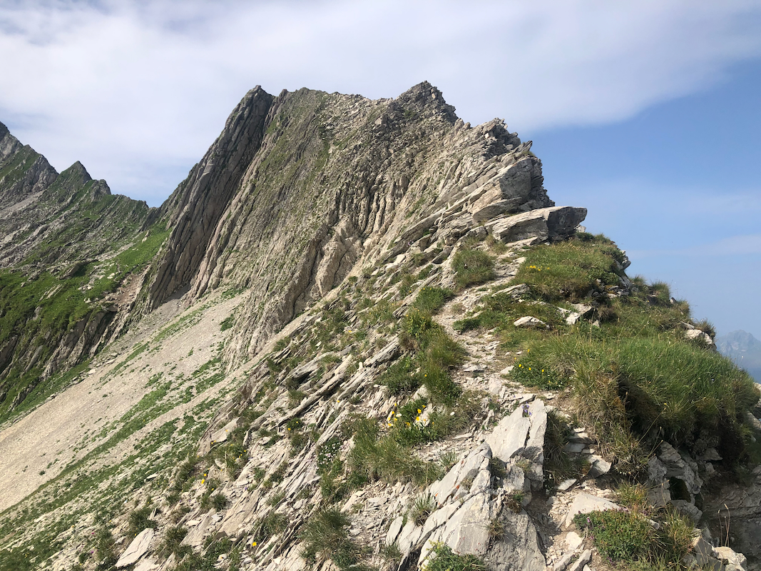
The route now runs in aa line well left of the summit visible ahead. Then, an easy scramble up
a shallow gully. Next, traversing just left of the peak (a false summit), then a short
descent to a notch. The crossing of this notch is protected with a cable. There is exposure
here. Then, a final easy ascent to the summit cross.
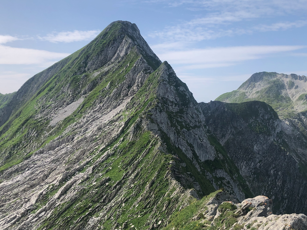
The route now continues down, initially a bit east, then descending along a fairly
exposed route,
mostly protected by cables. From the col, a well marked route descends back
into the main vally and the junction by the upper farm building.
If time permits, it is recommended to do the short side trip and
climb Sur Combe. elevation 13 meter lower than Vanil Noir.
Comments:
Heidi and I had travelled from Bergen, first with the ferry directly to Denmark, then 2 days
of driving before arriving in the small village of Gstaad. I had breakfast at 0700, then left
for the trailhead. I likely should have looked more carefully, there is a trailhead much closer
to my point of departure on the east side of this mountain.
I arrived at the trailhead parking shortly before 0830, the parking lot was almost full. A couple
of free slots, all that I needed. I started hiking at 0930, a very nice morning. There were several
people at the mountain hut, below it a nice sign indicating both a more direct as well as a more
gentle route.
I continued to the nice col, Col de Bounavaletta, arriving there in just a little more than one
hour, a very acceptable rate of ascent. From here, the trail got more exposed, traversing steeper
terrain across to gain the north ridge of the peak. I now continued
following the very top of this
ridge going south. This is NOT the marked route to the summit. However, clearly some people had
taken this alternative. I remembered vaguely from a trip report (Denise?) that there should be
some chains/cables protecting exposed points? The wind had picked up and strong gusts affected
my balance a bit. I had already put my hat away as it otherwise would be taken by the wind. This
ridge certainly had plenty of exposure and a number of very narrow sections. I crossed a local
top along the way and started a short descending section. Time consuming with this wind. This
could not be what Denise had written about!
I took a short break and considered the way ahead.
Pretty obvious conclusion, better to go all the way back to the beginning of this ridge, then
locate the "normal route". Without the wind, and with enough time, this ridge might have been
fun to explore further.
I turned and before I was back at the beginning, almost one hour had passed by. The trail marked
with red and white paint went on the left side, not at the ridge at all. As soon as I hit a short
scramble section, there was a cable. OK, this was another route with respect to difficulty, much
easier. Much closer to the summit, the route crosses a small notch, now on the ridge. This point
was well protected by cables, fairly exposed. I arrived shortly thereafter at the summit cross.
The time was 1120, not bad given my long scramble on the ridge. I left after 10 minutes and continued
to the col between Vanil Noir and Sur Combe. Most of this is a descending traverse in pretty
steepish terrain. Chains protected almost the entire route here. I was back down in the col with
the trail fork shortly before 1200, plenty of time to also visit Sur Combe.
An easy ascent in less than 15 minutes and I was on the summit. This place had a very nice view and
also a pretty nice summit cross. I decided to take my main break up here. The wind was now also
much weaker than before I got to Vanil Noir.
I left around 1220, and had a pleasant walk back down
to my car, arriving there at 1345.