Parângul Mare
- Parângul Mare
- 2519 m
- Primary factor 2103 m
- Location: North 45:20.408, East 023:32.356 (GPS at the summit)
- Romania
- Difficulty: YDS class 1
- Climbed: August 9, 2011
Parângul Mare
|
|
How to get there:
Locate the city of Petrosani, this city is located at Hwy. E79/66, running north-south
near this city. From Petrosani, find a paved road 7A, (Strada Maleia) going west. It continues
straight uphill as road 709F. (7A forks left and soon becomes a pretty bad dirt road, supposed to
be improved in the future). In any case, do proceed uphill, eventuelly in a few switchback curves
until you arrive at hotel Rusu. This is a good place to
spend the night. The location is N45:23.421, E023:26.416, elevation about 1180 meter.
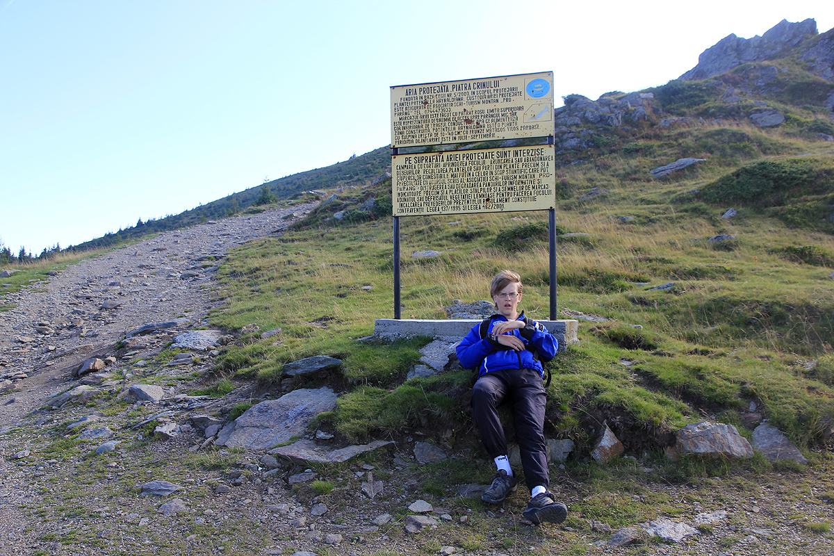
Above hotel Rusu, there is a ski area. A dirt road continues from the hotel and to the top station of the
chairlift. Any 4WD vehicle and most passenger cars should be able to drive up there, this location,
N45:23.061, E023:28.309, elevation about 1690 meter, is a good trailhead. However, it is perfectly
possible to do this hike directly from hotel Rusu as well.
Route description:
From hotel Rusu, follow the dirt road up to the top of the chairlift. If you start at the top station, then
head up the dirt road as it continues more steeply uphill to the top of
the next skilift. From here, the 4WD road
continues up the ridge to a level area with signs below the ridge leading up to the
first summit along a long ridge system, the Parângul Mic, 2073 meter.
Do not climb this peak, but locate the trail that forks right and starts a long traverse across the south face.
This entire trail is marked with a red stripe on a white rectangle, you most likely have seen these markers as
you ascended up to this point.
Follow the trail as it traverses, turns a bit more left and ascends slightly more sustained before reaching the
main crest and the location N45:22.744, E023:30.693, elevation about 2130 meter. Before a new hump on the ridge,
the trail arrives at a signed trailfork. The left trail goes to a small lake, Lacul Mija. Take the right fork,
it will continue a gradual ascent as you see a steeper slope up to the mountain Cârja, 2405 meter looming ahead.
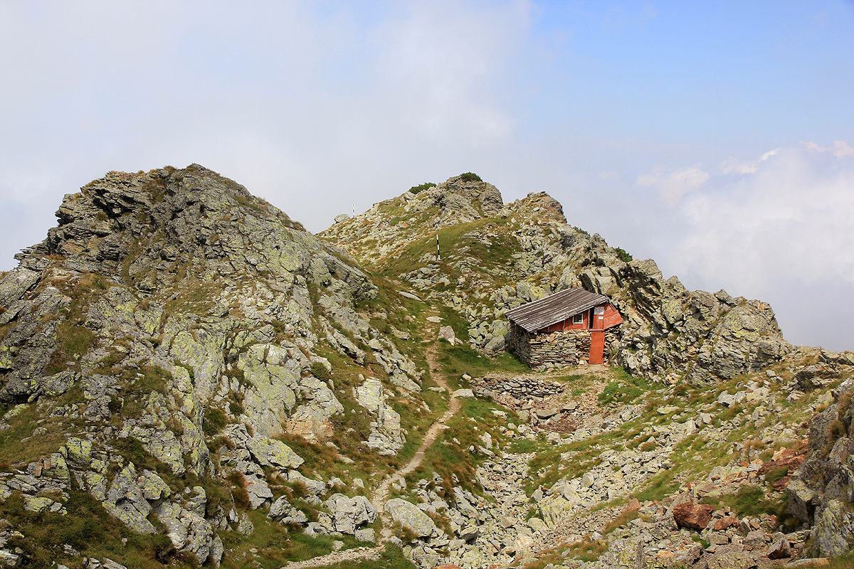
After a small hill, the trail runs by an old hut that
is well hidden between the rocks. Next, a more subsatntial
hill, the trail ascends in several switchback turns before the terrain levels off. The top plateau of Cârja
is quite large and fairly level. The trail passes just right of the highest point, there is no extra effort to
stop by at location N45:21.787, E023:31.269.
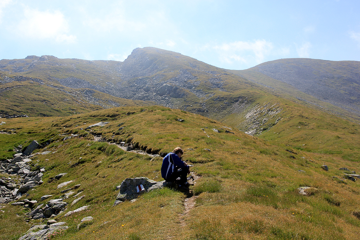
The route now descends about 60 vertical meter to a fairly distinct saddle, then ascends gradually further onwards.
The trail will pass close, but not across the next several small summits,
first on the right (west) side, then into a broad saddle and
across in order to bypass the next peak on its west side. From this location, the summit we are
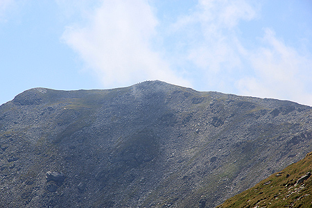
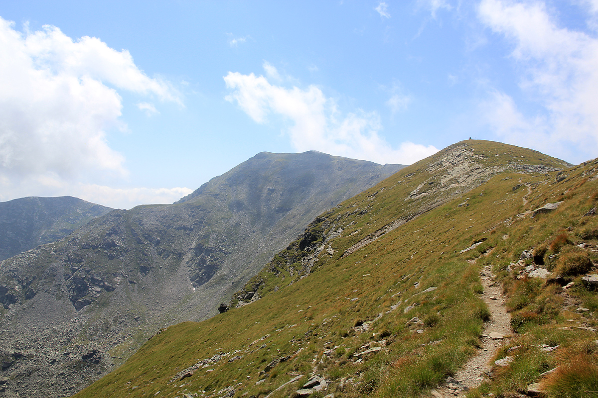
looking for, finally comes into view, still looking distant.
One will observe that the crest runs south before bending more east in order
to reach its highest point. There are several steep cliffs on
your left side, along this section. Overall, this is
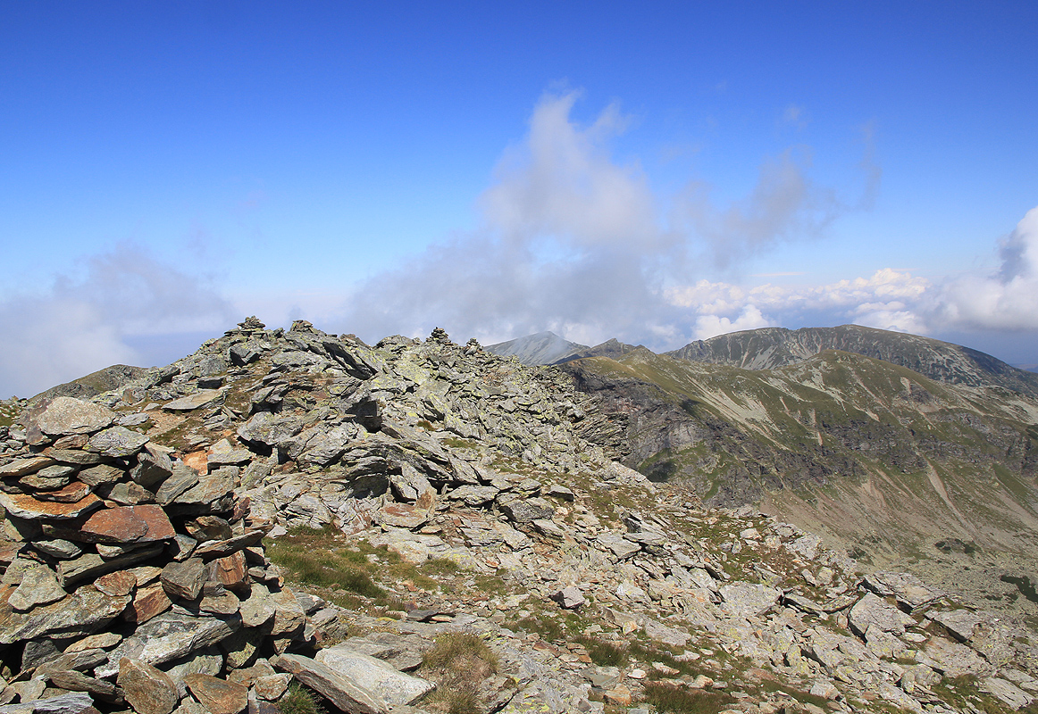
a quite scenic mountain landscape. Continue along the well marked and very visible trail to the summit.
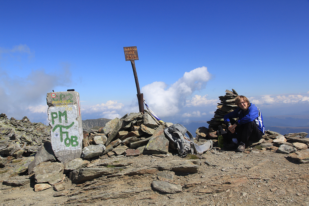
The official summit has a concrete marker.
A nearby, small hump filled with rocks and having several small cairns among them,
competes for the highest point. As this is only a few meter away, most hikers will want to visit both locations.
Comments:
After climbing Moldoveanu in a fairly full day effort, Pål and I drove across to the north of the mountains,
found a (fancy) restaurant that served us dinner, before continuing along Hwy. 7A as recommended by Google Maps.
This recommendation turned out to be questionable, the road got gradually worse and more and more affected by
road work, until reaching the 1950 col. At this point the road essentially ceased to exist and we were left with
about 15 kilometer of dirt that, at best, could pass as a 4WD road. This obviously caused a major delay and we did
arrive at hotel Rusu around 2200, indeed a long day.
The next morning, we wanted to drive up to the top of the lift since it would not start running until there were
more customers. Unfortunately, the car decided against this plan after 3 kilometer. Trouble was a very reasonable,
but somewhat loose uphill. As soon as the car felt a slight spin on its wheels, the engine lowered the torque
(in order to reduce the spin), the effect was unfortunately, that the engine died because the hill was now too steep
for the very low power. It is called "Driver assist", but certainly worked like "Stop the drivers intentions!"
I only (much) later figured out that this undesireable computer interference with my driving could be disabled
via a menu system that I could activate.
Consequently, we parked and proceeded on foot. Our starting location was N45:23.197, E023:27.386, elevation about 1400 meter.
We began walking at 0815 and reached the top of the highest lift around 0855. We arrived at the main crest around 0945 and had
a very nice hike along the range before arriving at the proper summit at 1130.
It was a day with lower clouds and fog, however, we stayed above this for most of our hike. I looked around for
competing summits, but there were none. We had lunch and a good rest, then left at 1200, - noon.
The return walk was equally nice until we walked into fog when leaving the ridge. We emerged from the fog back at the 4WD
road, descended back into the ski area and recovered our car at 1500.
Happy to achieve our two highest and two most prominent (the two peaks switch position!) peaks in our first two days, we
now set out for Retezat, the first national park in Romania, and the location of our next target.