How to get there:
Locate Hwy. 1 running north south in the west part of Costa Rica.
Drive to the town Bagaces. This is south of LIberia and north of San Jose.
In Bagaces, take Hwy. 164 north to the nice village Guayabal. From this village,
continue approximately 5 more kilometer and look for a square house with mountain
and nature decorations, the house is on your right hand side. This is Freddy's house.
The trail starts directly from his house.
It may be smart to contact Freddy before you arrive. He replies (in Spanish) to
Whatsapp calls to his number: +506-89898342. A hike with a guide for a single
person is about USD 50. With a GPS track, one may also do this climb unguided.
Freddy charges (2022) USD 15 for an unguided climb. Freddy has established the
trail and he also carries out the maintenance.
Route::
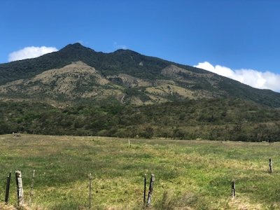
A quick summary of the peaks climbed in Central America.
The trail starts directly from the house. Head more or less directly uphill across
open fields, you cross a few fences in narrow spots between poles/trees. The trail
heads slighty left before entering the forest.
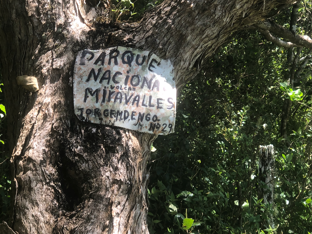
There is a small sign informing that
you enter the national park here.
The trail continues a bit uphill, then across more flat terrain before you get to
more sustained ascent. Well marked and easy walking. You pass a giant tree and continue
uphill. Higher yet, there is a small "camp site" and a trail fork. Here is an alternative
descent (going right) that descends more open (grass) slopes before merging back into
the trees fairly near the giant tree.
The route will now continue more sustained uphill. You will note that the ascent
continues up on a pretty broad ridge. Gradually, the quality of the trail becomes
worse with more big steps and more roots. Fairly typical of jungle trails.
This will lead to the "first summit",
where people (in the past) often turned around.
However, Freddy has now extended the trail to the very highest point.
First, descend steeply (a small rope for support), then continue along a very
rough trail. This section remains (YDS) class 2. This part of the route
is also extremely muddy, boots are certainly nice here, shoes would definitely
be all wet (and very dirty).
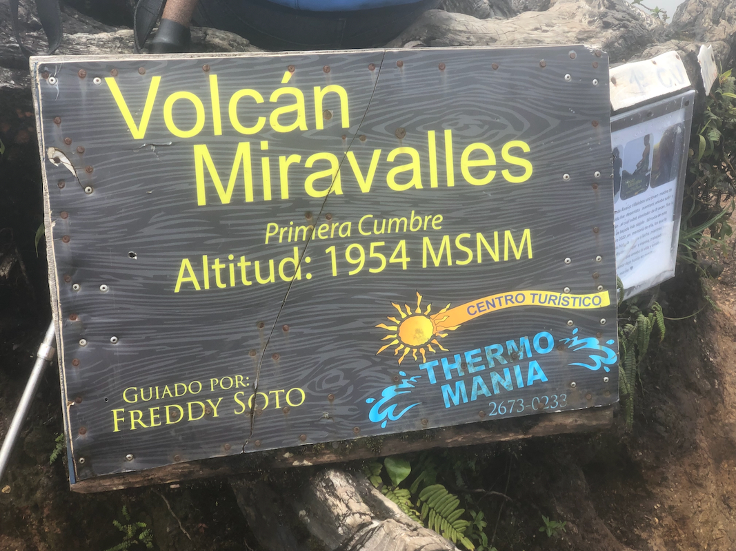
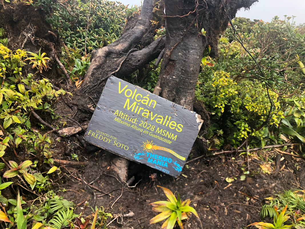
You finally arrive at the highest point.
There is no view and lots of trees.
However, walking about 10 more meter, slightly downhill will get
you to a viewpoint with the official summit marker. Comments:
I had sent a few messages to Freddy using Whatsapp. He did reply, but always with a voice message.
I tried to ask that he replied with text (that I could give to Google translate), but that
never worked. I used Google translate to create messages in Spanish to send him, but I never
got a reply that I would understand. (I sort of believed that he knew everything he needed..)
The day before, I had the reception in my hotel in San Jose call him and tell him that I
would leave early and planned to climb the mountain. He sort of confirmed that everything
was in good order.
It is a long drive from San Jose, I knew it would be a full day. I left the hotel at 0330 in the
morning. Light traffic, but sort of more than expected. I arrived at Freddy's house around 0700,
he and a second guy named Julian were standing outside waiting for me. I changed and without many
words we all headed uphill, 3 dogs also came along. Before the forest, Freddy went right and waved
goodbye, Julian would act as my guide on this trip.
We kept quite a reasonable pace, the 3 dogs were happy to come along on a long walk.
Julian stopped at the first summit, but then quickly followed when I just walked by without
stopping. The trail became quite bad, deep mud, very slippery and many roots and branches
that needed attention. Short, steep sections that needed some assistance from hands.
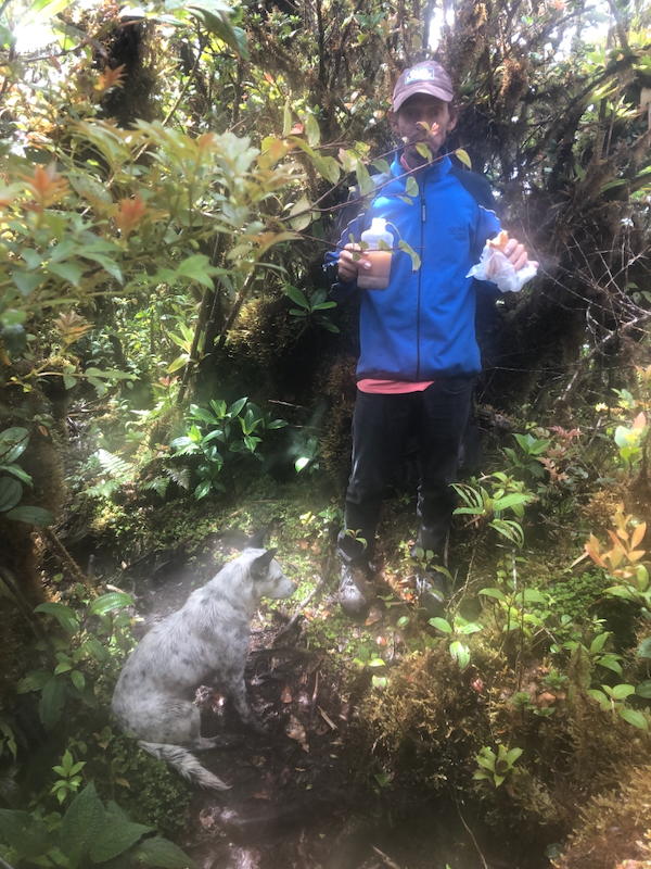
We arrived at the proper summit about 2:55 after leaving Freddy's house, pretty acceptable.
A short break and some photos were needed. Julian wanted to have a small lunch. The dogs were
running around, still quite happy. We headed back down after about 15 minutes.
The trail needed full attention, it took me about 30 minutes to walk back to the first summit.
Further down, the trail is much easier and Julian wanted to take the left fork and descend along
the boundary between grass and forest until cutting back into the forest to regain the
uphill trail. This was shortly above the giant tree.
We continued down and were back at Freddys
about 2 hours after leaving the first summit.
Nice to change back into summer clothes, then say goodbye to Julian after
paying him for the job. He was happy waving when I turned my car towards
San Jose. More traffic on my return drive, I also missed the turn to drive via
the bay, then the toll road to San Jose. Instead, I drove more or less in a constant
queue, across the mountains towards the airport, then across to Hwy. 27 and back home
to our hotel, named Alta Hotel, arriving there well ahead of dinner at 1730.