How to get there:
From Alger, take Hwy. A2 (a big 6 lane road), east to the town of Setif.
From here, head north following roads that gets progressively smaller, to the
location N36.4965, E005.4965. The access road to the mountain forks uphill near
this location. Follow this slightly rougher road to a parking area near location
N36.50830. E005.49803, elevation about 1535 meter.
This is the normal trailhead. However, the road continues (4WD) uphill and actually
passes the summit within 200 meter on its north side. The mountain is a National Reserve
and access may be subject to permits and the use of a local guide.
Route description:
From the parking / trailhead described above, continue up the forest road that
actually runs almost to the summit, passing it on the north-west side.
Follow the road as it makes a sharp left turn, then onwards to a similar
right turn.
Shortly after this second
turn you may ascend a faint trail that climbs more steeply, it will hit
the road again above an open section of terrain.
It is only a small saving compared to just stay on the road.
Follow the road through its second right turning curve and a bit more.
Here, a fairly visible trail forks left in order to climb the (broad) ridge.
This trail is more distinct as it climbs gently through the
forest, the distance from this trail fork to the summit is about one kilometer.
Again, an alternative is to follow the road until you are about 160 meter due north
of the summit.
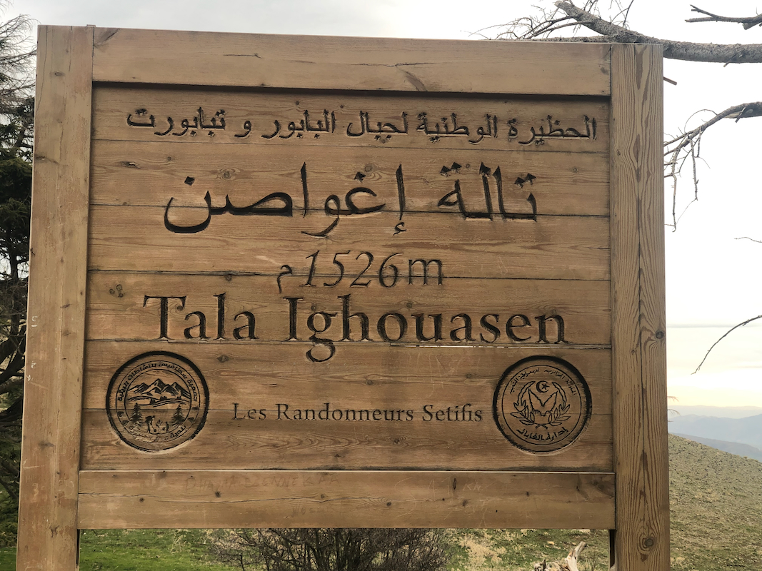
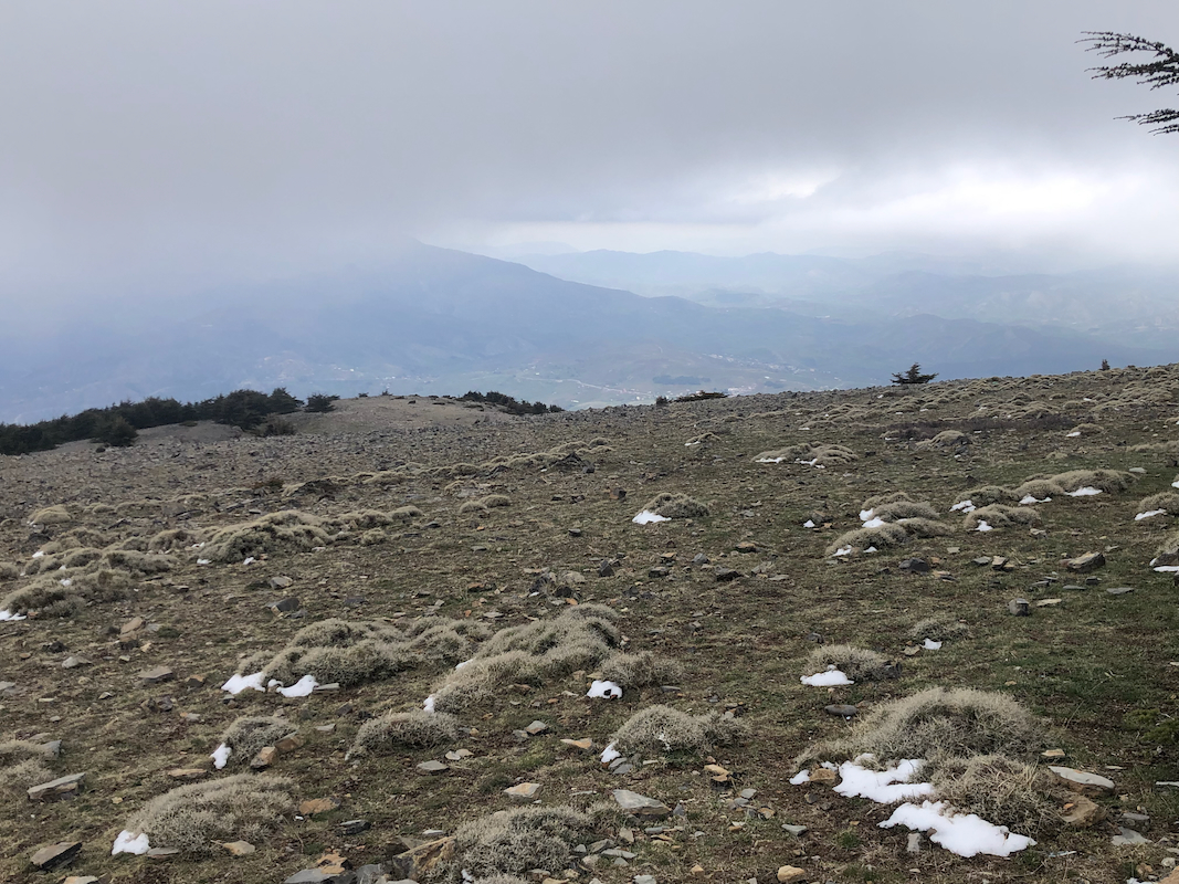
The summit is a smaller, flat area among several trees. There is a small summit
sign with the name and the elevation.
Comments:
This was the first peak on a 10 day trip to Algeria.
My friend Per and I had talked about doing a trip together since around
2015, then Covid came, and then he had an accident resulting in a very
unfortunate head injury. Thus, several years passed, but now finally, we were
going to do a trip together.
I contacted Mouflon Tours and they were responsible for all local transport
and logistics. Per came from Molde on February 21st., ready for an early
departure the next morning. Our flight to Frankfurt with connection to
Alger, departed already at 0550.
Short connect across from Terminal A to B in Franfurt, still managed to get a 15 minute
stop in a Senator lounge for some food. Arrival in Alger at 1155, we carried a form that
should be converted to a Visa on Arrival, all fixed in about 30 minutes.
Outside we located Soufiane, our guide and a car with driver. The plan was to get close
to this mountain already on arrival day.
We drove east on Hwy. A2. A very nice road with 3 lanes in each direction.
A late lunch near the town of Setif around 1530.
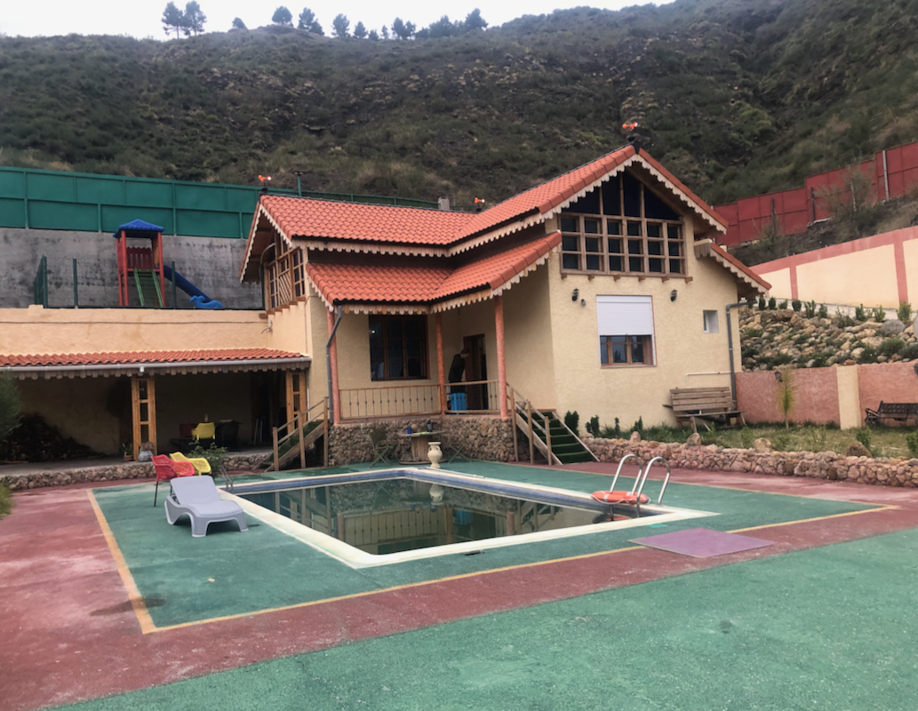
Heading north, progress was now slower as we took the Hwy. N-9 branch and smaller roads
to a private residence
located near N36.4629, E005.3984.
This was quite a nice place, we were served the traditional Couscous dinner, then early to bed.
Breakfast the next morning, then a small road got us down into the valley and uphill towards Babor.
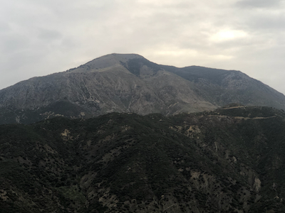
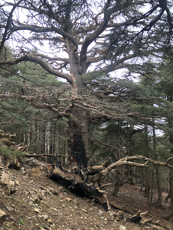
Typical mountain landscape, quite an impressive valley.
We drove to a parking area at location
N36.508302. E005.498027, eelvation about 1535 meter.
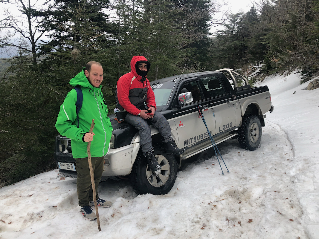
Here, we had to wait for a 4WD truck from the Park Office. It finally arrived with 4 more people.
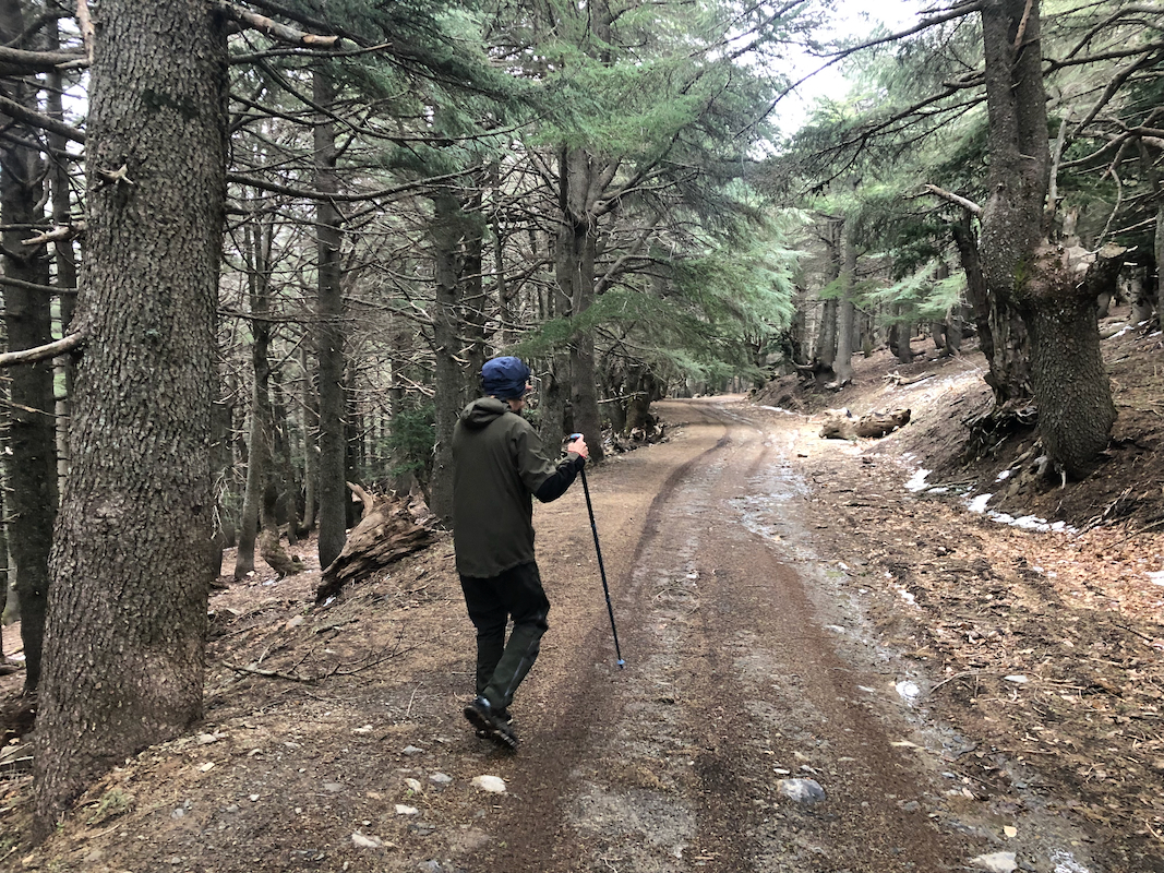
Walking started at 0920, the route was pretty obvious and we made good progress. Surprisingly, when we
arrived at about 1850 meter, the snow cover started to be more extensive, the last 100 vertical
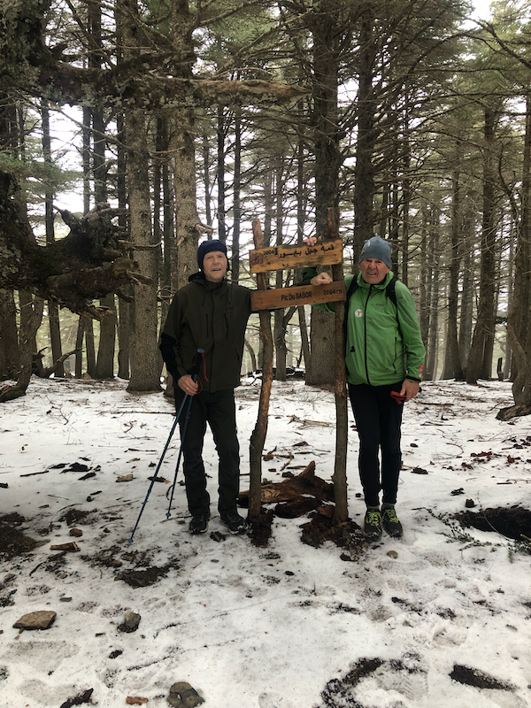
being almost only on snow. We arrived at the summit at 1040, so 1:20 up.
After a brief 10 minute stop for some pictures, we returned directly north to the forest road.
The idea was to meet the truck with the local guides. However, the snow had prevented driving
this high, we strolled down the road to
find the truck partially off-road. Our man
Soufiane, had set out on foot to meet us on the summit, but we obviously had missed each other.
Per and I proceeded to hike back down
to the trailhead. Eventually, we all met there and I was
asked to drive the truck downhill to the beginning of the forest road where our driver
was waiting.
We next had lunch in the first little village before driving to the bigger city of Batna where
our hotel waited. Our next peak would be Djebel Chelia.