Location: North 27.96091, West 15.57125 (GPS at the summit)
Difficulty: YDS class 3
Climbed January 9. 2015.
Information:
How to get there:
This mountain is quite a bit west of the much more
well known Mount Aspiring.
How to get there is indeed a good question. This mountain is located in a very
isolated area, blocked off by wilderness and a large river. The best
record of a proper climb (that I am aware of) can be checked by viewing
the GPS track from
the ascent of Denise and Richead McLellan. They did use an airplane to get to and from
their starting location. Their climb involved 4 nights camping on the mountain.
This is a quick summary and reference to climbs made on this trip.
Route description:
Study the route used by Denise and Richard, as referenced above.
Also, see the description from our visit below.
Comments:
After returning from our Aspiring attempt, we had only a single day to
spare before driving to the airport in Christchurch, in order for
Adrian to make his flight back to London. We were quite intrigued by this
remote peak, but realized that a proper climb would require several
days, even so some airplane support seemed likely. Thus, we checked with
Aspiring Helicopters if they could fly us to some ridge around treeline, in this
way we might be able to visit the peak or at least get some idea of how
difficult it might be. Another concern was the cost, two helicopter trips
might simply be a bit beyond our budget. Aspiring suggested an attractive
option. They already had a flight booked to take two tourists round trip to
Milford Sound. They offerd us to come along on that ride, then we could fly by
Skippers Range on the return and if possible, they could drop us there, then
return for a pick-up later.
This was indeed attractive, in particular, we would get a nice flight crossing
most of the Southern Alps, a fine addition to our hike on Aspiring.
We joined the two tourist and had a scenic flight,
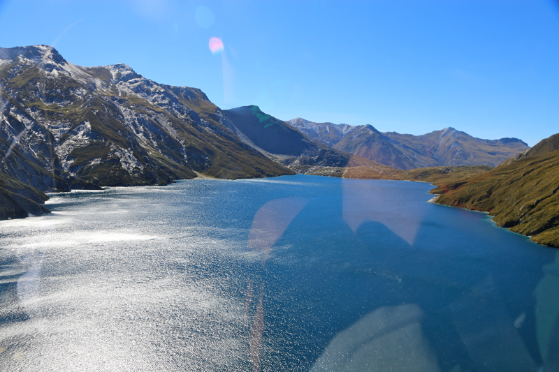
first to lake Lochnagar
where we landed
and had a short walk
in the local area.
Next, across the remaining wild and jagged terrain
to the airport in Milford Sound.
There, we did a short walk and visited the local tourist
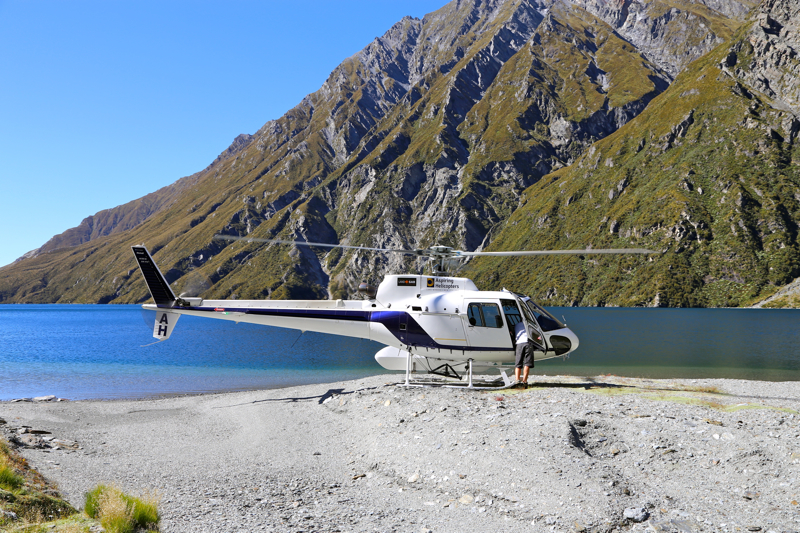
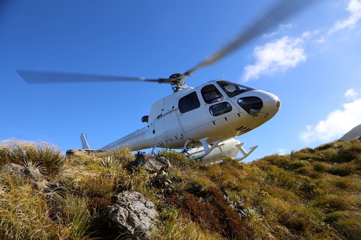
building for lunch. Next, we took off again and flew to Skippers. The area was full of clouds,
but with a few small glimses of terrain, our pilot did find a ridge and suggested to land on it.
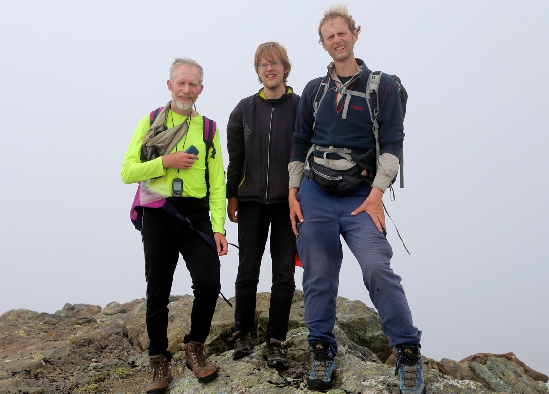
OK, here we go, fancy helicopter landing on a narrow mountain ridge, we jumped out got our gear
from the outside storage bin and asked that he return by 1800. Off he went and silence returned
to our world. We looked around, the ridge continued uphill. The summit was completely hidden in
a cloud.
We started up the ridge at 1225. We had touched down at location
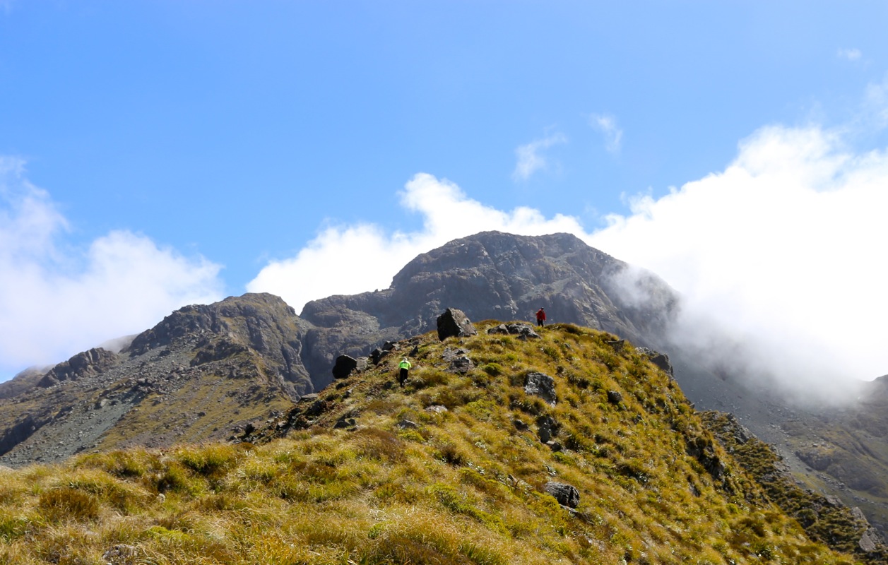
S44.43248, E168.18425, elevation 1200 meter. The ridge was pretty nice, easy to follow with
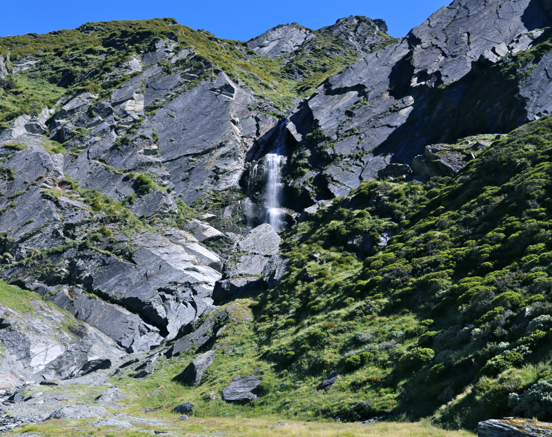
a little bit of scrambling here and there. We crossed over the final hump before the main peak.
It looked best to traverse a bit left, then scramble uphill. The small lake (on the map) was almost
dry. We had a very entertaining climb, no difficulries
and 1:30 after start, we were on top.
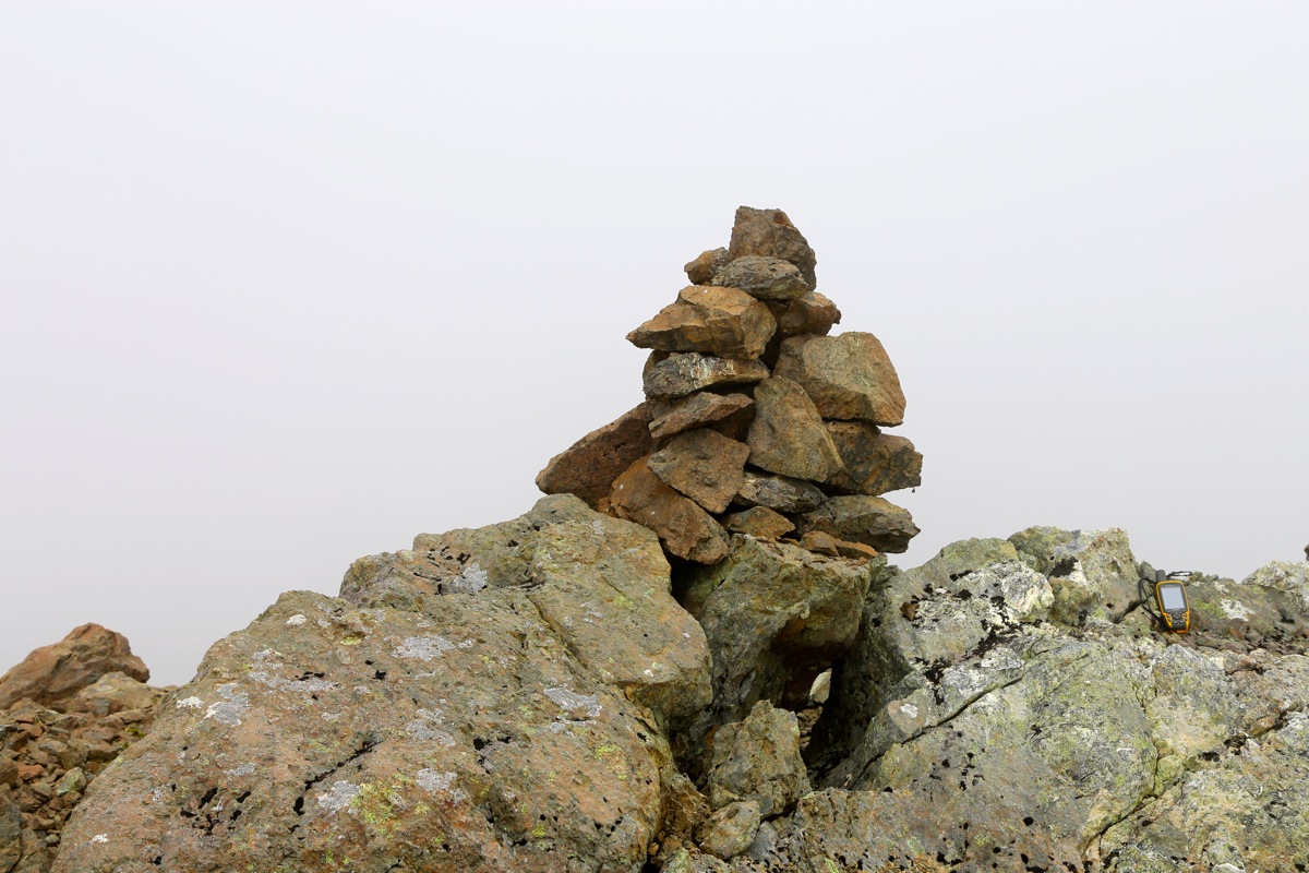
Absolutely no sign of any previous visit.
We built a small cairn then tried to get a view, however,
the clouds were not willing to let us see. We left the summit at 1415m about 20 minutes after
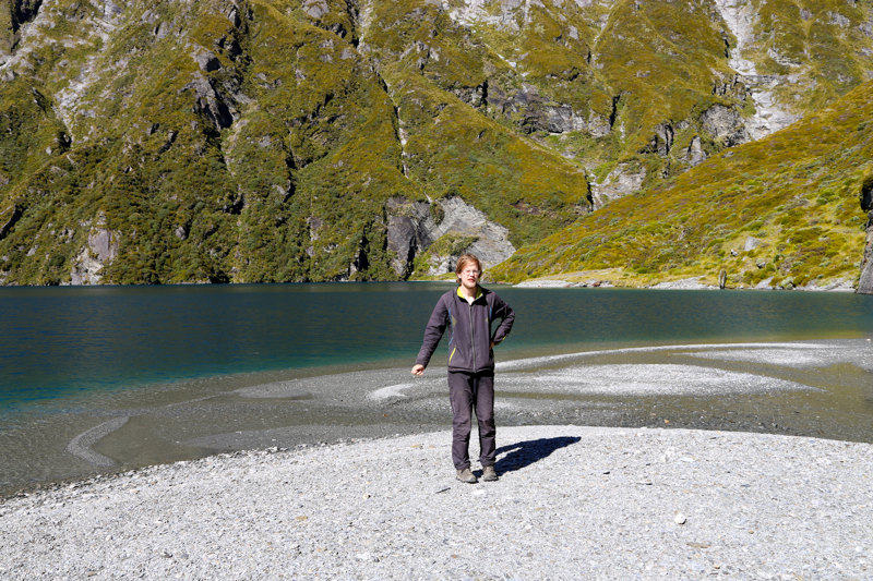
arrival. We followed pretty much the same route downhill
and swere back at the pick.up point after
1:30, the same time down as up.
Finally, the weather improved
and we enjoyed the fine
view as the sun lit from peak to valley and all the landscape in between.'
The helicopter came at 1815,
just late enough to make us a bit nervous. The return flight
was indeed very spectacular. We flew across the crest of the Southern Alps and had
very good views in all directions. We also had a last, but very good look at Aspiring.
Overall, this was a very good way to spend the last day before driving Adrian back to
the airport.
The next morning, we left Wanaka and drove to Christchurch. After dropping Adrian,
we continued north in order to attempt our
last New Zealand ultra Tappy.
