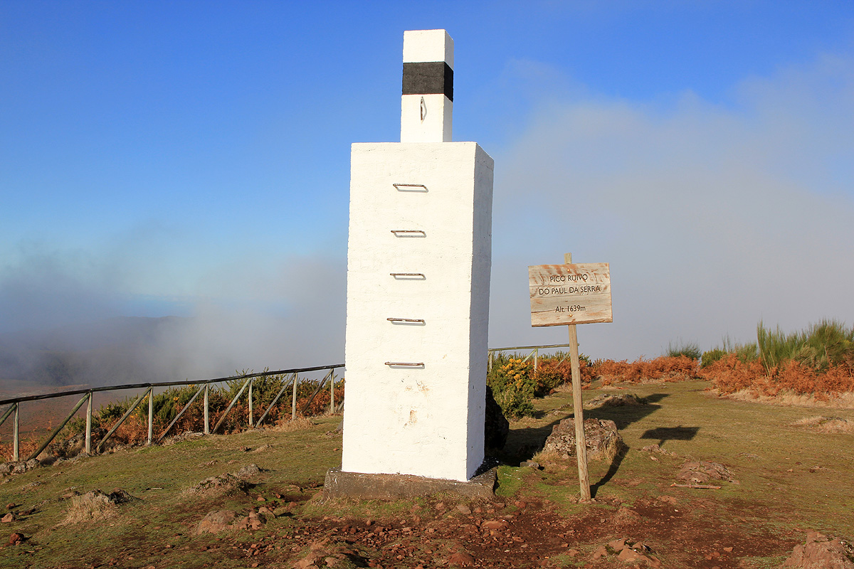
Pico Ruivo do Paul da Serra
- Pico Ruivo do Paul da Serra
- 1649 m
- Primary factor 642 m
- Location: North 32:46.618, West 017:04.811 (GPS at the summit)
- Madeira, Portugal
- Difficulty: YDS class 1
- Climbed: December 12, 2011.

Pico Ruivo do Paul da Serra
|
|
Summary information about all hikes and climbs in Madeira.
How to get there:
Drive from Funchal west towards Ribeira Brava, then to Serra de Agua. Exit here (do not drive through the tunnel)
and climb to the key saddle Boca Encumeada at 1007 meter. This saddle divides the highland plateau in the west from
the rugged mountains further east. Turn left at the pass and drive up onto the high
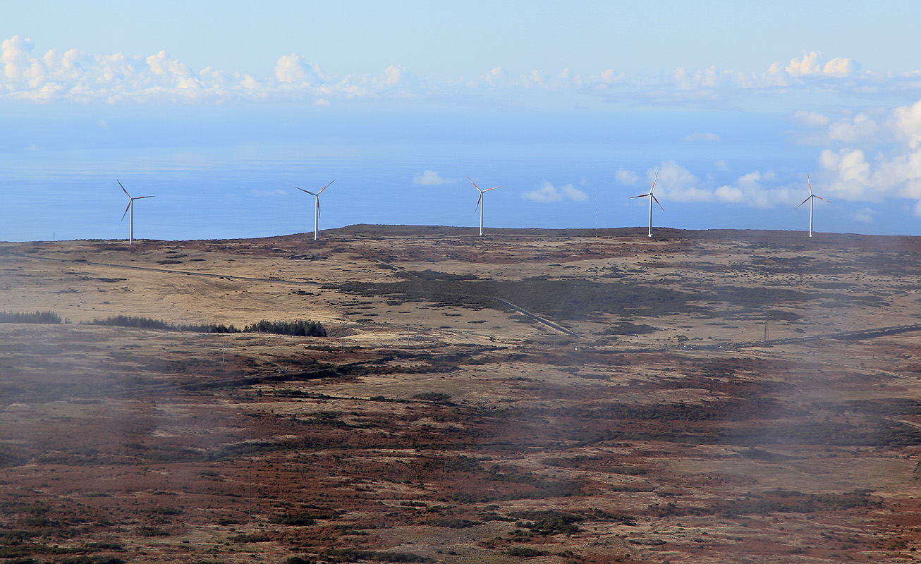
plateau, - home of many giant wind mills.
Drive across the plateau, then the Hwy. turns more left and starts descending. Pay attention and locate
the first paved side road that forks off on your right hand side at a sharp angle. Turn onto this road and drive
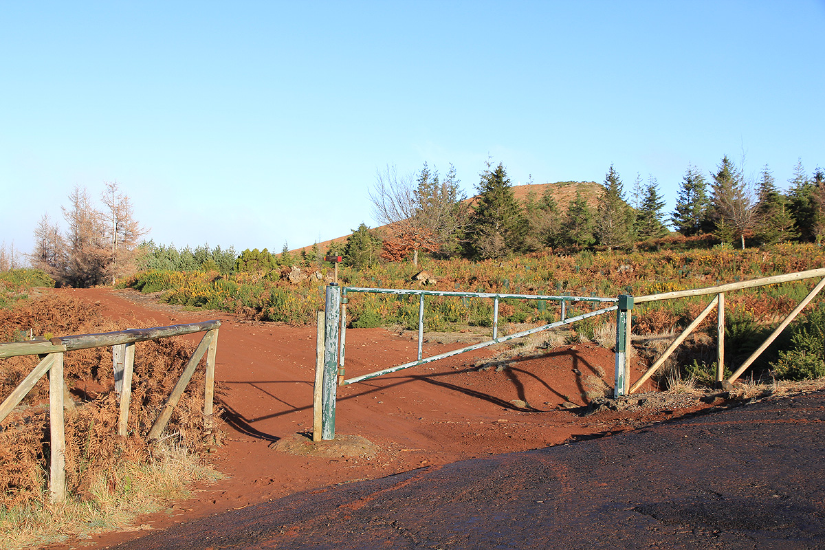
gently uphill until you locate trail signs and a big iron gate on your
left, while there is a small parking area on
your right. This is the trailhead, location N32:46.212, W017:04.697, elevation about 1550 meter.
Route description:
Walk through the gate and along the dirt road for about 100 meter. You will arrive at a new trail
intersection with new trail signs. Turn right and continue
along a wide trail until you hit the
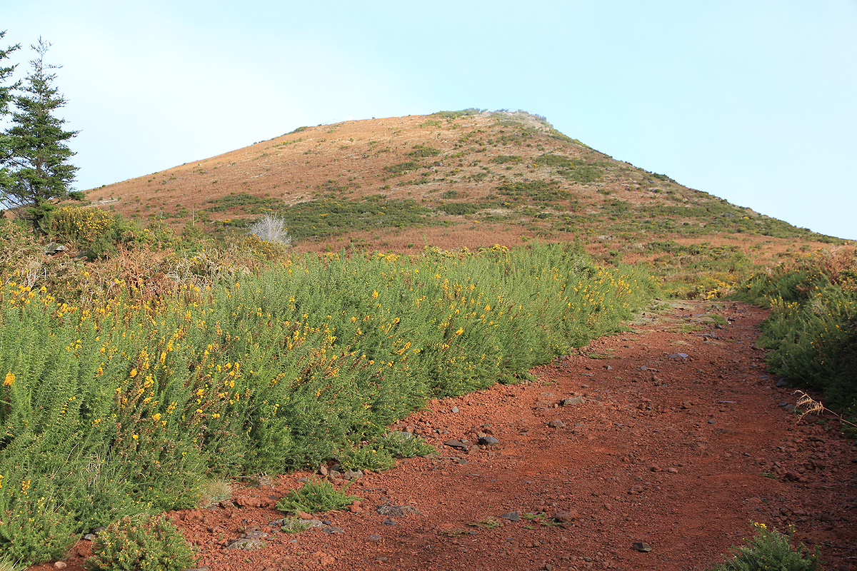
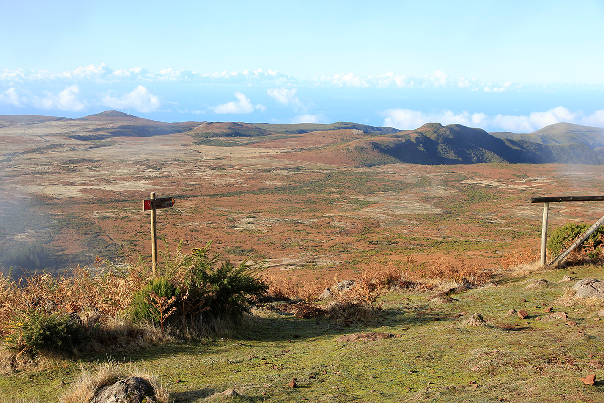
third set of signs. Make a left here and climb the small hill in front of you.
There are some viewing platforms as well as a summit marker on the short summit ridge.
Comments:
Besides Pico Ruivo, the island highpoint and ultra prominent, there is only one other mountain with
prominence exceeding 600 meter. This is the highest point of the highland area to the west.
As a hike, this is rather trivial, estimate 10-15 minutes of easy walking in each direction.
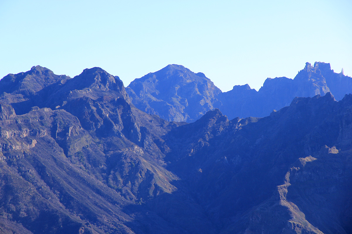
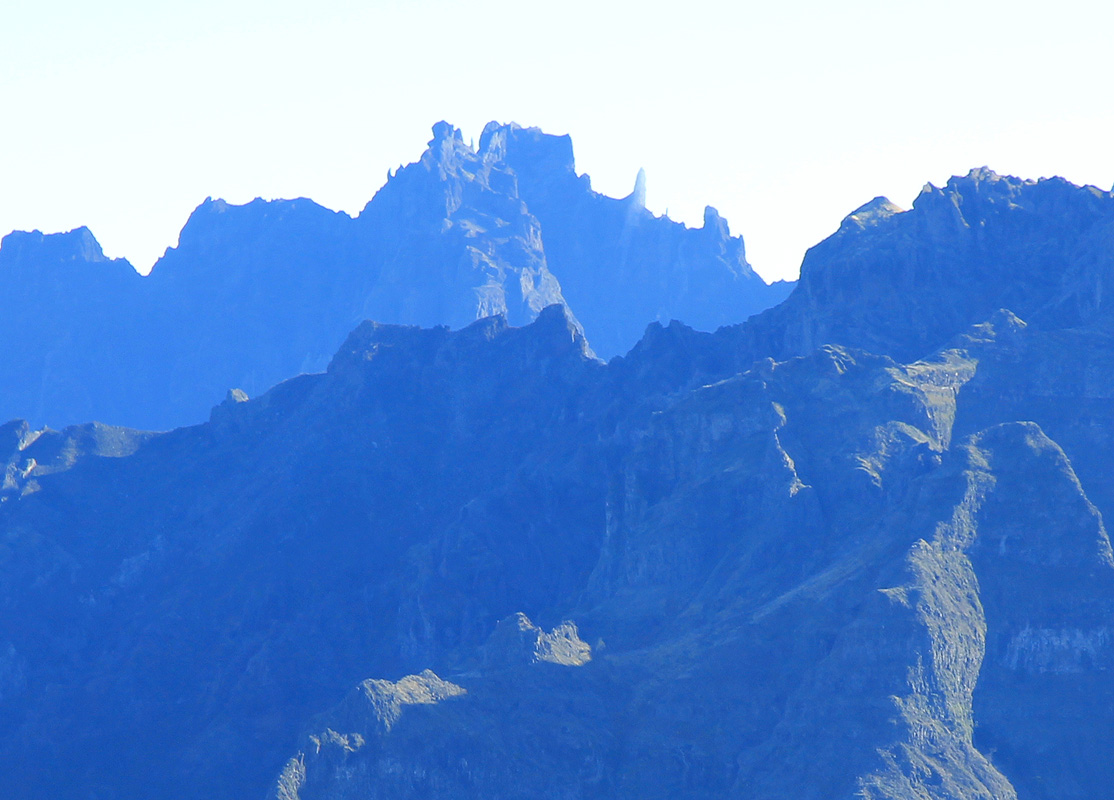
The view is however, pretty good and well worth a visit.
I arrived more or less at the same time
as the clouds that rolled in, thus photography was limited.