Location: North 60.76944, East 5.45202 (GPS at the summit)
Climbed November 29, 2020
Difficulty YDS class 2
Information:
How to get there:
Drive E-39 north from Bergen. Immediately before the long
Eikefet tunnel, take Hwy. 570 (left turn) north towards
Masfjorden. Measure from here. Drive 12.3 kilometer. In a left bending
curve, locate a big parking area on your right. Park there. The location
is 60.74858, 5.39001, elevation about 35 meter.
Route description:
This is an official trailhead for a trail to the DNT hut Kalvedalshytta. This is also
the trail that may be followed almost all the way to the summit of Storevasseggene.
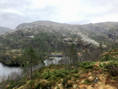
First, follow the well marked trail as it heads uphill and then crosses back down to lake
Sørkvingevatnet. The trail follows the lake shore, then turns left and
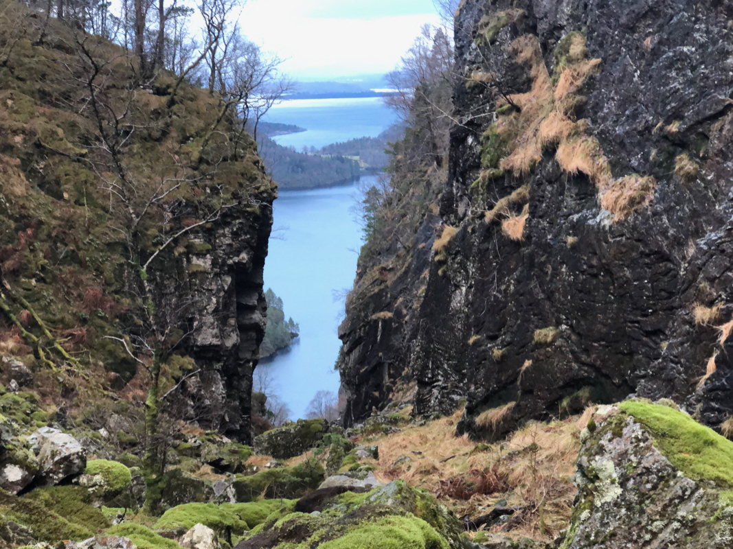
ascends a very interesting ravine. Near the top, a trail merges from the right. Continue
straight to lake Blådalsvatnet. The trail turns right here and ascends to lake
Setretjørna. There are several huts across this small lake. From here, you will
see the Storevasseggene ahead and a bit of Blådalsnipa hidden behind further left.
Continue up the T-marked trail towards Kalvedalshytta, leave the trail shortly before
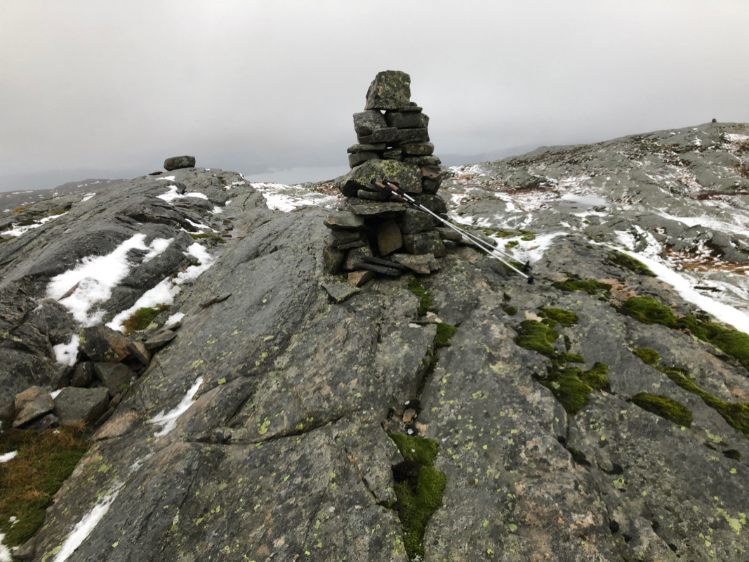
the main crest and complete the easy ascent to the summit of Storevasseggene. There are
two cairns, the one to the south-east is the highest.
Comments:
I made breakfast to eat in the car and left early. I knew this would
be a fairly long hike at a time of year with very limited daylight.
I arrived at the nice trailhead parking shortly after 0900 and, after changing,
I started already at 0915, much earlier than my previous hikes this fall.
The beginning of the trail was well marked and had signs of limited use. Most likely,
this is a new trailhead and a new trail that needs breaking in. Soon, I merged with
a more established trail running next to lake Sørkvingevatnet. The next stage,
ascending Gjeljeholet was
nice and one could see that the trail had been subject to
work. I was soon at the next big lake, Blådalsvatnet.
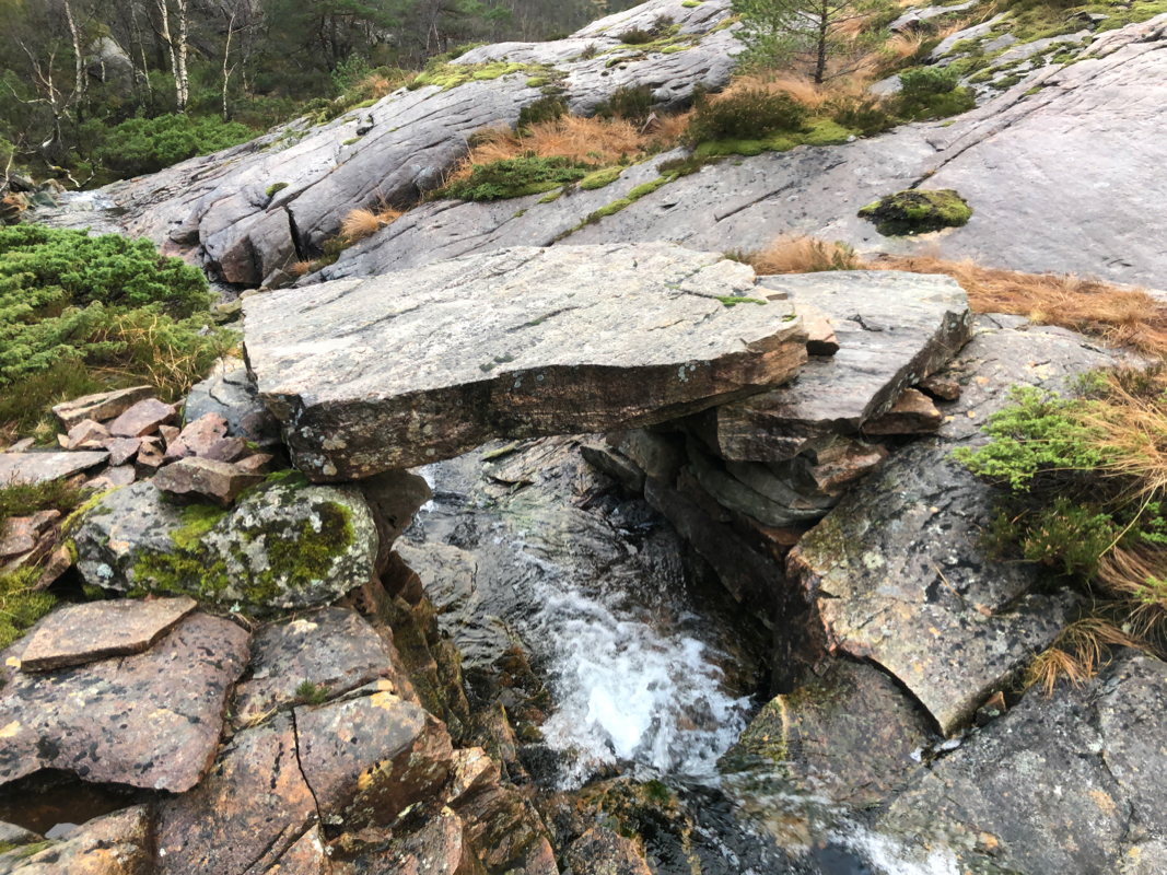
I arrived at the Setretjørna lake, quite a surprise to see many mountain cabins
located in the same area. Another surprise was a very nice bridge spanning
a small creek. The big rock
that spans across must weigh many hundred kilo.
I immediately started thinking about how this bridge ahd been built.
It started to rain and all rock surfaces were super slippery. Some had a thin coating
of ice from the previous night. Still, progress was pretty good as I got closer to the
main crest and it was time to leave the trail.
The last section to the summit cairn
was both short and easy.
My next goal was Blådalsnipa.
This trip report continues there.