Location: North 66.84255, East 015.46139 (GPS on the summit)
Norland, Norway
Difficulty: (YDS) class 2
Climbed September 19. 2015
Climbed (again) August 11. 2020
Information:
How to get there:
From the city of Bodø, drive east on Hwy. 80 to Fauske, then south
on E-6. The road leaves the fjord and heads south, climbing gently in Saltdalen.
Locate the Storjordet on your left side. This is a national park center, there
is also a Shell gas station with a large cafeteria and huts for rent. This location is
about 1.5 kilometer before you get to the road fork where Hwy. 73 forks left and connects
to Sweden.
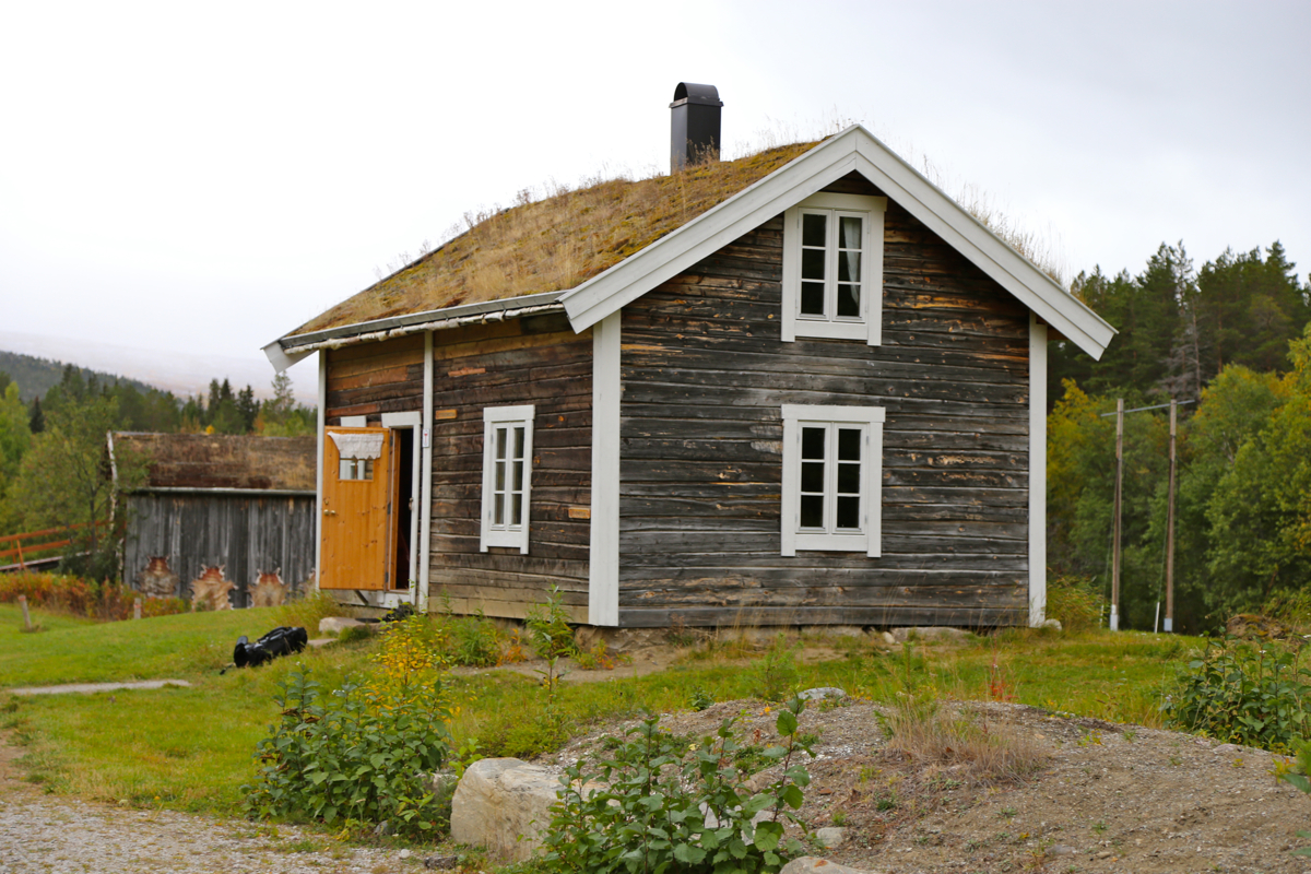
Immediately behind this center (access by road from the parking area (right side), there
is a DNT self serve hut called Storjordstua,
a very convenient starting point for this climb.
This location is N66.81506, E015.40142, elevation about 109 meter.
One may also drive north on E-6, from the gas station (above) about 670 meter, then turn
sharply right onto a small road. Follow this road a few hundred meter to a designated
parking area. The trail (signed) starts about 200 meter before you reach the parking area.
Route description:
From the DNT hut, walk back (south) the access road, then left towards the river.
Follow signs for Solvågtind, initially 10.5 kilometer. The trail immediately
takes you across the river on a long, nice suspension bridge. Follow red marks to reach an
old road, turn left here. Follow this road, completely flat, until a signed trail goes
right. Shortly, this trail ascends to a very nice,
old road that ascends the hillside.
After a while, the sign for Solvågtind forks right, this is another short-cut trail
that will merge with the wide path higher up. Eventually, the wide path turns into a normal
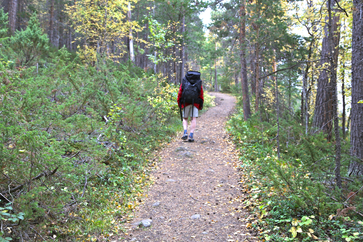
trail as yet another sign for Solvågtind points uphill. Continue uphill through the
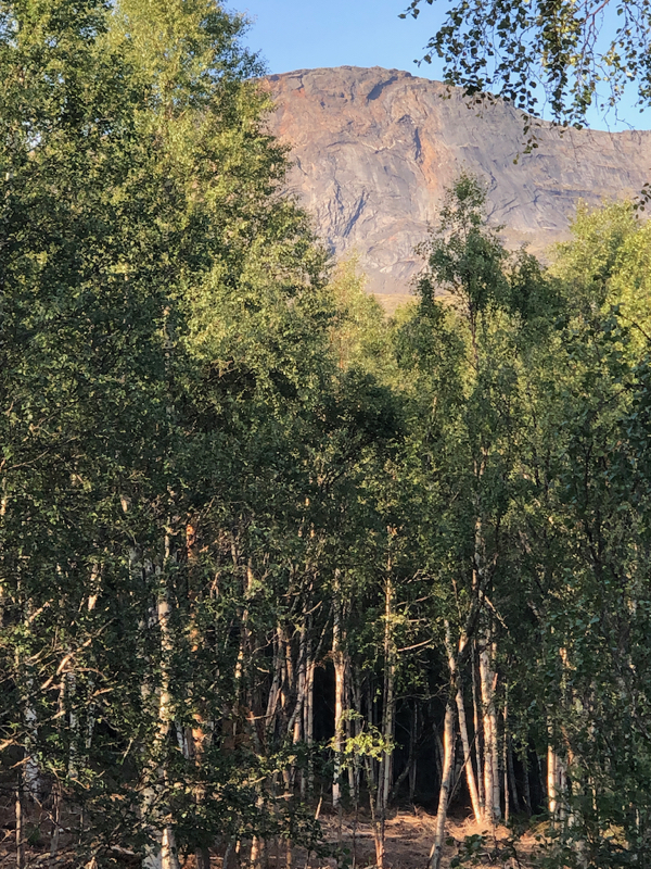
birch forest and reach the treeline at location N66.82715, E015.4190, elevation about 675 meter.
A clear trail continues uphill, however after crossing two small creeks it more or less
dead-ends in a third creek. Better then to leave the trail near the second creek and head directly
uphill on nice grassy slopes. You may recover a faint trail on the horisontal plateau just below
the cliffs of Solvågtind. In any case, follow below these cliffs to your left (when facing uphill),
you will then find cairns that lead you to the correct (and easy) slope that gains the wide saddle with a small
pond marked at 1290, just south of summit 1401.
Cross this saddle to its east side (follow trail/cairns), then ascend along a pretty visible trail
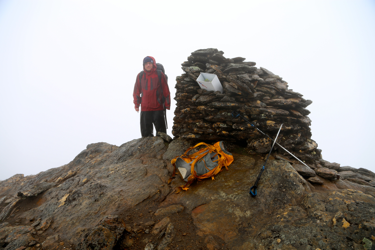
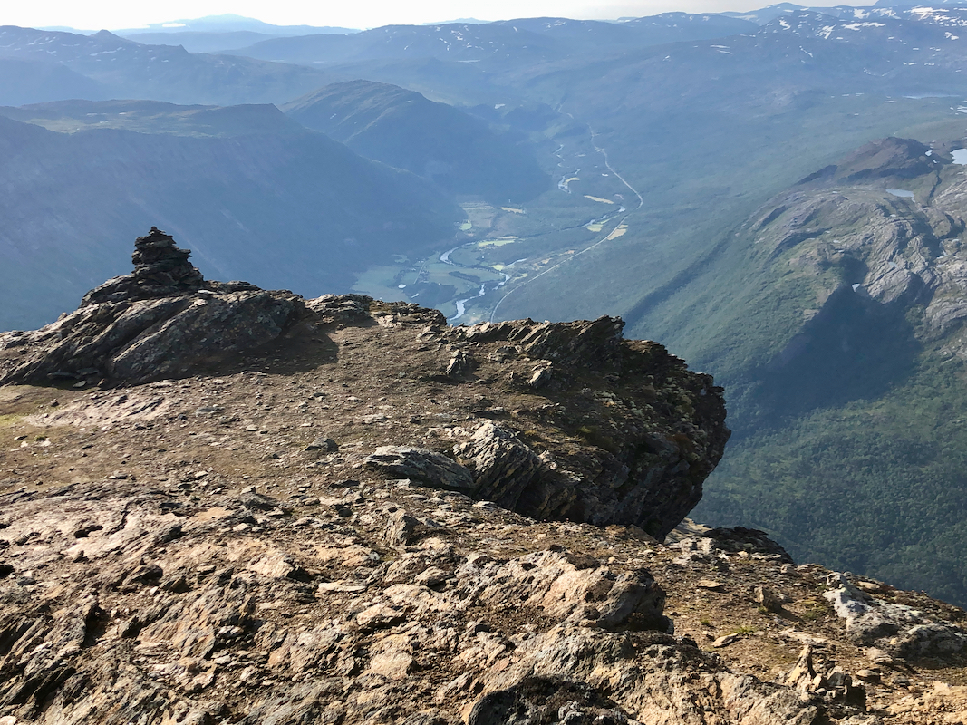
marked with cairns. The rest of this climb is quite easy as one gets near the cliffs before a final
ascent along the ridge to a big summit cairn. Comments:
The forecast called for a really rainy day, we decided to climb a nearby mountain with a trail.
Solvågtind was sort of the obvious choice since the trail started directly at the doorstep of
our DNT-hut. We started at 0850 and the weather seemed better than expected. The suspension bridge crossing
the big river is quite nice and we were surprised to find this very nicely built trail/road (for horses ?) climbing
the hillside. Higher up, we walked into fog and subsequently lost the trail by the creek. Not because of
fog, but really more due the fact that the trail simply ended there. Ascending to the plateau below the
upper cliffs, we first tried to ascend a bit early. This looked like a feasible route, but clearly not
the tourist route. We turned back down and searched further along to find the correct route. Up in the
broad saddle, we lost the trail again (possibly due to fog this time) and climbed the next slope in a rather
inconvenient fashion. Hitting the trail at the top, we completed the climb along the very nice and easy last
section, however, now we had strong gusts of wind and horizontal rain.
We arrived at the summit at 1200, stayed only 10 minutes, then headed back down - looking for more agreeable weather.
Back at our hut by 1435, good use of a day that never showed a sign of being nice.
2020 climb:
For some (mysterious) reason, this peak was marked as unclimbed on my map of prominent mountains in Norway.
My first plan was to visit with my friend Jostein, when that plan changed and I again was back up
in the Bodø region, I added this peak as a good objective in the morning before my return
flight to Trondheim.
After a very nice climb of Skjelåtinden on August 10., I drove across to
E-6, located the nice (and hidden) parking area, then prepared for a short hike up to the hut
Storjordfjellkoia. I planned to stay there, climb the peak the next morning and have plenty of
extra time (in reserve) for catching my flight in Bodø late afternoon.
I arrived at the hut after a short walk of about 40 minutes. To my surprise, there was smoke from
the chimney. Kai, Liv, Anne and Lukas plus 2 dogs were already there. Very nice people, they were not
unhappy about having a new person in the small hut. A single room and 4 beds. I got a bed and we had
a nice evening before going to bed.
I was up early and left around 0500. A very nice hike in perfect early morning weather. I arrived
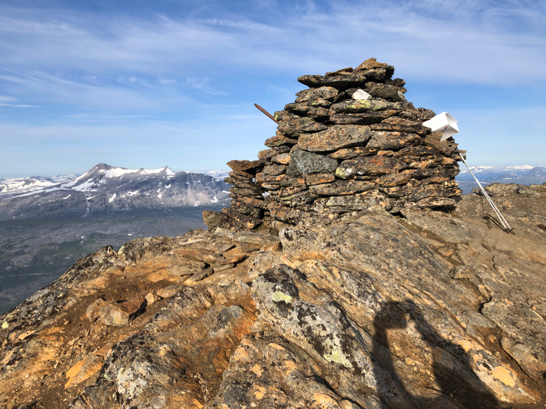
at the summit after 2.5 hours.
A good rest there with great views
before returning to the hut at
0945. Time for breakfast. I told my new friends goodbye and hiked back dowb to my car
in 30 minutes. I had not recognized a single place, it was not until starting on a trip
report that I understood that I had been here about 5 years ago, that time in fog, so
perhaps hard to remember any details.
I had my flight back to Trondheim late afternoon, a nice trip with 5 climbs had
been concluded.
Resources:
Images
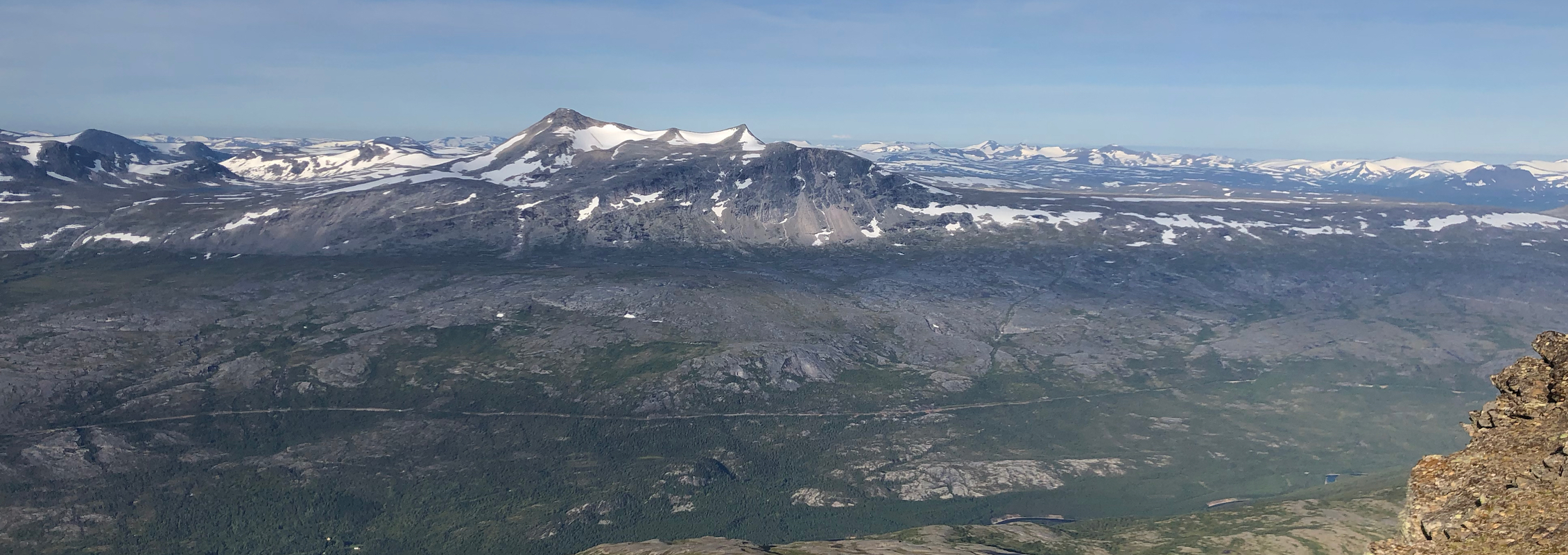
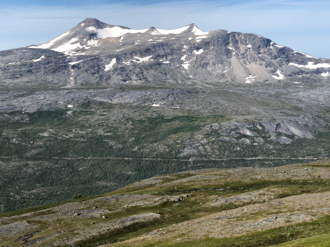
Solvågtind as seen from near the Storjordfjellkoia hut.
