Location: North 67.94199, East 012.94199 (GPS at the summit)
Hinnøy , Norway
Difficulty: (YDS) class 3
Climbed August 24. 2014.
Information:
How to get there:
This mountain is located on the island Moskenesøya, the last
island that is connected to Norway via Hwy. E-10 (no ferries).
Drive to Moskenes, then continue a short distance to Sørvågen.
One should start at the lighted track that runs around the lake Sørvågvatnet.
This can be accessed from two sides, I turned right onto a small, local road directly
east of the lake and located parking on the left side close to the end of this road.
Location N67.89399, E013.02708, elevation about 15 meter.
Route description: To Munkebu:
Follow the big track (lysløpen) until it passes a small, local hill with
benches and a picnic table. Look for and locate a trail that heads uphill from
the big track. This trail will climb a short distance to reach lake Stuvdalsvatnet.
From here, the trail is bigger and much better defined as it runs along the east side
of the lake. After leaving the last hut (sharp bend on the trail), the route continues
uphill. This is a place where one easily can loose the correct trail and end up in
steep terrain above Tridalsvatnet. Pay attention to cairns and the trail and keep as far
right as possible at all (small) forks. The correct trail climbs more or less directly
up the (broad) ridge from south to north. It never traverses out on the west facing
slopes.
This section of the trail is fairly steep, and chains (as handrails) have been
put in place to assist hikers. After an easy stretch, the trail again climbs to the
summit of Djupfjordheia, 510m. From here, the trail descends about 100 meter to the
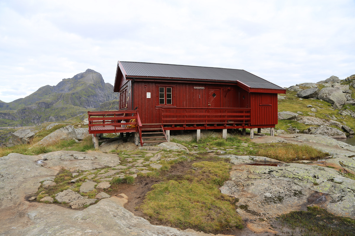
DNT (self-serve) hut Munkebu. To Hermannsdalstinden:
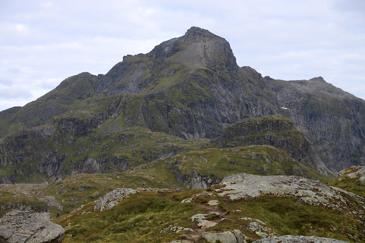
From the Munkebu hut one can more or less see the route all the way to the
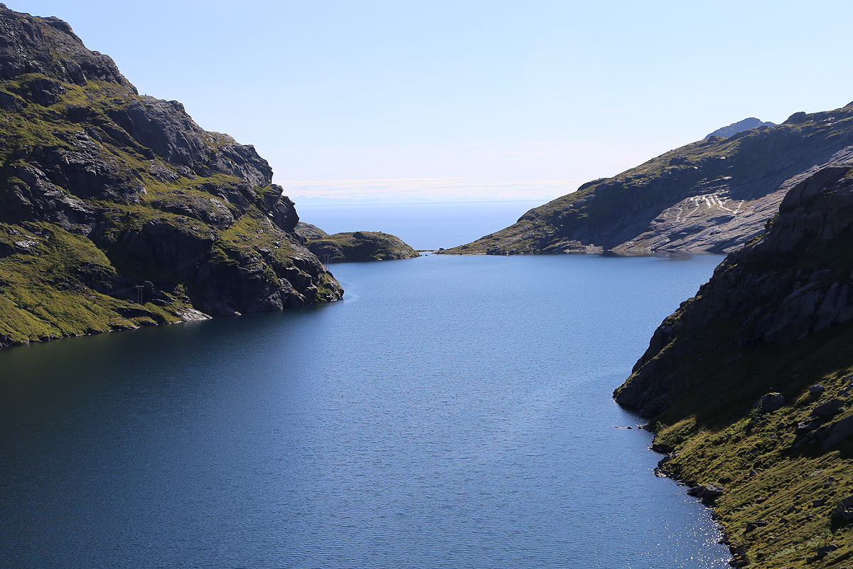
summit of Hermannsdalstinden. First, descend to the passage between lake Fjerddalsvatnet
and lake Tennesvatnet. Next ascend to point 413m, directly west. From here, turn directly
north and descend to the passage between Tennesvatnet and lake Krokvatnet.
Continue north to point 449m, then again west descending to the saddle from Krokvatnet to
Forsfjorden. There is a good trail marked with cairns all the way, but this is really
a route that has many uphills and downhills in sequence. Finally, the route ascends south
of point 536m, to the saddle between lake Krokvatnet and lake Litlforsvatnet.
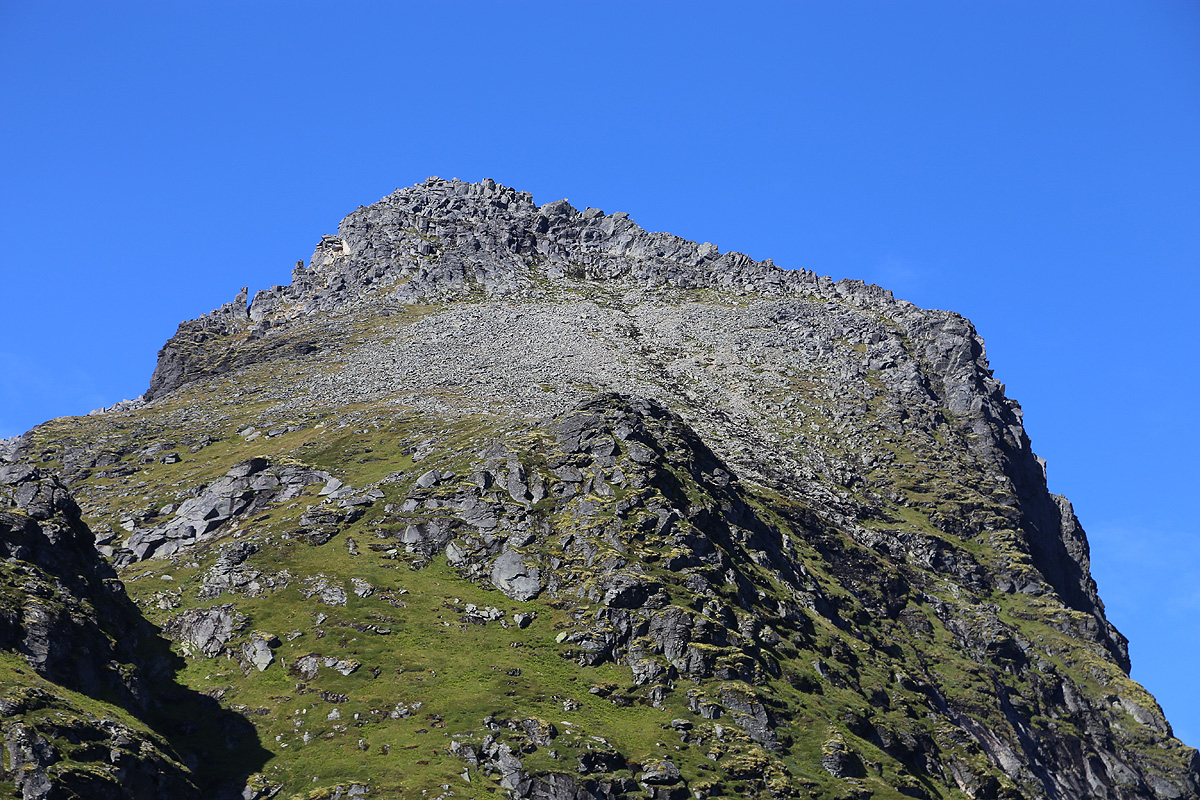
You are now at the base of the mountain, no more up and down, from here it is only up until
you arrive at the summit. First, the very distinct
and fairly steep ridge directly in front
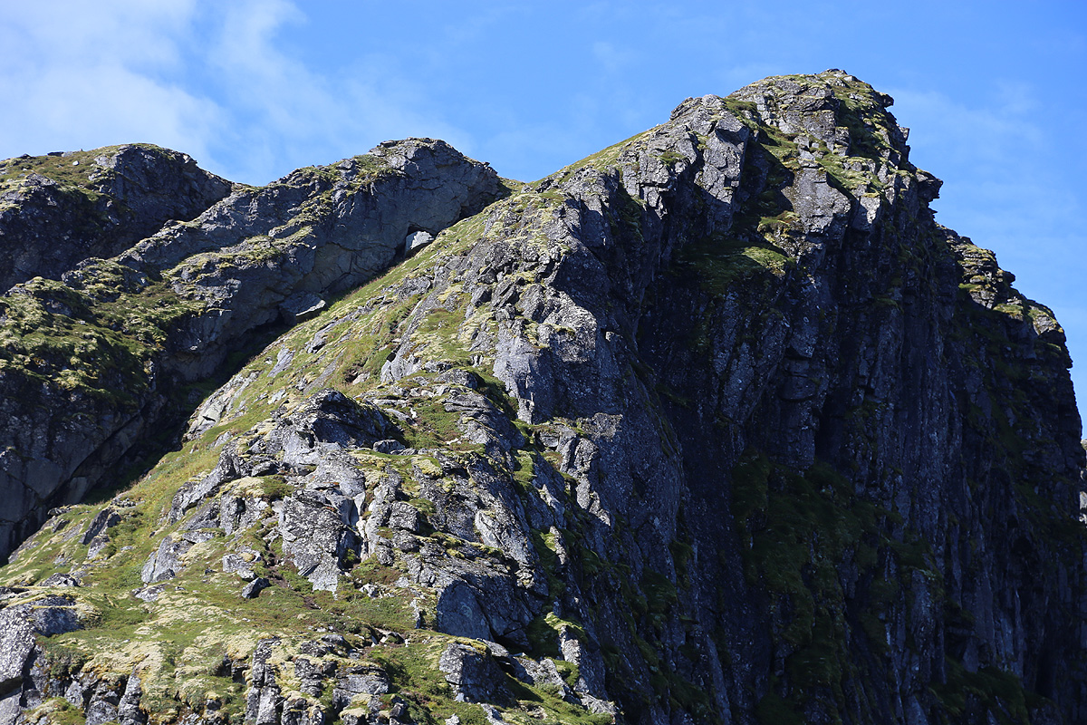
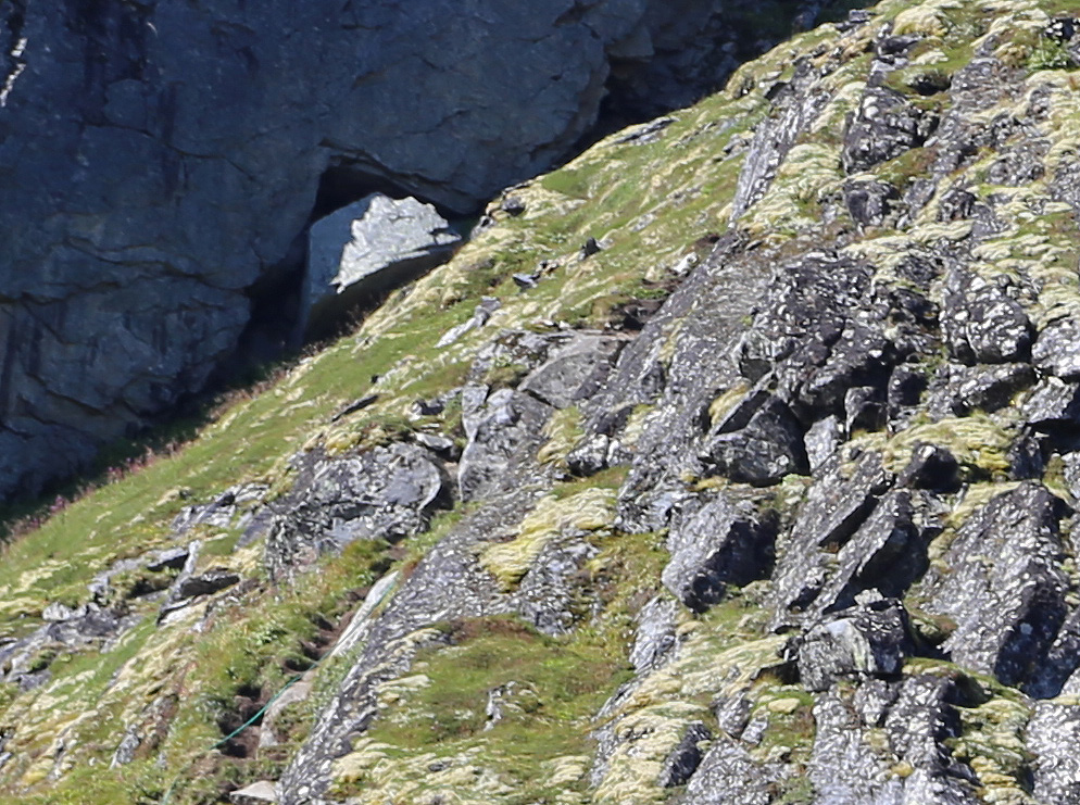
must be climbed. The trail quickly steepens
and you arrive at a short section where a thick
green rope has been
placed. Climb directly up, this is definitely (YDS) class 3. If this
stretch looks hard, one may actually turn left a bit below the rope, walk off-trail, follow a natural
passage uphill while going somewhat left, then turn right and regain the ridge just above
where the green rope is attached to a big rock. This bypass is actually (YDS) class 2. Above
this section, the route continues directly up the ridge with nice and easy class 3 scrambling.
Now, the terrain gets much easier. The route continues nicely with an ascending traverse
going left, this avoids an area with rocks higher up. The trail then turns right and continues towards
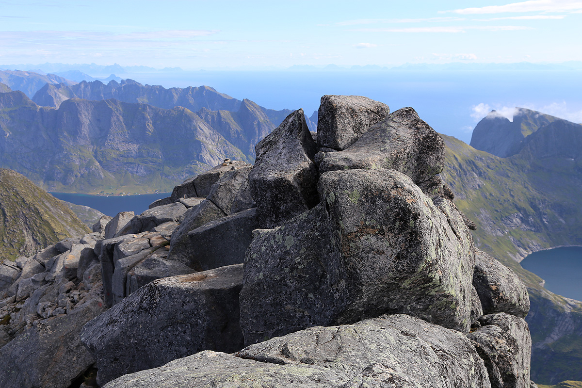
the large rocks that make up the summit area.
Look for red paint on these rocks showing the
route, up, then left along a ramp, followed by a small gully that leads to the main crest.
Next, one actually moves between two rocks and emerges on the north side of the summit ridge.
From here, the route is well marked as it moves across
and up on big rocks until the summit is
only a few meter away. The final move is a class 3 where you step on a narrow rock, then climb
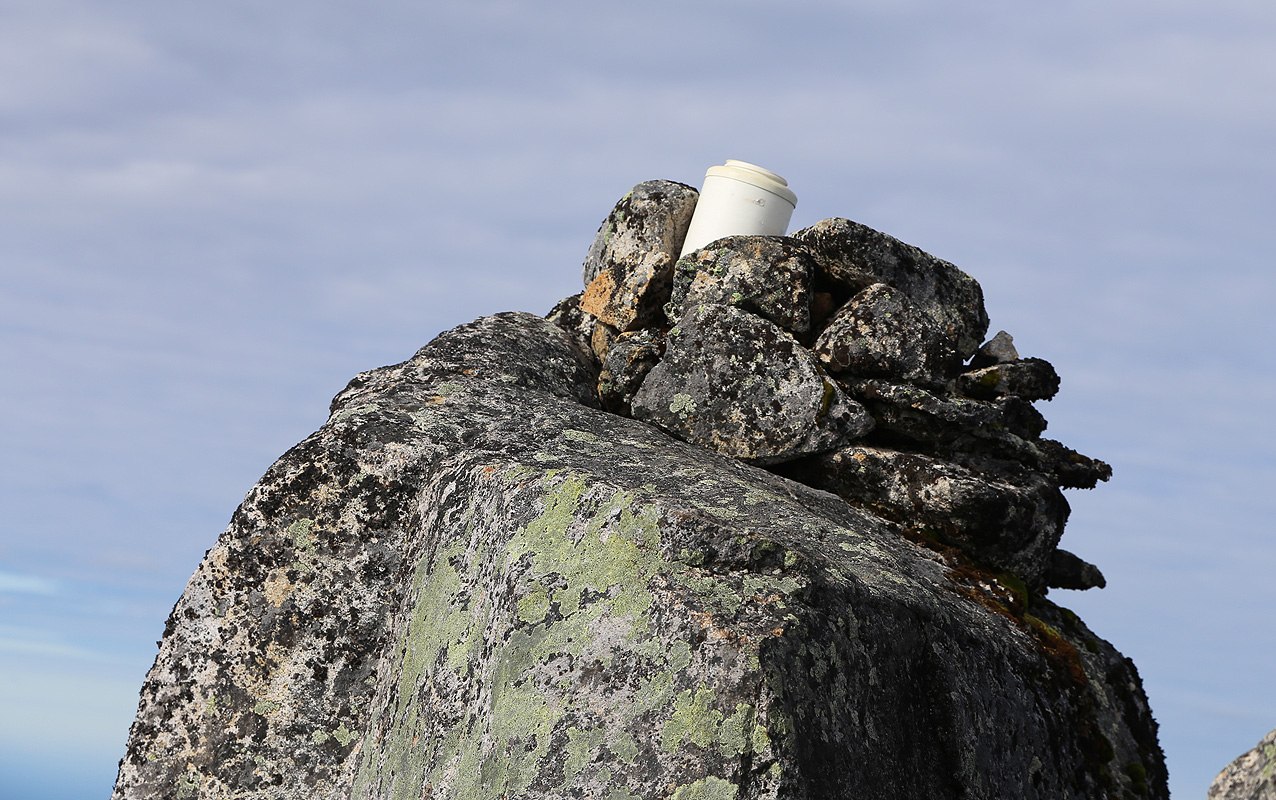
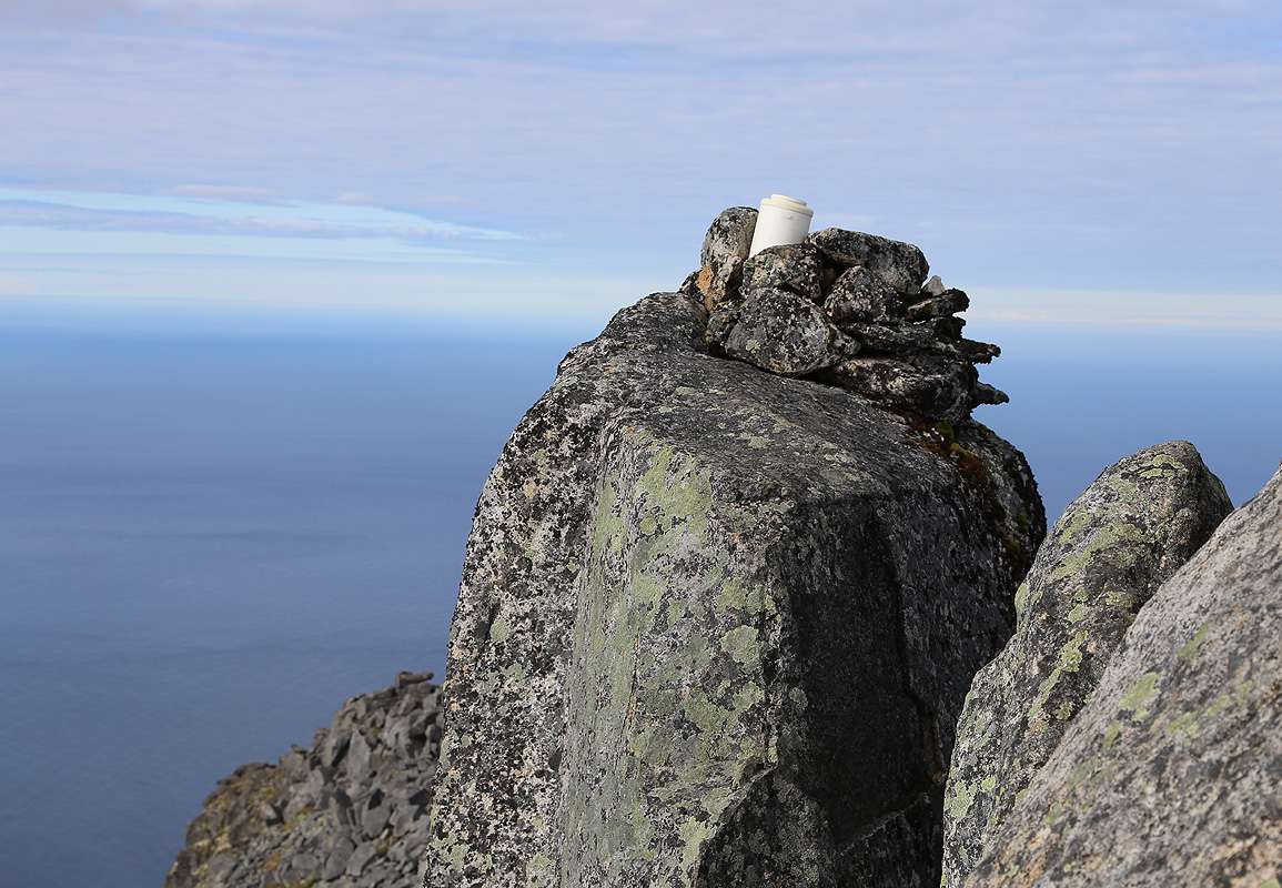
up onto the summit rock next to the small cairn.
There is defenitely only room for a single person
at a time on this summit. Comments:
I arrived at the trailhead around 2030 after a long, but very scenic drive from the base
of Møysalen, it had taken a full day to climb this peak.
I left my car at 2045 and hoped to reach Munkebu before dark. I somehow lost the correct trail
and ended up in the steep slopes above Tridalsvatnet. Bush-walking straight uphill got me back
on track. I later learned that almost everyone had made this mistake, so there is obviously an
issue with the trail marking at some point after the trail leaves Stuvdalsvatnet.
I arrived at Munkebu by 2230, just before dark. A young couple from Seattle was already there,
having climbed Hermannsdalstinden earlier in the day.
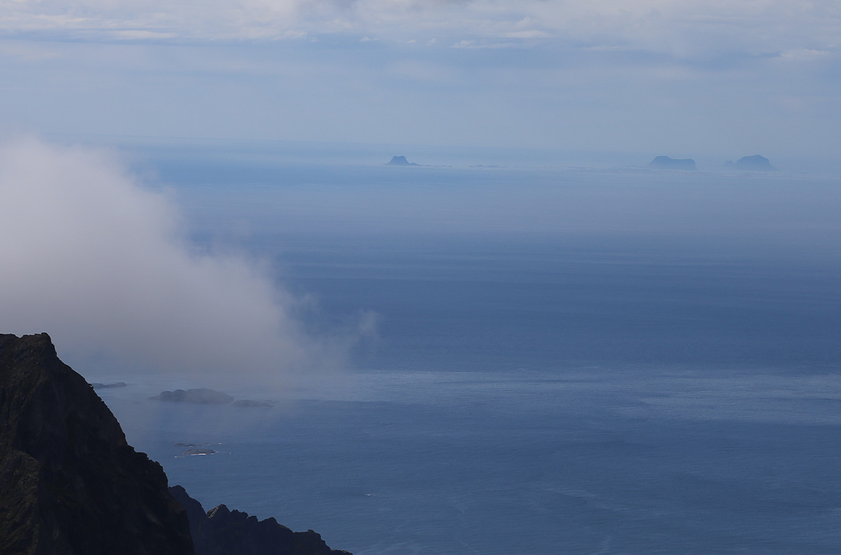
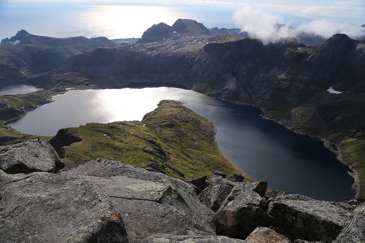
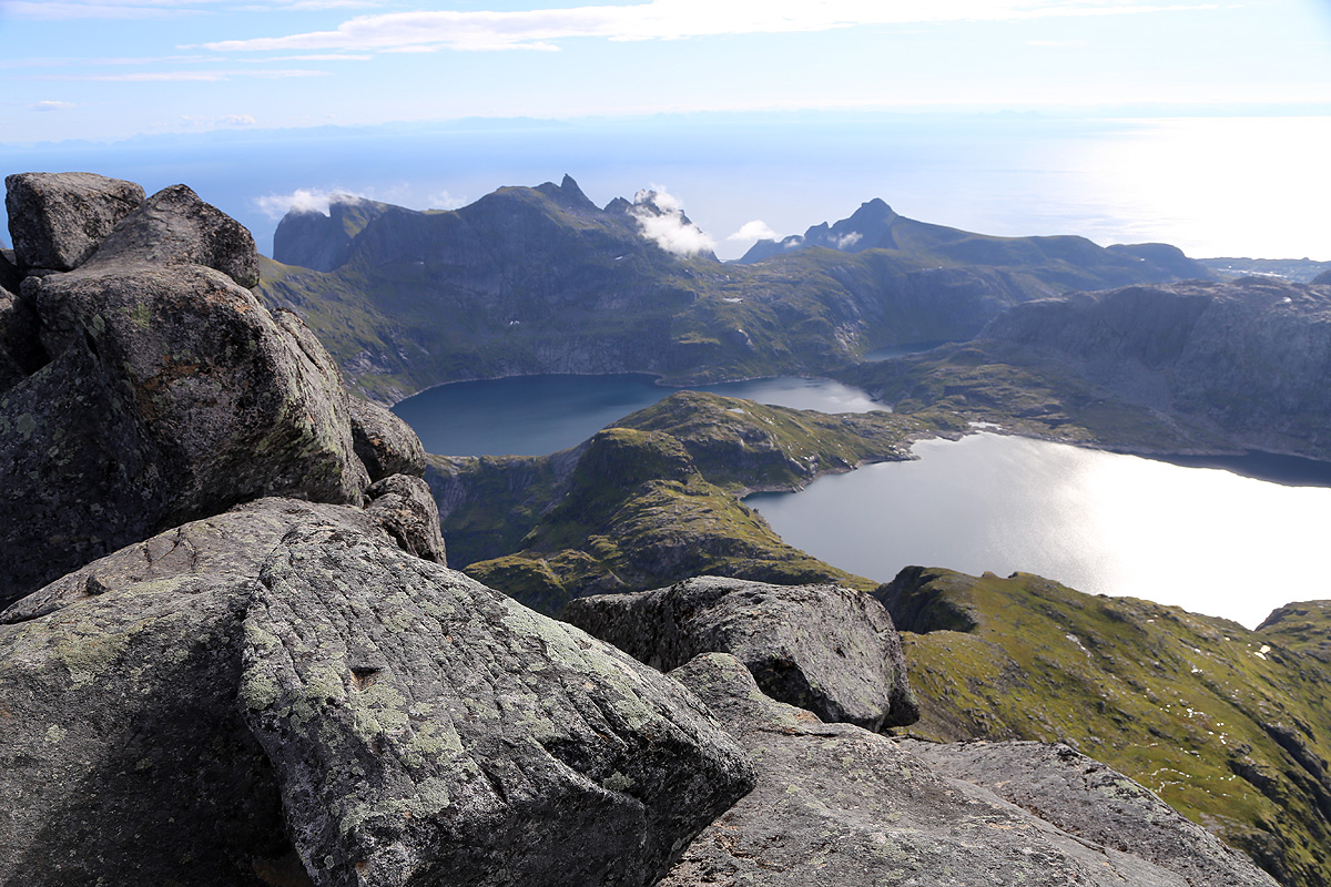
I left at 0835 the next morning and had a very nice hike, then climb, arriving at the summit
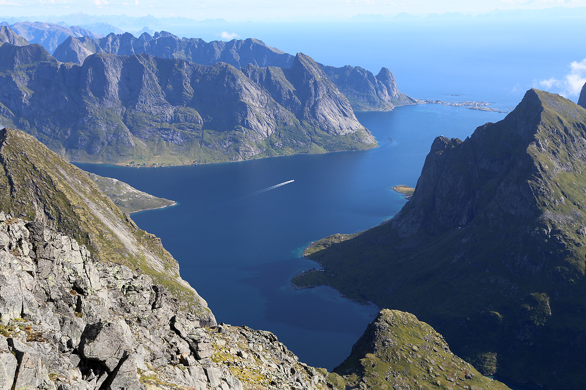
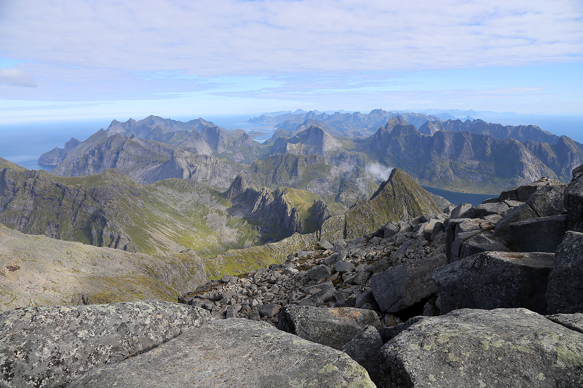
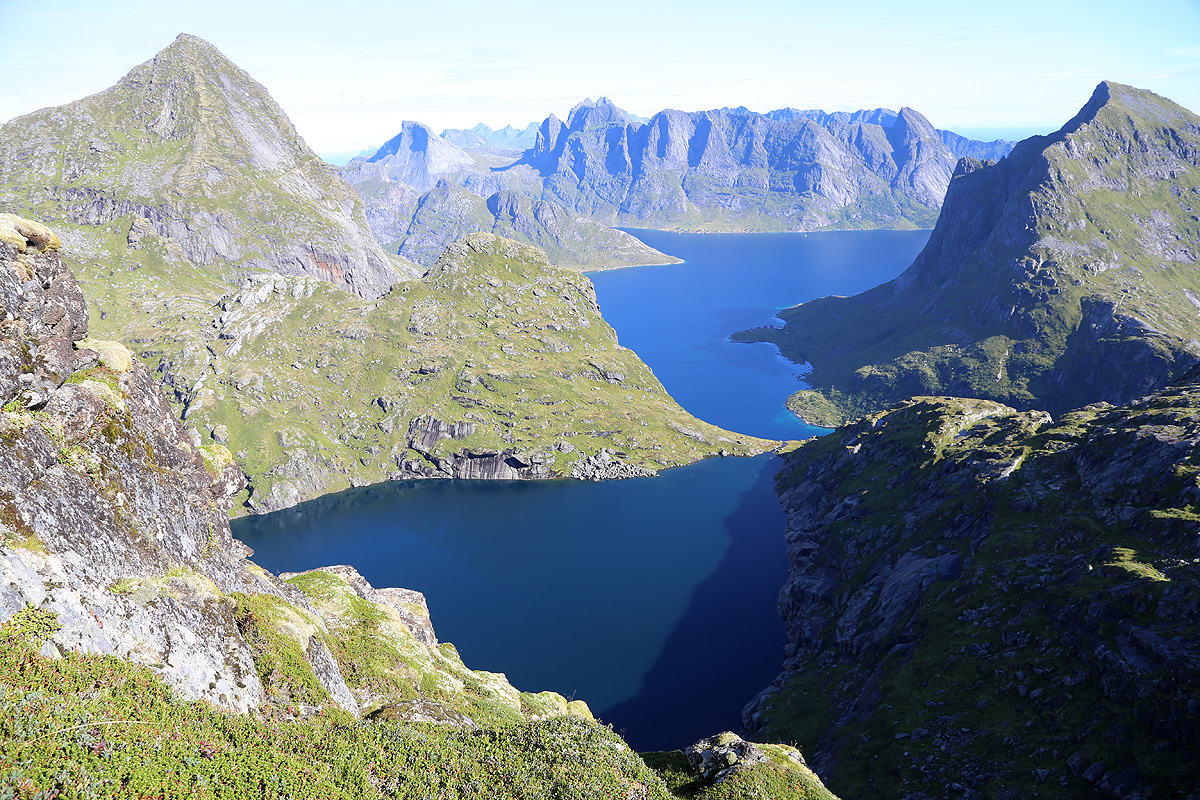
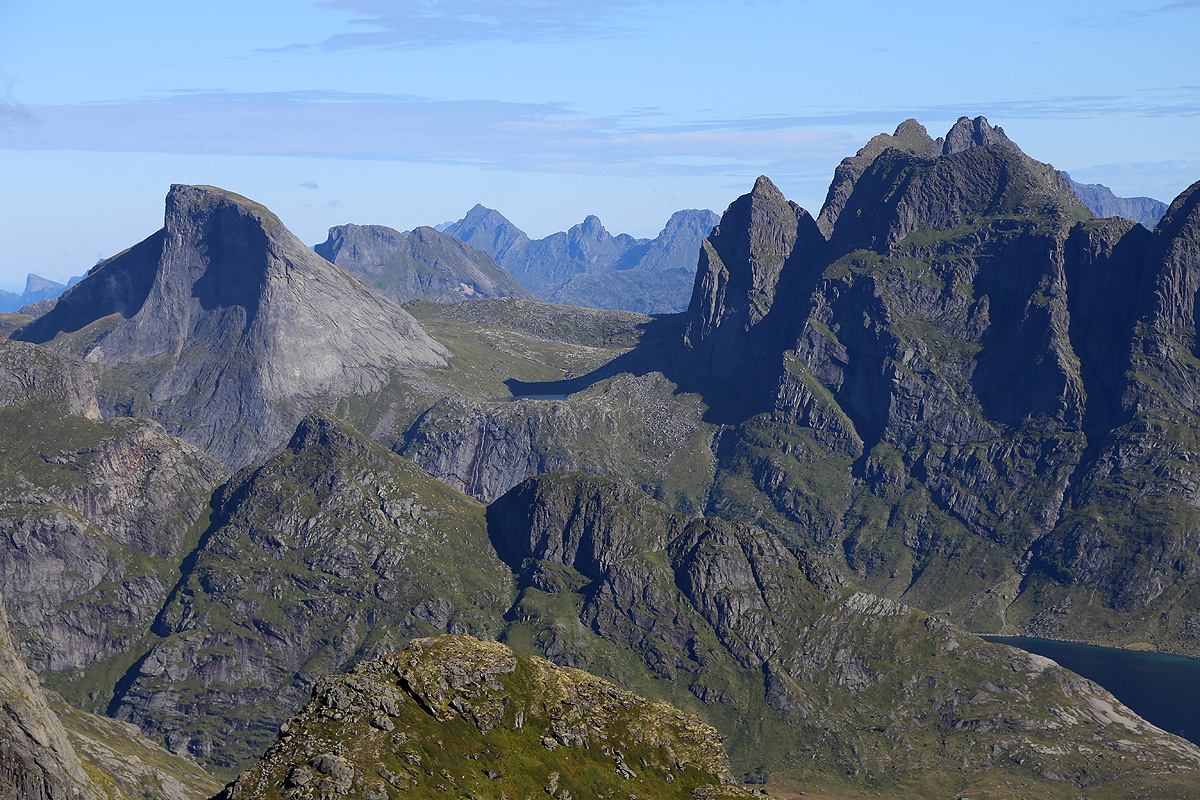
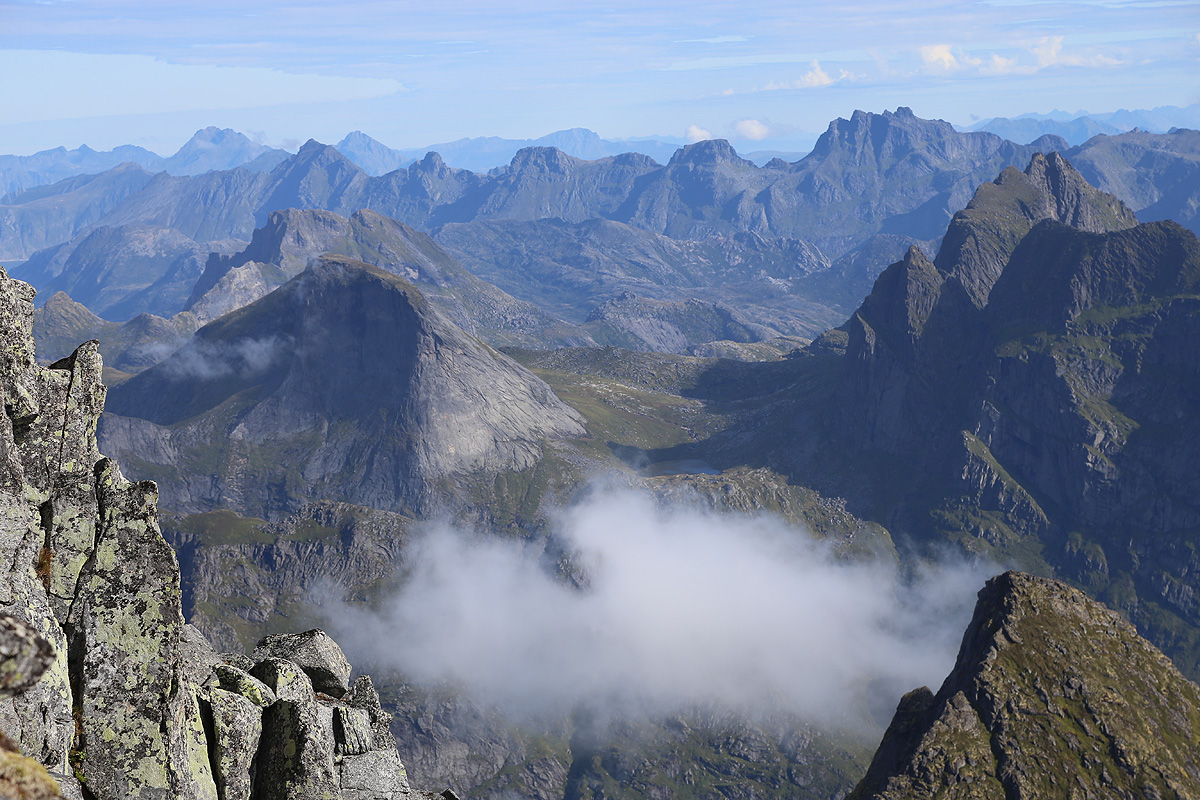
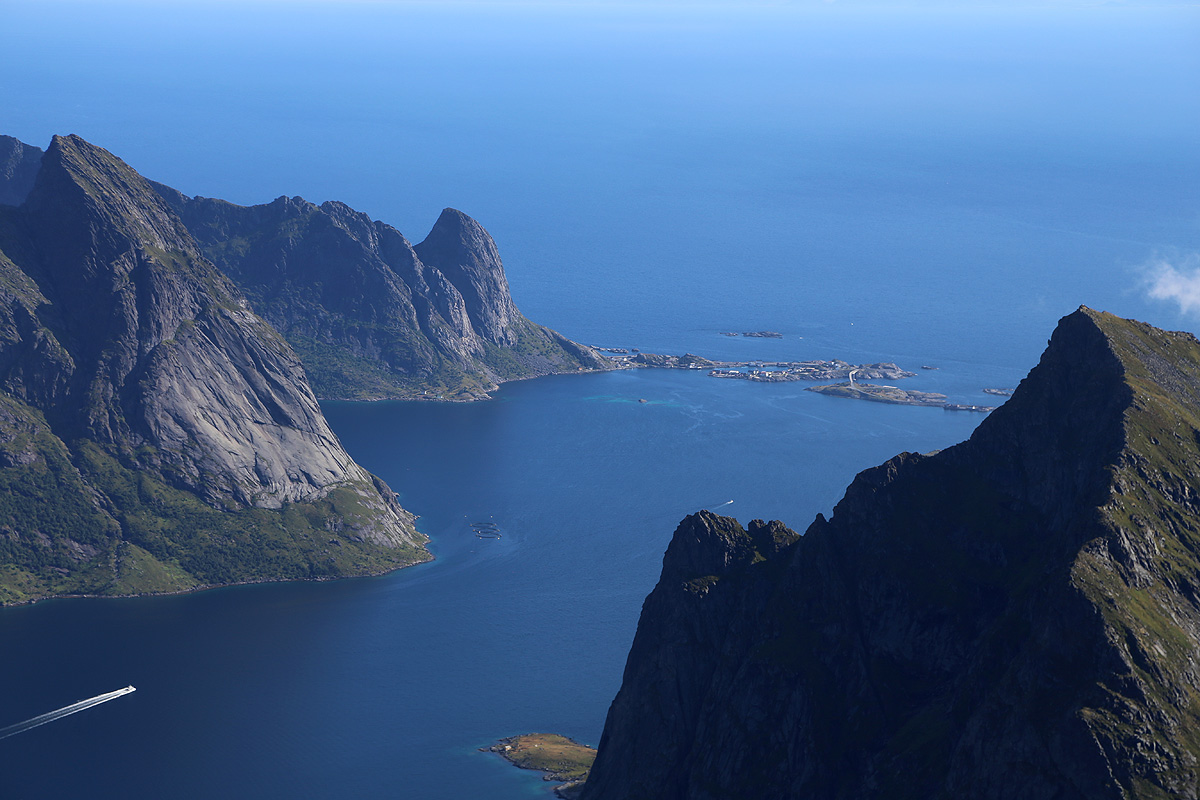
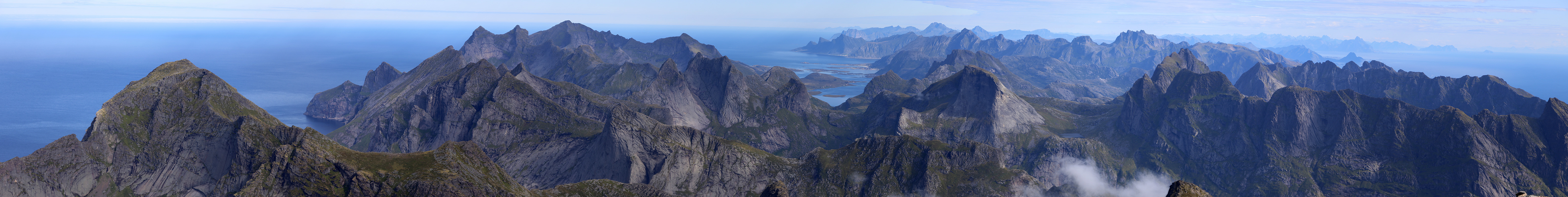
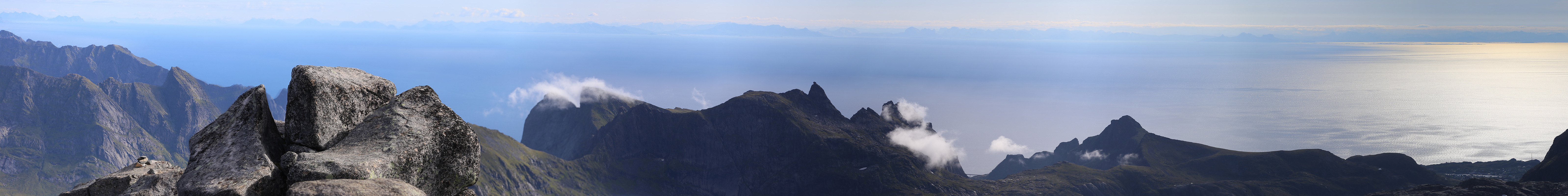
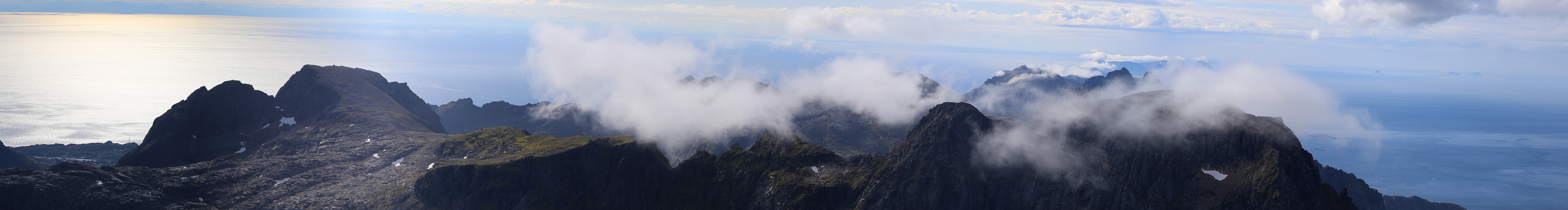
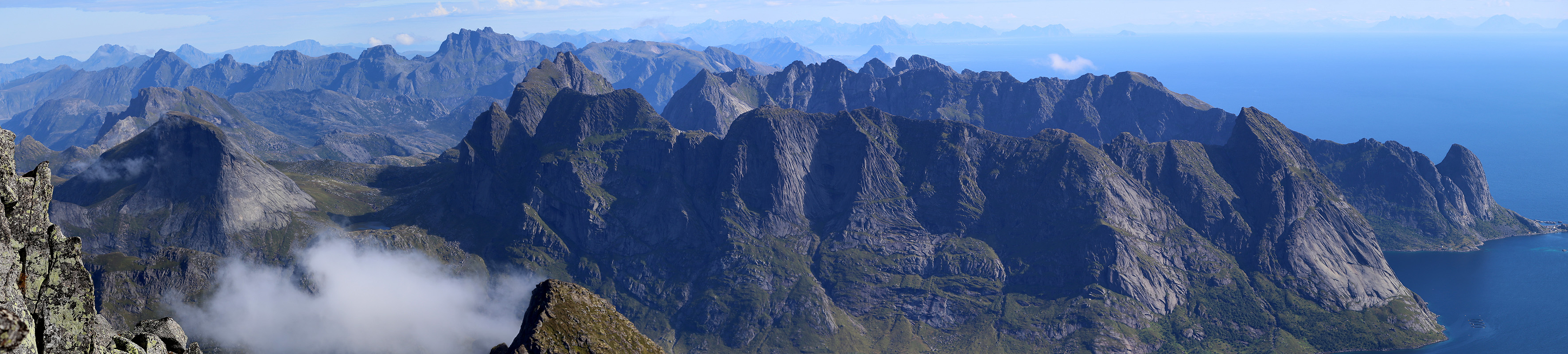
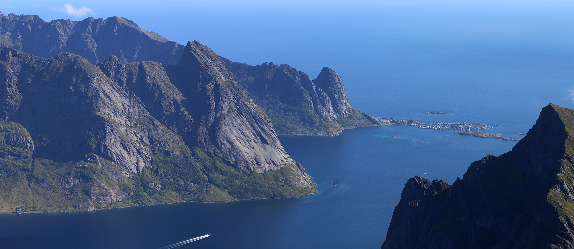
by 1115. The view was exceptional
and the summit rather limited real estate. I spent 25 minutes
mainly sitting on top before
heading back down. It does not get much better
than this, Lofoten
is a very special place.
The return hike took 2 hours and 20 minutes including
some nice breaks in order to talk to people I met on the trail between Forsfjorden and Munkebu.
There were many tourists from other European countries, in particular, from France. No Norwegians.
I took a long break back at Munkebu and finished the half chicken that was reserved for today.
Since I needed to get back to the Evenes airport, I left at 1515 and arrived back down at my car
around 1700, about the same time as I had used the previous evening.
I drove out to the end of the road at Å, in order to have completed the entire E-10
in Lofoten, then turned and had an equally nice drive back to the airport.
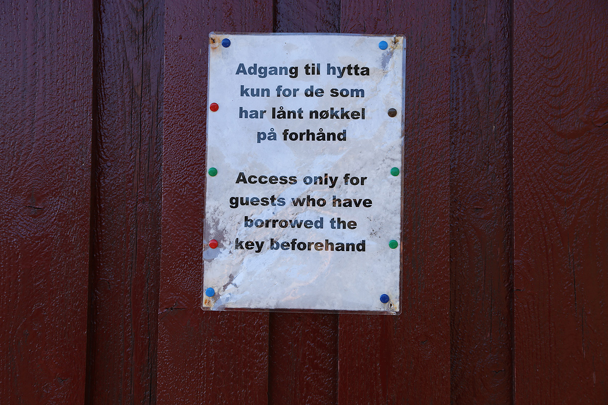
Special note about Munkebu:
This hut is supposed to be one of DNT's self serve mountain huts. However, it seems that
the rules and practice concerning this hut rather tries to discourage usage rather than
the opposite, contrary to the goals of DNT.
First, the hut is locked with a special key, not the DNT standard. I can only see disadvantages
with this policy. During my stay, two Germans appeared, they had paid the required deposit to
borrow a DNT standard key. Not surprisingly, they were quite disappointed to find that it was impossible
for them to make use of this hut.
Second, there is a sign posted on the hut wall that only
people that have borrowed the key in advance are permitted to use the hut. Normally, everybody
are welcome to stay in a DNT hut as long as they pay and contribute to keeping the hut in good order.
Third, the tourist office in Moskenes asked that payment be left with them in Moskenes, while the
normal procedure is to pay or leave a one-time credit card authorization in the box for
payments that is located in the hut. Finally, the second hut (sikringshytte) was locked with a
different key and there was no instruction concerning toilet facilities. This may represent
a serious problem. The large majority of hikers/tourists in the area in mid August are
foreigners, mostly from central Europe. But this is not unique to Lofoten. Adequate, information
signs in English would go a long way to explain how to make use of Munkebu as well as
enforcing an obligation to follow the well established rules. I was quite dissappointed
to see how this hut is managed.
